
AZT: Rincons & Catalinas study guide · Lesson 11 of 19
Ecology & Life Zones
Sky islands & the six life zones
This is the lesson's study guide from the FlashFeed app, plus its key facts and a self-test.
What you'll be able to do
- Define the sky-island concept and its consequence of stranding endemic species on the peaks.
- Identify the six stacked biotic life zones the trail climbs through, from Sonoran Desert scrub to mixed-conifer forest.
- Describe the Sonoran Desert scrub zone by its arborescent cacti, desert legumes, and drought-adapted shrubs.
The deepest reward of this stretch isn't a view or a summit — it's the chance to climb through an entire continent's worth of ecosystems in a single day. This lesson explains the sky-island concept and the stacked life zones the trail passes through.
Sky islands & the six life zones
The Rincons and Catalinas are sky islands: isolated mountain ranges surrounded by radically different lowland environments — here, forested peaks marooned in a sea of desert. Their isolation and their steep elevation gradient preserve stacked life zones and species found nowhere else, so each range functions as an ecological island where northern and Mexican species are stranded far from their main ranges.
Climbing the trail takes you through six distinct biotic communities stacked by elevation, and the ascent is roughly the ecological equivalent of driving from northern Mexico to Canada:
- Sonoran Desert scrub at the lowest elevations, defined by arborescent (tree-like) cacti like the saguaro, desert legumes such as mesquite and palo verde, and small-leaved (microphyllous) drought-adapted shrubs.
- Desert grassland above it, with perennial bunchgrasses interspersed with ocotillo and soapweed yucca — the golden, rolling country of the valley approaches and Redington Pass.
- Madrean oak woodland, the transition "encinal" belt dominated by evergreen oaks and pointleaf manzanita, a hallmark of the Madrean sky islands as the air grows cooler and wetter.
- Pine-oak woodland, where ponderosa pine and alligator juniper appear — the first ponderosas a welcome sign to a climbing hiker that the worst heat is below.
- Pine forest higher still, where dense stands of ponderosa pine close overhead as the oak component thins out and moisture increases beyond the pine-oak mix below.
- Mixed-conifer forest on the highest peaks, of Douglas fir and quaking aspen — glacial relicts from the cooler, wetter Pleistocene, cool islands of northern forest sitting improbably atop desert ranges.
The extreme elevational range and long isolation of these mountains let plants that occur nowhere else in the United States thrive in the higher zones. That's the magic of the sky island: by climbing a few thousand feet you don't just change the scenery, you change biomes entirely — and you walk among living relics of an older, colder Southwest stranded on the peaks. Understanding this gradient turns a hard climb into a guided tour through deep ecological time.
Key terms
- Sky Island
- An isolated mountain range surrounded by radically different lowland environments — here, forested peaks marooned in a sea of desert. The isolation and the elevation gradient preserve stacked life zones and species found nowhere else, making each range an ecological island.
Key concepts
Sonoran Desert scrub
- The lowest and hottest biotic community the trail crosses, at the very bottom of the elevation gradient.
- Tree-like (arborescent) cacti define it, alongside legumes such as mesquite and palo verde and small-leaved drought shrubs.
- Its signature giant is the towering saguaro; the belt is named for the arid North American region it belongs to.
Desert grassland
- The golden, rolling belt just above the lowest zone, defining the valley approaches and Redington Pass.
- Perennial bunch-forming plants dominate here, interspersed with ocotillo and soapweed yucca.
- This open, nearly treeless, prairie-like zone sits between the saguaro country below and the oak woodland above.
Madrean oak woodland
- A transition belt where the air grows cooler and wetter, a hallmark of these isolated southwestern ranges.
- Spanish speakers call this evergreen 'encinal' belt; pointleaf manzanita grows among its trees.
- It is dominated by evergreen hardwoods of the genus Quercus, marking the shift from grassland to pine country.
Pine-oak woodland
- A wooded transition belt above the encinal, where the first tall conifers appear.
- The first ponderosas here are a welcome sign to a climbing hiker that the worst heat lies below; alligator juniper grows alongside.
- Named for the mix of two tree types it shares: tall ponderosa conifers and evergreen Quercus hardwoods.
Mixed-conifer forest
- The highest biotic community, crowning only the tallest peaks of these ranges.
- Its Douglas fir and quaking aspen are glacial relicts, survivors stranded from the cooler, wetter Pleistocene.
- A cool island of northern woodland atop the desert ranges, blending several evergreen tree species with aspen.
Key facts
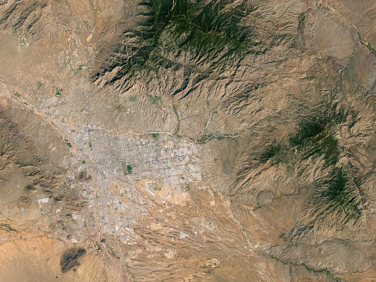
Six biotic communities
The route traverses six distinct biotic communities stacked by elevation: desert scrub, desert grassland, oak woodland, pine-oak woodland, pine forest, and mixed-conifer forest. Climbing from bottom to top is the rough ecological equivalent of driving from northern Mexico to Canada.
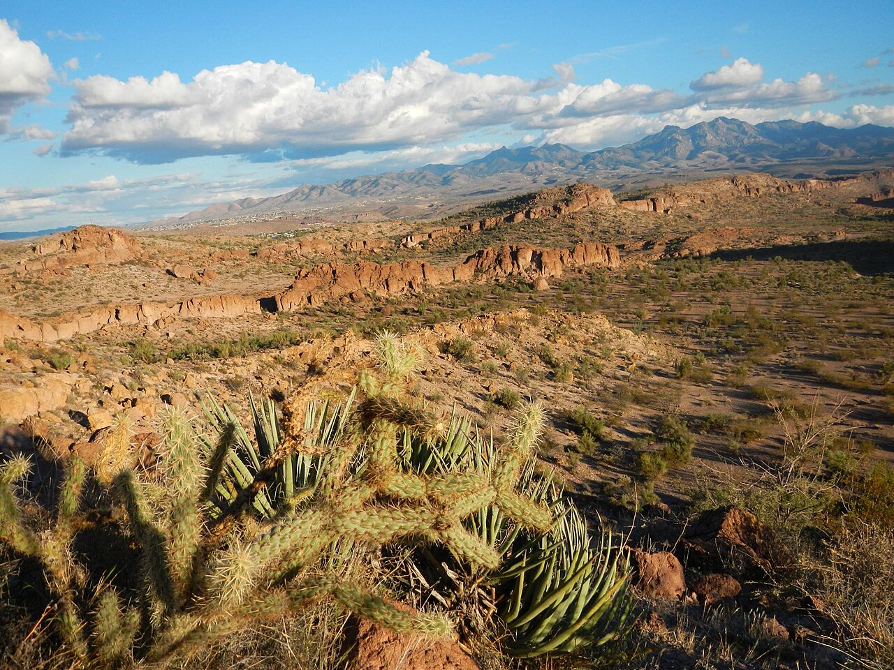
Desert grassland
Above the scrub, desert grassland features perennial bunchgrasses interspersed with ocotillo and soapweed yucca. It's the golden, rolling country of the valley approaches and Redington Pass — open, exposed, and grass-dominated.
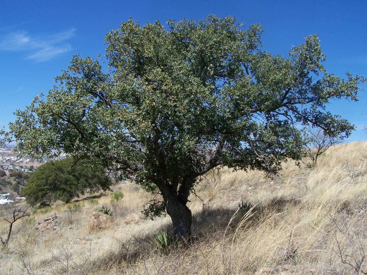
Madrean oak woodland
The Madrean oak woodland is the transition zone, dominated by evergreen oaks and pointleaf manzanita. This 'encinal' belt — a hallmark of the Madrean sky islands — marks the shift from desert to mountain as the air grows cooler and wetter.
Pine-oak woodland
Higher still, pine-oak woodland introduces ponderosa pine and alligator juniper as the climate cools and moisture increases. The first ponderosas are a welcome sign for the climbing hiker that the worst of the heat is below.
Mixed-conifer forest
The highest peaks are capped by mixed-conifer forest of Douglas fir and quaking aspen — glacial relicts left over from the cooler, wetter Pleistocene. These cool islands of northern forest sit improbably atop ranges surrounded by desert.
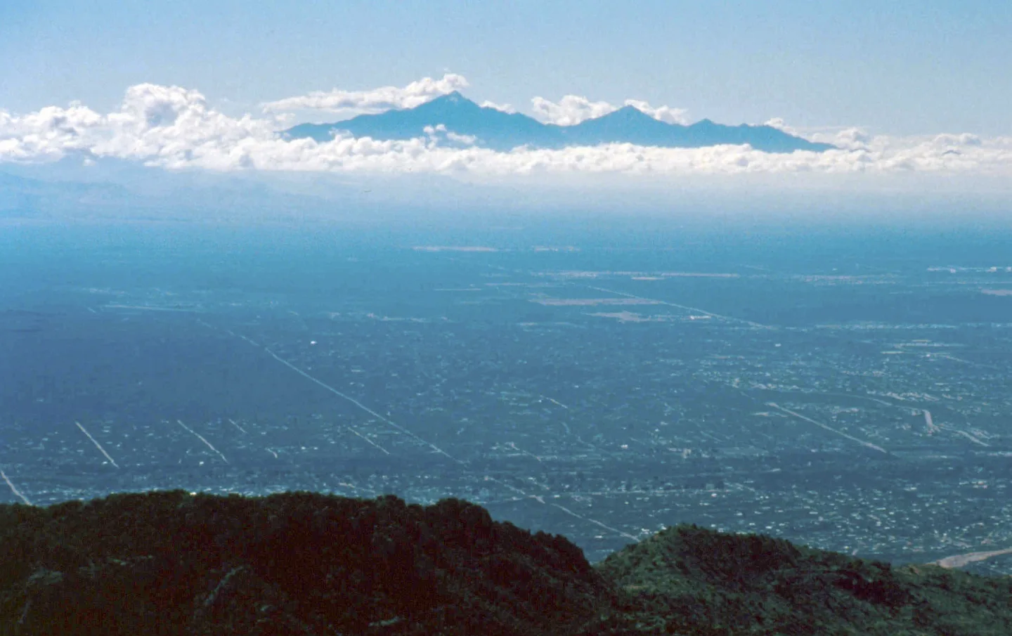
Plants found nowhere else
The extreme elevational range and long isolation of these sky islands let plants that occur nowhere else in the United States thrive in the higher zones. The mountains act as refuges, stranding northern and Mexican species far from their main ranges.
Self-test
Answer each question from memory, then check your work against the answer key.
1. What is a 'sky island' as the term applies to the Rincons and Catalinas?
- AA chain of desert peaks joined by continuous forest corridors
- BA high plateau with uniform vegetation from base to summit
- CA cluster of coastal volcanic islands ringed by ocean
- DAn isolated mountain range whose forested peaks are surrounded by a sea of lowland desert
2. What consequence does a sky island's long isolation produce in its higher zones?
- AIt connects the range to distant forests through vegetation corridors
- BIt strands northern and Mexican species far from their main ranges as living refuges
- CIt gradually eliminates every unique species from the range
- DIt lets lowland desert species colonize and dominate the peaks
3. The higher zones of these sky islands harbor plants that occur nowhere else in what area?
- AThe United States
- BThe Sierra Madre
- CThe Rocky Mountains
- DThe Sonoran Desert
4. Which two features of a sky island let it preserve stacked life zones and unique species?
- AIts low rainfall and its flat terrain
- BIts connectivity to other ranges and its gentle slopes
- CIts isolation and its steep elevation gradient
- DIts high rainfall and its uniform temperatures
5. Which statement is NOT true of the sky islands?
- AThey are forested peaks marooned in a sea of desert
- BThey function as ecological islands for stranded species
- CThey are lowland deserts surrounded by rings of forest
- DTheir isolation preserves species found nowhere else
6. Climbing the trail from bottom to top passes through how many distinct biotic communities?
- AThree
- BSix
- CTen
- DFour
7. Climbing from the base to the peaks is roughly the ecological equivalent of driving between which two places?
- ATexas and Florida
- BCalifornia and Oregon
- CArizona and Utah
- DNorthern Mexico and Canada
8. Which sequence correctly orders three of the zones from lowest to highest elevation?
- ADesert grassland, Madrean oak woodland, mixed-conifer forest
- BMadrean oak woodland, desert grassland, mixed-conifer forest
- CDesert grassland, mixed-conifer forest, Madrean oak woodland
- DMixed-conifer forest, Madrean oak woodland, desert grassland
9. Which biotic community sits at the lowest elevations of the climb?
- ASonoran Desert scrub
- BMixed-conifer forest
- CPine-oak woodland
- DMadrean oak woodland
10. Which of these is NOT one of the six life zones the trail climbs through?
- APine-oak woodland
- BAlpine tundra
- CDesert grassland
- DMadrean oak woodland
11. The lowest elevations are ___ scrub, defined by arborescent (tree-like) cacti such as the saguaro, desert legumes like mesquite and palo verde, and small-leaved (microphyllous) shrubs adapted to drought and heat.
- AChihuahuan Desert
- BGreat Basin Desert
- CMojave Desert
- DSonoran Desert
12. Which plant is the arborescent (tree-like) cactus that characterizes Sonoran Desert scrub?
- AAlligator juniper
- BOcotillo
- CSaguaro
- DSoapweed yucca
13. Which pair are named as the desert legumes of the Sonoran Desert scrub?
- AEvergreen oak and pointleaf manzanita
- BPonderosa pine and alligator juniper
- CMesquite and palo verde
- DDouglas fir and quaking aspen
14. The 'microphyllous' shrubs of Sonoran Desert scrub are defined by which adaptation?
- ASmall leaves suited to drought and heat
- BA total absence of any leaves
- CNeedle leaves that resist hard freezes
- DBroad leaves that maximize shade
15. Which is NOT a defining feature of the Sonoran Desert scrub zone?
- ASmall-leaved shrubs adapted to drought
- BDesert legumes like mesquite and palo verde
- CArborescent cacti such as the saguaro
- DQuaking aspen and Douglas fir stands
Go deeper
Answer key
- 1. D An isolated mountain range whose forested peaks are surrounded by a sea of lowland desertA sky island is an isolated range whose forested peaks are marooned in surrounding lowland desert. The isolation and elevation gradient set it apart from a connected or uniform range.
- 2. B It strands northern and Mexican species far from their main ranges as living refugesIsolation makes the peaks refuges that strand northern and Mexican species far from their main ranges. Desert species stay low, and the range stays cut off, not connected.
- 3. A The United StatesThe higher zones hold plants that occur nowhere else in the United States. The other regions are distractors, not the stated scope of the endemism.
- 4. C Its isolation and its steep elevation gradientA sky island's isolation and steep elevation gradient preserve stacked zones and species found nowhere else. The other pairs describe conditions the sky islands lack.
- 5. C They are lowland deserts surrounded by rings of forestThe reality is inverted: sky islands are forested peaks marooned in desert, not deserts surrounded by forest. The other three statements are true.
- 6. B SixThe route traverses six distinct biotic communities stacked by elevation, from desert scrub up to mixed-conifer forest.
- 7. D Northern Mexico and CanadaAscending through the six zones is like driving from northern Mexico to Canada — a continent's worth of ecosystems in one climb.
- 8. A Desert grassland, Madrean oak woodland, mixed-conifer forestAscending order is desert grassland, then Madrean oak woodland, then mixed-conifer forest at the top. The other sequences scramble that elevation order.
- 9. A Sonoran Desert scrubSonoran Desert scrub occupies the lowest elevations; mixed-conifer forest caps the highest peaks, with the woodlands in between.
- 10. B Alpine tundraThe six zones top out at mixed-conifer forest; there is no alpine tundra here. Desert grassland, pine-oak woodland, and Madrean oak woodland are all genuine zones.
- 11. D Sonoran Desert
- 12. C SaguaroThe saguaro is the tree-like cactus of the scrub. Ocotillo and soapweed yucca belong to desert grassland, and alligator juniper to pine-oak woodland.
- 13. C Mesquite and palo verdeMesquite and palo verde are the scrub's desert legumes. The other pairs are the signature plants of the pine-oak, mixed-conifer, and oak-woodland zones.
- 14. A Small leaves suited to drought and heatMicrophyllous means small-leaved — an adaptation to drought and heat. Broad, needle, and leafless forms are not what the term describes here.
- 15. D Quaking aspen and Douglas fir standsQuaking aspen and Douglas fir belong to the highest mixed-conifer forest, not the desert scrub. The other three are the scrub's defining plants.
Image credits
- Six biotic communities: Image by Robert Simmon, based on data provided by the Landsat 7 science team. · Public domain — commons.wikimedia.org/wiki/File:Tucson,_Arizona,_and_its_Surroundings_(2120).jpg
- Desert grassland: Wikimedia Commons · BLMArizona · Public domain — commons.wikimedia.org/wiki/File%3AViews%20of%20the%20Hualapai%20Mountains%20from%20the%20Cerbat%20Foothills%20(54385378820).jpg
- Madrean oak woodland: Wikimedia Commons · Deiv mm · Public domain — commons.wikimedia.org/wiki/File:Quercus_emoryi_(2008).jpg
- Plants found nowhere else: Wikimedia Commons · Unknown author · Public domain — commons.wikimedia.org/wiki/File:SkyIslands_from_SantaCatalinaMtns.JPG


