
AZT: Rincons & Catalinas study guide · Lesson 8 of 19
Trailheads & Access
Getting on and off trail
This is the lesson's study guide from the FlashFeed app, plus its key facts and a self-test.
What you'll be able to do
- Identify the southern access points — the Gabe Zimmerman Trailhead at Davidson Canyon and the Loma Alta Trailhead.
- Describe the Redington Road crossing as a remote, waterless, high-clearance hitch point between the ranges.
- Identify the northern access points — the Marshall Gulch Trailhead and the American Flag Ranch Trailhead near Oracle.
Whether you're thru-hiking the segment or section-hiking a piece of it, knowing the access points — and how they connect — is essential. This lesson runs south to north through the trailheads that get you on and off this stretch.
Getting on and off trail
At the southern end, the Gabe Zimmerman Trailhead at Davidson Canyon is the gateway to Passage 8: take I-10 to Exit 279 (Wentworth Road/Colossal Cave Road), turn east 0.2 mile to the Frontage Road, then south on the Frontage Road about 5.2 miles to the parking area. The trail runs continuously north from here into Rincon Valley. Mid-passage, Colossal Cave Mountain Park (via Old Spanish Trail) offers an access point with water and a resupply connection, though a park fee applies and stopping hikers must use the designated campgrounds.
Access into the Rincons proper is awkward by design — this is wilderness. The Loma Alta Trailhead (off Old Spanish Trail via Camino Loma Alta) reaches the Saguaro National Park boundary, but there's no direct vehicle access to the AZT: it takes about a 3-mile hike east on the Hope Camp Trail to connect, and parking is limited. On the far side of the Rincons, the trail crosses Redington Road near mile marker 12, where Tanque Verde Road has become rough dirt — a remote, exposed spot often used as a hitch point into Tucson, but high-clearance is wise and there's no water.
The Catalina passages are bracketed by two key trailheads. The Gordon Hirabayashi Campground, just off the Catalina Highway past Molino Basin, is the boundary between Passages 10 and 11 — the trail transitions continuously here from Redington Pass into the high Catalinas, though there's no water at the camp. At the top, the Marshall Gulch Trailhead (at the end of the road about 1.5 miles south of Summerhaven) marks the boundary between Passages 11 and 12, with paved access and parking — the high gateway between the Catalina crossing and the Oracle Ridge descent. Finally, the American Flag Ranch Trailhead near Oracle is the northern access: from town, take American Avenue to Mount Lemmon Road about 4 miles, then turn onto American Flag Ranch Road to the dead-end parking near the historic ranch.
One logistical note worth flagging: Summerhaven sits between the two high-country passages and links them via short road walks when trail reroutes are in effect — construction near Marshall Gulch has periodically required a detour through town. Always check current AZT Association notices for active reroutes before tackling this section, since the connection through the village can change from year to year.
Key concepts
Gabe Zimmerman Trailhead
- The southern gateway onto this whole segment, at the start of Passage 8.
- Reached via I-10 Exit 279 (Wentworth Road/Colossal Cave Road) and the Frontage Road, about 5.2 miles south to the parking area.
- From this Davidson Canyon access, the trail runs continuously north into Rincon Valley.
Loma Alta Trailhead
- An awkward-by-design access into the Rincon wilderness, off Old Spanish Trail.
- It reaches the Saguaro National Park boundary, but with no direct vehicle access to the AZT.
- From here it's about a 3-mile hike east on the Hope Camp Trail to connect, and parking is limited.
Marshall Gulch Trailhead
- A paved-access trailhead high in the Catalinas, marking a passage boundary.
- It sits at the end of the road, about 1.5 miles south of Summerhaven.
- The high gateway between the Catalina crossing and the Oracle Ridge descent — the Passage 11/12 line.
American Flag Ranch Trailhead
- The northern access point for this segment, near the town of Oracle.
- From town, take American Avenue to Mount Lemmon Road, continuing about 4 miles toward the access.
- Dead-end parking beside a historic property, where the AZT leaves singletrack for the road toward Oracle.
Passage 8
- The section's opening stretch, running through Rincon Valley.
- At 13.9 miles, one of the shorter legs, heading north from the Gabe Zimmerman Trailhead.
- Its high point tops out around 3,600 feet — pure low-desert walking.
Colossal Cave Mountain Park
- An early trailside stop on Passage 8 that usually has water, though an entry fee applies.
- It has established campgrounds and a picnic area where hikers fill up before the Rincons.
- Stopping hikers must use its designated campgrounds; it also offers a resupply connection.
Key facts
Trailhead: Gabe Zimmerman (Davidson Canyon)
The Gabe Zimmerman Trailhead at Davidson Canyon is the southern access for this stretch: take I-10 to Exit 279 (Wentworth Road/Colossal Cave Road), turn east 0.2 mile to the Frontage Road, then south on the Frontage Road about 5.2 miles to the parking area. The trail runs continuously north from here into Rincon Valley.
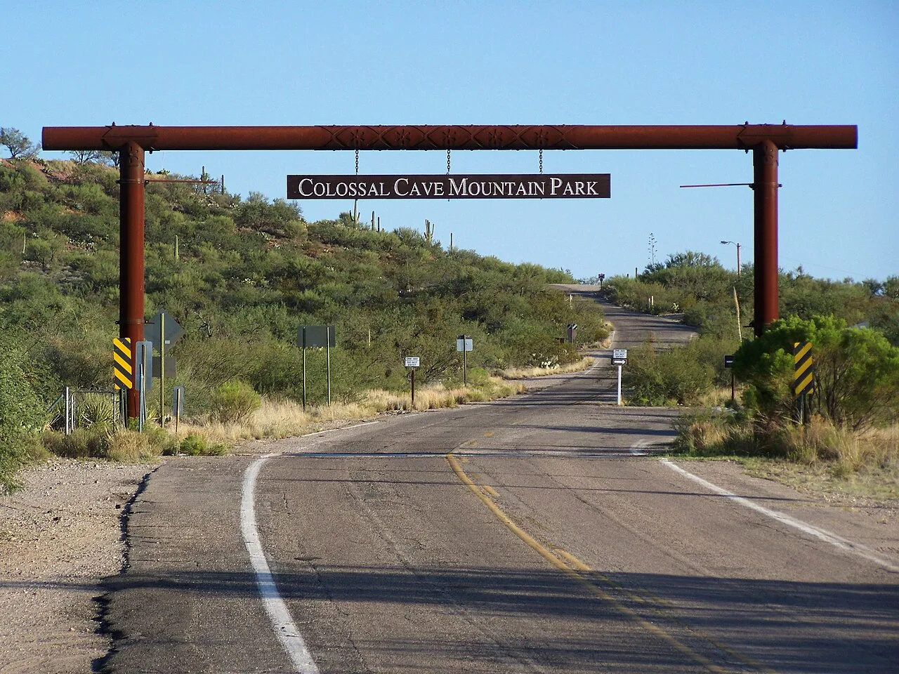
Trailhead: Colossal Cave Mountain Park
Colossal Cave Mountain Park, reached via Old Spanish Trail, is a mid-Passage-8 access point and water/resupply connection. A park fee is required to enter and park, and hikers stopping there must use the designated campgrounds.
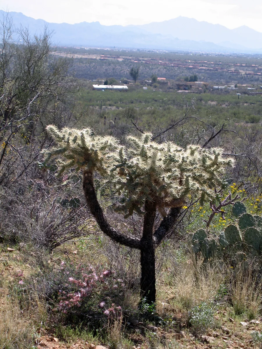
Trailhead: Loma Alta (Saguaro NP East)
The Loma Alta Trailhead (off Old Spanish Trail via Camino Loma Alta) accesses the Saguaro National Park boundary, but there's no direct vehicle access to the AZT — it takes about a 3-mile hike east on the Hope Camp Trail to connect. Parking is limited.
Trailhead: Redington Road
Tanque Verde Road becomes Redington Pass Road (dirt after about mile 3); the AZT crosses near mile marker 12. It's a rough, exposed access often used as a hitch point into Tucson, but high-clearance is wise and there's no water.
Trailhead: Gordon Hirabayashi
The Gordon Hirabayashi Campground, just off the Catalina Highway past Molino Basin (turn west about 0.3 miles to parking), is the boundary between Passages 10 and 11. The trail transitions continuously here from Redington Pass into the high Catalinas — but there's no water at the camp.
Trailhead: Marshall Gulch
The Marshall Gulch Trailhead, at the end of the road about 1.5 miles south of Summerhaven, marks the boundary between Passages 11 and 12. It has paved access and parking — the high-point gateway between the Catalina crossing and the Oracle Ridge descent.
Trailhead: American Flag Ranch
The northern access is the American Flag Ranch Trailhead near Oracle: from town, take American Avenue to Mount Lemmon Road about 4 miles, then turn onto American Flag Ranch Road to the dead-end parking near the historic ranch.
Connecting through Summerhaven
Summerhaven sits between the two high-country passages and links them via short road walks when trail reroutes are in effect (construction near Marshall Gulch has periodically required a detour through town). Always check current AZT Association notices for active reroutes before hiking the Rincon-Catalina section.
Self-test
Answer each question from memory, then check your work against the answer key.
1. Which trailhead is the southern access point at Davidson Canyon for this stretch of the AZT?
- AGabe Zimmerman Trailhead
- BLoma Alta Trailhead
- CMarshall Gulch Trailhead
- DAmerican Flag Ranch Trailhead
2. Which I-10 exit do you take to reach the Gabe Zimmerman Trailhead?
- AExit 291 (Marsh Station Road)
- BExit 306 (Mescal)
- CExit 297 (Houghton Road)
- DExit 279 (Wentworth Road/Colossal Cave Road)
3. The Loma Alta Trailhead has no direct vehicle access to the AZT. How do hikers connect to the trail from there?
- AA 1.5-mile road walk from Summerhaven
- BA short spur directly from the parking lot
- CAbout a 3-mile hike east on the Hope Camp Trail
- DAbout a 4-mile drive up Camino Loma Alta
4. The Loma Alta Trailhead reaches the boundary of which protected area?
- ACoronado National Forest
- BSaguaro National Park
- CColossal Cave Mountain Park
- DCatalina State Park
5. Which statement about the southern access points is NOT accurate?
- AFrom Gabe Zimmerman the trail runs continuously north into Rincon Valley
- BParking at the Loma Alta Trailhead is limited
- CThe Gabe Zimmerman Trailhead sits at Davidson Canyon
- DThe Loma Alta Trailhead offers direct vehicle access to the AZT
6. ___ becomes Redington Pass Road (dirt after about mile 3); the AZT crosses near mile marker 12. It's a rough, exposed access often used as a hitch point into Tucson, but high-clearance is wise and there's no water.
- AAmerican Avenue
- BTanque Verde Road
- CMount Lemmon Road
- DHope Camp Trail
7. The Redington Road crossing sits in the gap between which two mountain ranges?
- AThe Tortolitas and the Rincons
- BThe Catalinas and the Santa Ritas
- CThe Rincons and the Catalinas
- DThe Rincons and the Santa Ritas
8. Why is a high-clearance vehicle advised for reaching the Redington Road crossing?
- AThe road becomes rough dirt past about mile 3
- BIt fords a deep creek near the crossing
- CLarge boulders are embedded across the roadbed
- DIt crosses several deep sandy washes near the pass
9. What does the remote Redington Road crossing notably lack?
- AA shuttle stop
- BWater
- CA ranger station
- DA shaded campground
10. What is the Redington Road crossing commonly used for?
- AAs a hitch point into Tucson
- BAs the boundary between Passages 11 and 12
- CAs a paved trailhead with a large parking lot
- DAs a reliable water resupply stop
11. The northern access is the ___ near Oracle: from town, take American Avenue to Mount Lemmon Road about 4 miles, then continue on the ranch access road to the dead-end parking near the historic ranch.
- AGabe Zimmerman Trailhead
- BMarshall Gulch Trailhead
- CAmerican Flag Ranch Trailhead
- DLoma Alta Trailhead
12. Which trailhead marks the boundary between Passages 11 and 12?
- AGordon Hirabayashi Campground
- BGabe Zimmerman Trailhead
- CAmerican Flag Ranch Trailhead
- DMarshall Gulch Trailhead
13. The Marshall Gulch Trailhead sits about 1.5 miles south of which community?
- AVail
- BTucson
- CSummerhaven
- DOracle
14. The road to the American Flag Ranch Trailhead near Oracle ends at what?
- ADead-end parking near the historic ranch
- BA paved shuttle terminal
- CA staffed visitor center lot
- DA fee booth and campground
15. From the town of Oracle, which road do you follow first toward the American Flag Ranch Trailhead?
- AMarsh Station Road
- BAmerican Avenue
- CCatalina Highway
- DOld Spanish Trail
Go deeper
Answer key
- 1. A Gabe Zimmerman TrailheadThe Gabe Zimmerman Trailhead at Davidson Canyon is the southern gateway to Passage 8; the others are mid-section or northern access points.
- 2. D Exit 279 (Wentworth Road/Colossal Cave Road)Take I-10 to Exit 279 (Wentworth Road/Colossal Cave Road), turn east 0.2 mile to the Frontage Road, then south on the Frontage Road about 5.2 miles to the parking area.
- 3. C About a 3-mile hike east on the Hope Camp TrailFrom Loma Alta it takes roughly a 3-mile hike east on the Hope Camp Trail to reach the AZT; there is no direct vehicle access and parking is limited.
- 4. B Saguaro National ParkLoma Alta, off Old Spanish Trail via Camino Loma Alta, accesses the Saguaro National Park boundary.
- 5. D The Loma Alta Trailhead offers direct vehicle access to the AZTLoma Alta has NO direct vehicle access to the AZT — a roughly 3-mile hike on the Hope Camp Trail is required. The other three statements are accurate.
- 6. B Tanque Verde Road
- 7. C The Rincons and the CatalinasThe crossing is on the far side of the Rincons, and from Redington Pass the trail climbs into the high Catalinas — so it bridges the Rincons and the Catalinas.
- 8. A The road becomes rough dirt past about mile 3Tanque Verde Road becomes dirt (Redington Pass Road) after about mile 3 and is rough and exposed, so high-clearance is wise.
- 9. B WaterThe crossing is flagged as having no water, so hikers must carry enough for this exposed stretch; it is undeveloped, but water is the resource specifically noted as absent.
- 10. A As a hitch point into TucsonThe remote, exposed crossing is often used as a hitch point into Tucson; it has no water and no developed trailhead facilities. Marshall Gulch, not Redington, is the 11/12 boundary.
- 11. C American Flag Ranch TrailheadThe ranch access road is American Flag Ranch Road. Compare: Gabe Zimmerman Trailhead — The southern gateway onto this whole segment, at the start of Passage 8.
- 12. D Marshall Gulch TrailheadMarshall Gulch, at the end of the road about 1.5 miles south of Summerhaven, is the Passage 11/12 boundary. Gordon Hirabayashi is the 10/11 boundary.
- 13. C SummerhavenMarshall Gulch is at the end of the road about 1.5 miles south of Summerhaven, with paved access and parking.
- 14. A Dead-end parking near the historic ranchFrom Oracle, American Flag Ranch Road ends at dead-end parking near the historic ranch — the northern access for the Rincon-Catalina section.
- 15. B American AvenueFrom Oracle you take American Avenue to Mount Lemmon Road about 4 miles, then turn onto American Flag Ranch Road to the parking area.
Image credits
- Trailhead: Colossal Cave Mountain Park: Wikimedia Commons · Eegorr · CC BY 3.0 — commons.wikimedia.org/wiki/File:Colossal_Cave_Park_-_Entry.jpg
- Trailhead: Loma Alta (Saguaro NP East): Wikimedia Commons · Alice Wondrak-Biel · Public domain — commons.wikimedia.org/wiki/File:Cholla,_Saguaro_NP_(RMD)_(987062b3-3d46-47f2-93b5-13775c28d47f).jpg

