
U.S. National Parks study guide · Lesson 10 of 27
Lesson 10: Southwest & Colorado Plateau
Canyon Country · Rock, Wood & Cactus · Caves, Reefs & Extremes · Which Southwest Park Is It? · By the Numbers
This is the lesson's study guide from the FlashFeed app, plus its key facts and a self-test.
What you'll be able to do
- Identify the canyon-country headliners of the Colorado Plateau.
- Explain the rock, wood, and cactus marvels of the Southwest.
- Recognize the Southwest's desert extremes of heat, elevation, and dunes.
- Identify a Southwest park from a single distinctive clue.
- Recall Southwest elevation and temperature extremes and match parks to states.
Canyon Country
The Colorado Plateau is a slab of rock the size of several states, slowly lifted a mile or more into the sky. As it rose, rivers kept cutting downward — and the result is the densest cluster of jaw-dropping parks in the country. These five are the headliners, all carved from sandstone and limestone laid down over hundreds of millions of years.
Grand Canyon
The marquee of the marquees. The Colorado River runs ~277 miles through the canyon, which reaches up to 18 miles wide and more than a mile (~6,000 ft) deep. Astonishingly, the river only began carving it ~5–6 million years ago, as the plateau rose to meet the water. The walls expose nearly 2 billion years of Earth's history; the oldest rock at the bottom, the Vishnu Schist, is ~1.8 billion years old. Stacked life zones run from desert scrub at the river to spruce-fir forest on the high North Rim — the ecological equivalent of a trip from Mexico to Canada. Eleven tribes are traditionally associated with the canyon, including the Havasupai, who still live at Supai deep inside it. It drew 4.92 million visitors in 2024, the 3rd-most of any national park, ~90% of them to the South Rim. (It is not, surprisingly, the deepest canyon in the U.S. — just the most expansive and revealing.)
Zion
Utah's first national park (1919) and now its busiest — 4.95 million visitors in 2024 made it the 2nd-most-visited park in the country. Its towering Navajo Sandstone cliffs, up to ~2,000 ft, are petrified ancient sand dunes about 180 million years old, banded in red, pink, and cream. The Virgin River carved Zion Canyon and the slot canyon called The Narrows, and still cuts deeper. Angels Landing's exposed knife-edge got its name in 1916 when a visitor said only an angel could land there; the chained route now requires a lottery permit, in place since 2022.
Bryce Canyon
Despite the name, Bryce is not a canyon — it's a series of natural amphitheaters eroded into the edge of the Paunsaugunt Plateau. Inside them stands the densest concentration of hoodoos (rock spires) on Earth, glowing orange, pink, and white. They form as over 200 freeze-thaw cycles a year pry apart the Claron Formation limestone, and the rim retreats 1–4 ft per century. Southern Paiute legend says the hoodoos are the "Legend People" turned to stone by Coyote. High and cold — the rim reaches 9,115 ft at Rainbow Point — it's an International Dark Sky Park with superb stargazing.
Arches
Near Moab, Arches catalogs over 2,000 natural stone arches, the greatest density on Earth. Delicate Arch, a 52-ft freestanding span, rides Utah's license plate; Landscape Arch stretches ~290 ft, among the longest in the world. They form where water and ice widen cracks in Entrada Sandstone "fins" until a hole opens — and they collapse just as naturally (Wall Arch fell in 2008). Ranger Edward Abbey wrote the wilderness classic Desert Solitaire (1968) here.
Canyonlands
Utah's largest national park is a vast, dry wilderness carved by the Green and Colorado Rivers into four districts: Island in the Sky (mesa-top overlooks), The Needles (banded spires), The Maze (one of the most remote places in the U.S.), and the rivers themselves. The mysterious Upheaval Dome may be a meteor crater or a collapsed salt dome. The Maze is so remote the NPS warns help can be days away — fittingly, it once hid outlaws like Butch Cassidy.
Rock, Wood & Cactus
Beyond the famous canyons, the Southwest hides parks built around stranger marvels: a wrinkle in the Earth's crust, a forest turned to stone, cacti that live two centuries, trees named for a prophet, and pines older than the pyramids. Each one protects a single astonishing thing.
Capitol Reef
This park protects the Waterpocket Fold, a ~100-mile-long "wrinkle" (a monocline) in the Earth's crust. Rock layers were bent and uplifted 50–70 million years ago, then eroded to reveal tilted, colorful strata, sheer cliffs, and white domes — one of which resembles the U.S. Capitol, giving the park its name. At its heart sits Fruita, a historic Mormon orchard settlement. Visitors can still pick fruit in season from the roughly 1,900 trees the NPS maintains, and buy fresh-baked pies at the Gifford House. Petroglyphs left by the Fremont culture line Highway 24. It's an International Dark Sky Park.
Petrified Forest
Along old Route 66 in eastern Arizona lies one of the world's largest concentrations of petrified wood — ~225-million-year-old Late Triassic logs turned to rainbow-colored quartz — alongside the banded badlands of the Painted Desert. The transformation happened by permineralization: silica-rich groundwater replaced the wood cell by cell, with iron and manganese painting the agate red, orange, and purple. It's the only national park containing a stretch of historic Route 66. Taking petrified wood is illegal, and the park keeps a famous file of "conscience letters" from visitors mailing back stolen pieces they blame for bad luck.
Saguaro
Flanking Tucson in two districts, Saguaro protects dense forests of the giant saguaro cactus — the iconic silhouette of the American West, which grows only in the Sonoran Desert. Saguaros can live 150–200 years, top 40 ft, weigh several tons when full of water, and may not sprout a first arm until age 50–75. A "nurse tree" such as a palo verde shelters the seedling for decades before the cactus outlives and replaces it. The Tohono O'odham harvest the fruit each summer to mark their new year, and the blossom — Arizona's state flower — opens in May–June. Summer here is dangerously hot, 100–110°F.
Joshua Tree
East of Los Angeles, this park marks where two deserts meet: the higher, cooler Mojave, full of twisted Joshua trees (giant yuccas), and the lower, hotter Colorado, of creosote, cholla, and ocotillo. Jumbled monzogranite boulders — formed underground, then weathered into rounded stacks — draw climbers to over 8,000 routes. Mormon settlers reputedly named the tree for the prophet Joshua reaching skyward; it is pollinated only by the yucca moth in a strict mutualism. A renowned Dark Sky Park, it drew ~3.0 million visitors in 2024.
Great Basin
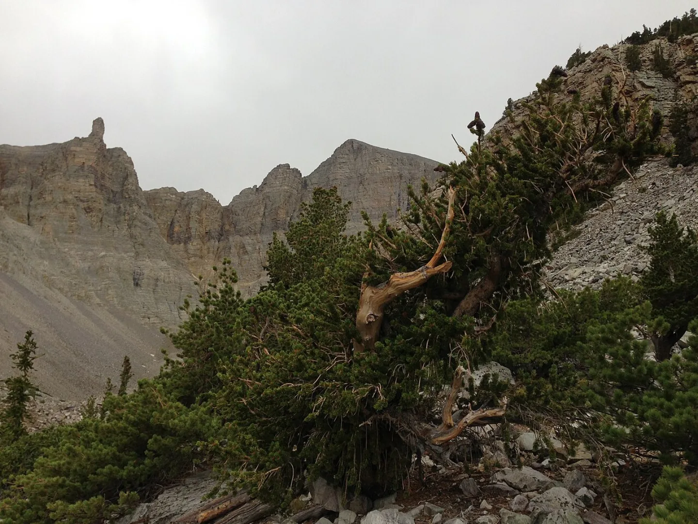
In remote east-central Nevada, Great Basin is a "sky island" climbing from sagebrush desert through piñon-juniper and aspen to alpine tundra at 13,065-ft Wheeler Peak. It shelters ancient bristlecone pines — some about 5,000 years old — the ornate Lehman Caves, and Nevada's only glacier, a small rock glacier below the peak. With only ~150,000 visitors in 2024 and some of the darkest skies in the country, it's a quiet gem. A bristlecone here named "Prometheus" was cut down in 1964 and found to be ~4,900 years old — among the oldest trees ever documented, and a turning point for protecting the species.
Caves, Reefs & Extremes
The far Southwest pushes nature to its limits — underground, underwater (long ago), and off the temperature charts. These five parks include a cave carved by acid, two slices of the same ancient reef, a river that doubles as an international border, dunes of pure white, and the lowest, hottest, driest park of all.
Carlsbad Caverns
Beneath the Chihuahuan Desert of southeast New Mexico, Carlsbad's "Big Room" is one of the largest cave chambers in North America — about 8.2 acres of floor under a ceiling reaching ~255 ft. It formed in an unusual way: sulfuric acid, rising from oil and gas deposits below, dissolved the limestone of an ancient Permian reef (the Capitan Reef) from the inside, rather than ordinary rainwater seeping down. Each summer evening, hundreds of thousands of Brazilian free-tailed bats pour out at dusk. A teenage cowboy, Jim White, explored and publicized the cave in the early 1900s, naming many formations — he first spotted the bats as what looked like "smoke" rising from the ground.
Guadalupe Mountains
Just across the Texas line from Carlsbad rises Guadalupe Peak — at 8,751 ft, the highest point in Texas — beside El Capitan's sheer limestone prow and McKittrick Canyon's blazing fall foliage. The whole range is an exposed section of the Permian Capitan Reef, a ~265-million-year-old fossil reef from a tropical sea and one of the best-preserved on Earth — the very same reef that hosts Carlsbad Caverns underground. Geologists travel here to study an ancient marine reef now standing as desert mountains. It's a quiet park, with ~200,000 visitors in 2024.
Big Bend
Where the Rio Grande makes its great "big bend" along the Mexico border, this vast West Texas park (~801,000 acres) stacks deep canyons — Santa Elena's walls rise ~1,500 ft — the rugged Chisos Mountains, and sprawling Chihuahuan Desert beneath one of the darkest skies in the contiguous U.S. Its layered marine, volcanic, and desert rocks hold rich fossils, including the giant pterosaur Quetzalcoatlus, whose ~35-ft wingspan was discovered here. You can legally hike to the river and look across into Mexico; the village of Boquillas runs a small, ranger-supervised border crossing.
White Sands
In New Mexico's Tularosa Basin lies the world's largest gypsum dune field — about 275 square miles of brilliant white, wind-rippled sand. Rain dissolves gypsum from surrounding mountains; it pools and dries in Lake Lucero, and wind grinds the selenite crystals into sand. Because gypsum doesn't absorb heat, the dunes stay cool to the touch. Life here has evolved white camouflage, from bleached lizards to white mice. Fossilized human footprints found in the basin (announced 2021) suggest people walked here ~21,000–23,000 years ago — among the oldest evidence of humans in the Americas, possibly rewriting the timeline of human arrival. It became a national park in December 2019.
Death Valley
The largest national park in the contiguous U.S. (~3.4 million acres) is a study in extremes. Badwater Basin sits at −282 ft — the lowest point in North America — and Furnace Creek recorded 134°F on July 10, 1913, the hottest air temperature reliably measured on Earth. From the basin the land climbs to 11,049-ft Telescope Peak, a two-mile vertical range within one park. It's the driest place in North America (~2 inches of rain a year), yet a rare "superbloom" can carpet it in wildflowers after wet winters, and the Devils Hole pupfish cling to life in a single geothermal pool — among the rarest fish on Earth. The Timbisha Shoshone still live in the valley they call Tümpisa.
Which Southwest Park Is It?
The desert and plateau parks each have a signature you can recognize once you know what to look for — a single river, a forest of spires, a cave full of bats, a field of white sand. Read the clues from broad to specific and name the park before the last one gives it away.
Grand Canyon
An Arizona park where essentially one river — the Colorado — did all the carving. Its walls expose nearly 2 billion years of Earth's history, layer by readable layer. Eleven tribes are traditionally associated with it, including the Havasupai, who still live deep inside at Supai. It's the 3rd-most-visited national park.
Zion
Utah's first national park, and the 2nd-most-visited in the country. Its towering cliffs are petrified sand dunes about 180 million years old, banded in red, pink, and cream. A knife-edge spine here, reached by chains under a lottery permit, was said to be a place only an angel could land.
Bryce Canyon
Despite its name, this Utah park is not a canyon — it's a set of eroded amphitheaters carved into a plateau's edge. Inside them stands the densest concentration of rock spires on Earth. Southern Paiute legend says those spires are the "Legend People" turned to stone by Coyote.
Arches
A Utah park near Moab with the greatest density of natural stone openings on Earth — over 2,000 of them. Its most famous freestanding span appears on the state's license plate. Ranger Edward Abbey wrote the wilderness classic Desert Solitaire here.
Carlsbad Caverns
A New Mexico park whose main attraction lies entirely underground. It formed unusually — sulfuric acid dissolving an ancient reef from the inside, not ordinary rainwater. Each summer evening, hundreds of thousands of bats stream out of its mouth at dusk.
Death Valley
The largest national park in the contiguous United States. It holds both the lowest point in North America and the hottest air temperature ever reliably recorded on Earth. Rare pupfish survive in a single geothermal pool within it, among the rarest fish anywhere.
Saguaro
An Arizona park split into two districts flanking the city of Tucson. It protects forests of a giant cactus found only in the Sonoran Desert — one that can live two centuries. The Tohono O'odham harvest that cactus's fruit each summer to mark their new year.
White Sands
A New Mexico park in the Tularosa Basin, ringed by a military missile range. Its dunes are the world's largest gypsum field — brilliant white and cool to the touch. Fossilized human footprints here suggest people walked the basin over 20,000 years ago.
By the Numbers
The Southwest parks set records you can measure: the lowest basin, the highest peak in a state, the hottest day on Earth, and the busiest gates in the system. Here are the figures worth memorizing — and a quick map of which park sits in which state.
The Extremes
Death Valley is the land of superlatives. Badwater Basin sinks to −282 ft, the lowest point in North America — a salt flat below sea level. And on July 10, 1913, Furnace Creek reached 134°F, the hottest air temperature ever reliably recorded on Earth. Within the same park the land climbs to 11,049-ft Telescope Peak, a two-mile vertical range.
The High Points
Two peaks anchor the region's elevations. Wheeler Peak tops out at 13,065 ft, the high point of Great Basin National Park in Nevada and home to ancient bristlecone pines just below the summit. Guadalupe Peak rises to 8,751 ft — the highest point in all of Texas, nicknamed the "Top of Texas," reached by a strenuous ~8.4-mile round-trip climb.
The Crowds
Two Southwest parks sit near the very top of the visitation charts. Zion drew about 4,946,592 visitors in 2024, making it the 2nd-most-visited national park in the country — remarkable for a single narrow canyon served mostly by shuttle. Grand Canyon welcomed about 4,919,163 visitors the same year, the 3rd-most, with roughly 90% of them heading to the South Rim. The two are separated by only a few thousand visitors.
Park to State
Knowing which state holds which park anchors the whole region. Grand Canyon is in Arizona, sharing the state with Saguaro, Petrified Forest, and part of Joshua Tree's desert kin. Big Bend is in Texas, deep in the southwest corner on the Rio Grande, alongside Guadalupe Mountains. Great Basin is in Nevada, near the Utah line. Utah carries the densest cluster — Zion, Bryce, Arches, Canyonlands, and Capitol Reef — while New Mexico holds Carlsbad Caverns and White Sands.
Park to Summit
Each park has a named high point worth pairing with it. Death Valley rises to Telescope Peak (11,049 ft), snow-capped in winter and visible from the salt flats far below — a reminder that even the hottest, lowest park reaches two miles into the sky. Great Basin pairs with Wheeler Peak (13,065 ft), Guadalupe Mountains with Guadalupe Peak (8,751 ft), and Grand Canyon with Point Imperial (8,803 ft) on its quiet North Rim.
Key concepts
Grand Canyon
- An Arizona park where one river did almost all the work.
- Its walls expose nearly 2 billion years of Earth's history, layer by layer.
- Eleven traditionally associated tribes include the Havasupai, who still live deep inside it at Supai.
Zion
- Utah's first national park, and the second-most-visited in the country.
- Its cliffs are petrified sand dunes ~180 million years old, in red, pink, and cream.
- A knife-edge spine here, reached by chains under a lottery permit, was said to be a place only an angel could land.
Bryce Canyon
- Despite its name, this Utah park is not a canyon — it's a set of eroded amphitheaters.
- It holds the densest concentration of rock spires on Earth.
- Southern Paiute legend says those spires are the "Legend People" turned to stone by Coyote.
Arches
- A Utah park near Moab with the greatest density of natural stone openings on Earth.
- Its most famous freestanding span appears on the state's license plate.
- Ranger Edward Abbey wrote the wilderness classic Desert Solitaire here.
Carlsbad Caverns
- A New Mexico park whose main attraction lies entirely underground.
- It formed when sulfuric acid dissolved an ancient reef from the inside, rather than ordinary rainwater.
- Each summer evening hundreds of thousands of bats stream out of its mouth at dusk.
Death Valley
- The largest national park in the contiguous United States.
- It contains both the lowest point in North America and the hottest air temperature ever reliably recorded on Earth.
- Rare pupfish survive in a single geothermal pool within it, among the rarest fish anywhere.
Saguaro
- An Arizona park split into two districts flanking the city of Tucson.
- It protects forests of a giant cactus found only in the Sonoran Desert.
- The Tohono O'odham harvest that cactus's fruit each summer to mark their new year.
White Sands
- A New Mexico park in the Tularosa Basin, surrounded by a military missile range.
- Its dunes are the world's largest gypsum field — brilliant white and cool to the touch.
- Fossilized human footprints here suggest people walked the basin over 20,000 years ago.
Key facts
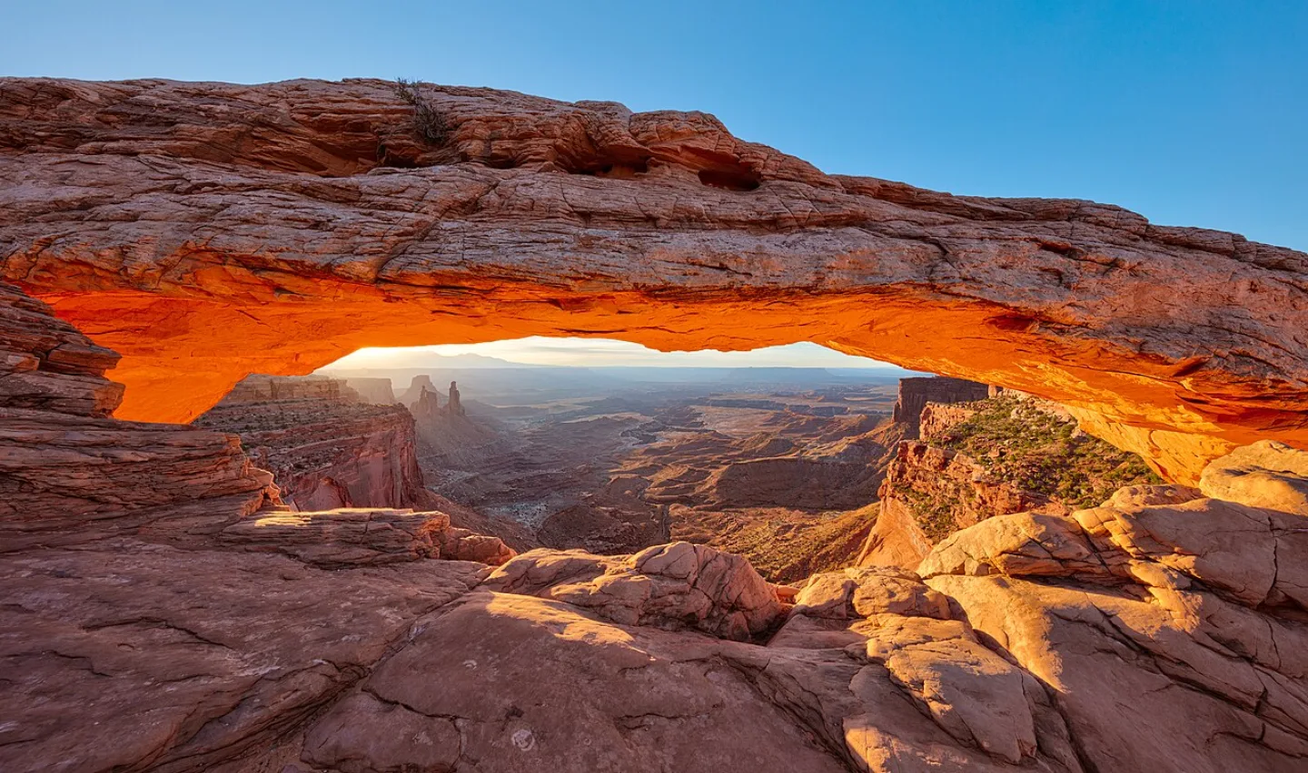
Canyonlands
Utah's largest national park is a vast wilderness carved by the Green and Colorado Rivers into four districts: Island in the Sky's mesa-top overlooks, the banded spires of The Needles, the remote Maze, and the rivers themselves. Mysterious Upheaval Dome may be a meteor crater or a collapsed salt dome. The Maze is so remote the NPS warns help can be days away — it was a hideout for outlaws like Butch Cassidy.
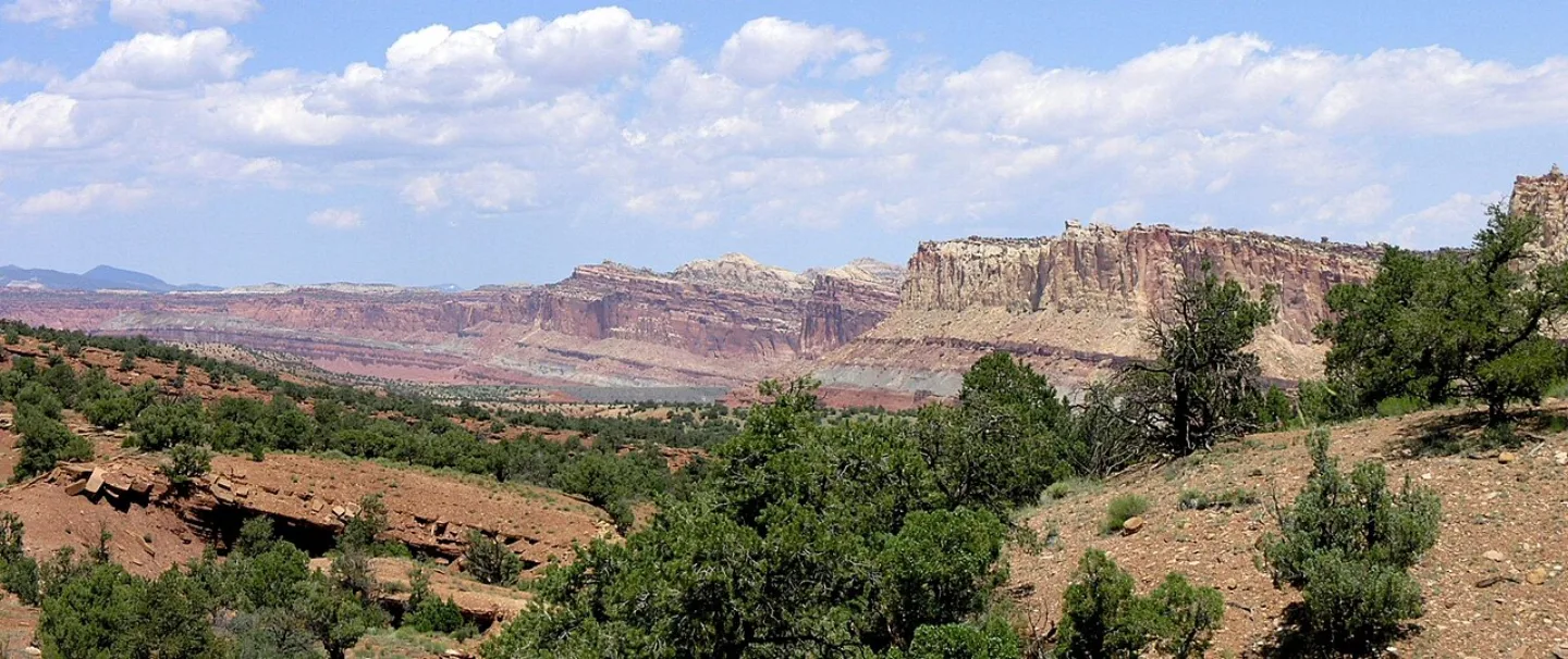
Capitol Reef
Capitol Reef protects the Waterpocket Fold — a ~100-mile-long "wrinkle" in the Earth's crust where rock layers were bent and uplifted 50–70 million years ago, then eroded into colorful cliffs and domes (one resembling the U.S. Capitol). At its heart is Fruita, a historic Mormon orchard settlement. Visitors can still pick fruit from the ~1,900 trees the NPS maintains — and buy fresh-baked pies at the Gifford House.
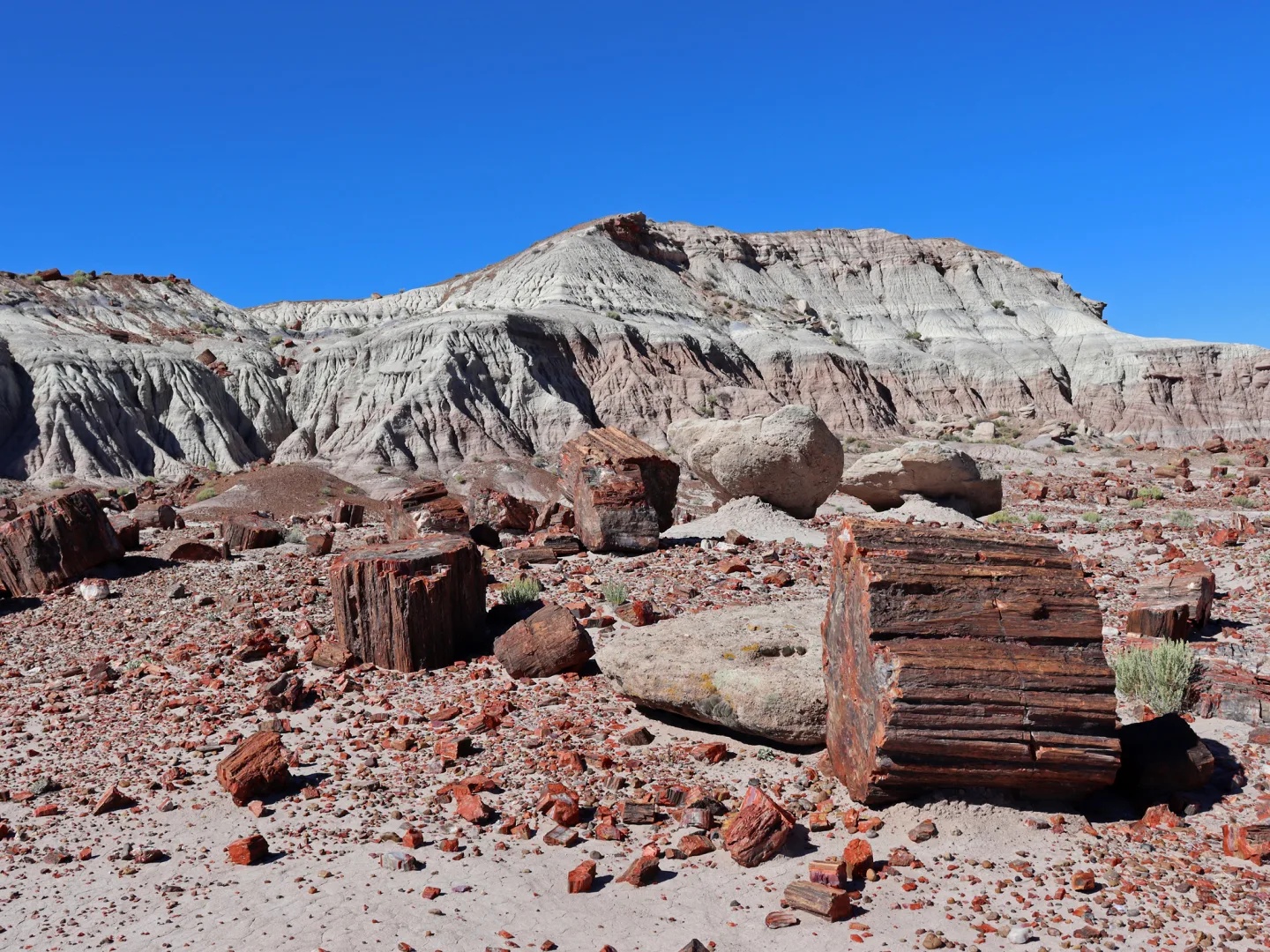
Petrified Forest
Along old Route 66 in eastern Arizona lies one of the world's largest concentrations of petrified wood — ~225-million-year-old Triassic logs turned to rainbow quartz, plus the banded badlands of the Painted Desert. Silica-rich groundwater replaced the wood cell-by-cell, with iron and manganese coloring the agate. It's the only national park containing a stretch of historic Route 66. Taking petrified wood is illegal — and the park keeps a famous file of "conscience letters" from visitors returning stolen pieces that brought bad luck.
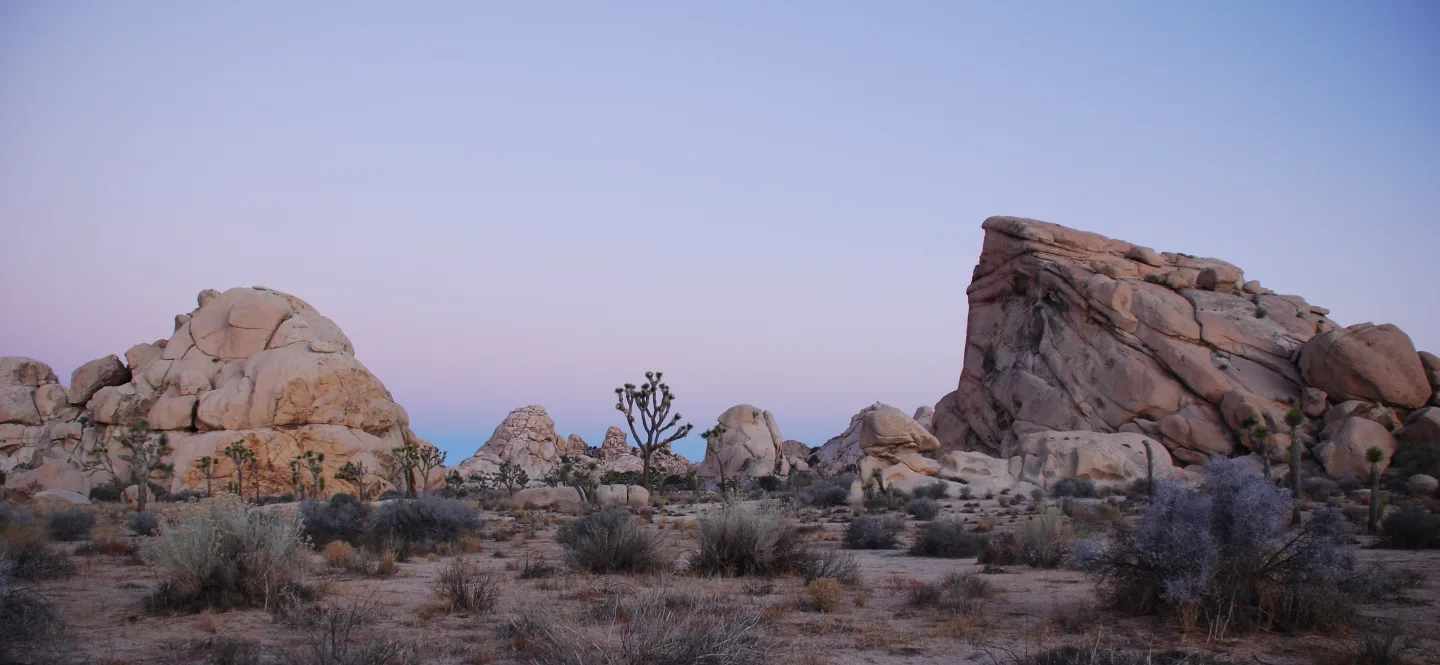
Joshua Tree
East of Los Angeles, Joshua Tree marks where the Mojave and Colorado deserts meet — the higher, cooler Mojave full of twisted Joshua trees (giant yuccas), the lower, hotter Colorado of creosote and cholla. Jumbled monzogranite boulders that formed underground and weathered into rounded stacks draw climbers to 8,000+ routes. Mormon settlers reputedly named the tree for the prophet Joshua reaching skyward; it's pollinated only by the yucca moth in a strict mutualism.
Great Basin
In remote east-central Nevada, Great Basin climbs from sagebrush desert to 13,065-ft Wheeler Peak, a "sky island" holding ancient bristlecone pines — some ~5,000 years old — and the ornate Lehman Caves. Below the peak sits Nevada's only glacier, a small rock glacier. With ~150,000 visitors in 2024 and some of the darkest skies in the U.S., it's a quiet gem. A bristlecone here named "Prometheus" was cut down in 1964 and found to be ~4,900 years old — spurring stronger protection of the species.
Guadalupe Mountains
West Texas hides Guadalupe Peak (8,751 ft), the highest point in the state, beside El Capitan's sheer limestone prow and McKittrick Canyon's blazing fall foliage. The whole range is an exposed slice of the Permian Capitan Reef — a ~265-million-year-old fossil reef from a tropical sea, one of the best-preserved on Earth (the same reef that hosts Carlsbad Caverns). Geologists travel here to study an ancient marine reef now standing as desert mountains.
By the numbers
- How long is the Grand Canyon, measured along the Colorado River that carved it?
- 277 miles
- How many visitors came to Zion National Park in 2024, making it the 2nd-most-visited national park?
- 4.95 million visitors
- In Great Basin National Park, how high (in feet) is Wheeler Peak, the summit that holds ancient bristlecone pines?
- 13065 feet
- How old, in years, are the Triassic petrified logs at Petrified Forest National Park?
- 225000000 years
- How high is Guadalupe Peak, the highest point in Texas?
- 8751 feet
- What is the hottest air temperature reliably recorded on Earth, measured at Furnace Creek in Death Valley on July 10, 1913?
- 134 degrees Fahrenheit
- How far below sea level is Badwater Basin in Death Valley — the lowest point in North America?
- -282 ft
- What is the hottest air temperature ever reliably recorded on Earth, set at Furnace Creek, Death Valley, in 1913?
- 134 °F
- How high is Wheeler Peak, the high point of Great Basin National Park?
- 13065 ft
- How high is Guadalupe Peak, the highest point in Texas?
- 8751 ft
- About how many people visited Zion National Park in 2024, the 2nd-most-visited national park?
- 4946592 visitors
- About how many people visited Grand Canyon National Park in 2024?
- 4919163 visitors
Matched pairs
Each item on the left goes with the one on the right.
- The densest concentration of hoodoos (rock spires) on Earth
- Bryce Canyon
- Capitol Reef
- protects the Waterpocket Fold, a ~100-mile wrinkle in the Earth's crust
- Badwater Basin (−282 ft), the lowest point in North America
- Death Valley
- Grand Canyon
- Arizona
- Big Bend
- Texas
- Great Basin
- Nevada
- Death Valley
- Telescope Peak (11,049 ft)
Step by step
Trace how the gypsum dunes of White Sands are made
- Rain dissolves gypsum from the surrounding mountains
- The dissolved gypsum pools in Lake Lucero
- The water dries and leaves selenite crystals behind
- Wind grinds the crystals into brilliant white sand
Rain, a drying lakebed, and wind turn mountain gypsum into white dunes.
Self-test
Answer each question from memory, then check your work against the answer key.
1. In which national park did ranger Edward Abbey write the wilderness classic Desert Solitaire in 1968?
- AZion
- BArches
- CBryce Canyon
- DCanyonlands
2. Which Southwest park, despite its name, is not a canyon but a set of eroded amphitheaters holding the densest concentration of rock spires (hoodoos) on Earth?
- ABryce Canyon
- BZion
- CGrand Canyon
- DArches
3. About how long is the Grand Canyon, measured along the Colorado River that carved it?
- A190 miles
- B18 miles
- C277 miles
- D400 miles
4. Which canyon-country park was Utah's first national park (1919) and its busiest, drawing ~4.95 million visitors in 2024?
- ACanyonlands
- BArches
- CBryce Canyon
- DZion
5. Which of these is NOT one of the five canyon-country headliners of the Colorado Plateau?
- AArches
- BCanyonlands
- CZion
- DSaguaro
6. The giant saguaro cactus protected at Saguaro National Park is found only in which desert?
- AColorado Desert
- BPainted Desert
- CSonoran Desert
- DMojave Desert
7. Capitol Reef National Park was set aside to protect what geological feature?
- AThe Waterpocket Fold, a ~100-mile wrinkle in the crust
- BThe Painted Desert badlands
- CThe Vishnu Schist
- DThe Capitan Reef
8. By what process did the logs at Petrified Forest turn to rainbow-colored quartz?
- AFreeze-thaw wedging of the wood
- BPermineralization — silica-rich groundwater replaced the wood cell by cell
- CWind grinding of dried crystals
- DSulfuric-acid dissolution
9. The Joshua tree survives through a strict mutualism, being pollinated exclusively by which organism?
- AThe lesser long-nosed bat
- BThe Brazilian free-tailed bat
- CThe yucca moth
- DHoneybees
10. Which statement about the giant saguaro cactus is accurate?
- AIts blossom opens in December
- BIt typically lives only about 50 years
- CIt grows across all four southwestern deserts
- DIt waits until age 50–75 to sprout its first arm
11. Which park protects the world's largest gypsum dune field — about 275 square miles of brilliant white sand in the Tularosa Basin?
- AWhite Sands
- BDeath Valley
- CBig Bend
- DCarlsbad Caverns
12. Carlsbad Caverns' Big Room formed unusually. What dissolved the limestone from the inside out?
- AA retreating glacier
- BSulfuric acid rising from oil and gas deposits below
- CThe Rio Grande's floodwaters
- DRainwater seeping down from above
13. Guadalupe Mountains and Carlsbad Caverns are both part of what ~265-million-year-old feature?
- AThe Waterpocket Fold
- BThe Colorado Plateau
- CThe Permian Capitan Reef
- DThe Vishnu Schist
14. Death Valley's Badwater Basin is the lowest point in North America. At what elevation does it sit?
- A−282 ft
- B−512 ft
- CExactly at sea level
- D−136 ft
15. Along which river, forming the U.S.–Mexico border, does Big Bend National Park sit?
- AThe Virgin River
- BThe Rio Grande
- CThe Colorado River
- DThe Green River
16. Which park is known for towering Navajo Sandstone cliffs and the knife-edge Angels Landing hike above the Virgin River?
- ACanyonlands
- BCapitol Reef
- CBryce Canyon
- DZion
17. Which Utah park protects over 2,000 natural sandstone spans, including the famous Delicate Arch on the state license plate?
- AArches
- BCapitol Reef
- CBryce Canyon
- DCanyonlands
18. Which park's chambers empty each summer evening as hundreds of thousands of Brazilian free-tailed bats stream out at dusk?
- AGuadalupe Mountains
- BGreat Basin
- CBig Bend
- DCarlsbad Caverns
19. Which park exposes nearly 2 billion years of Earth's history — down to the 1.8-billion-year-old Vishnu Schist — in walls over a mile deep?
- ABryce Canyon
- BGrand Canyon
- CZion
- DCanyonlands
20. Which park holds Badwater Basin — the lowest point in North America — and the hottest air temperature ever reliably recorded on Earth?
- AGreat Basin
- BBig Bend
- CDeath Valley
- DGuadalupe Mountains
21. Death Valley holds both Badwater Basin (below sea level) and Telescope Peak (11,049 ft). Roughly how much vertical relief separates them?
- AAbout one mile
- BAbout half a mile
- CAbout three miles
- DAbout two miles
22. How high is Wheeler Peak, the high point of Great Basin National Park?
- A9,115 ft
- B13,065 ft
- C11,049 ft
- D8,751 ft
23. Guadalupe Peak, the highest point in Texas, rises to what elevation?
- A8,751 ft
- B11,049 ft
- C6,000 ft
- D13,065 ft
24. In which state is Great Basin National Park?
- AUtah
- BArizona
- CNevada
- DNew Mexico
25. Which park–state pairing is correct?
- ABig Bend — Texas
- BGrand Canyon — Utah
- CSaguaro — New Mexico
- DGreat Basin — Arizona
Go deeper
- WatchNot a Canyon Despite its name, Bryce Canyon isn't a canyon. It's a series of natural amphitheaters, eroded into the edge of a plateau.
- WatchConscience Letters Petrified Forest holds one of the world's largest concentrations of petrified wood. The logs are about 225 million years old, turned to rainbow-colored quartz.
- WatchCarved by Acid Carlsbad Caverns' Big Room is one of the largest cave chambers in North America: about 8.2 acres of floor.
- WatchCool White Dunes Which Southwest park is it? Name it before the last clue gives it away.
- WatchZion vs. Grand Canyon Zion outdrew the Grand Canyon in 2024. It had about 4.95 million visitors, the second-most of any national park.
- StudyU.S. National Parks in the FlashFeed app
Answer key
- 1. B ArchesRanger Edward Abbey wrote Desert Solitaire at Arches in 1968.
- 2. A Bryce CanyonBryce Canyon isn't a canyon at all — it's amphitheaters carved into a plateau's edge, packed with the densest hoodoos on Earth. Southern Paiute legend says the spires are the 'Legend People' turned to stone by Coyote.
- 3. C 277 milesThe Colorado runs ~277 miles through the canyon. 18 miles is its maximum width, not its length.
- 4. D ZionZion (1919) was Utah's first park and, at ~4.95M visitors in 2024, the 2nd-most-visited in the country.
- 5. D SaguaroThe canyon-country headliners are Grand Canyon, Zion, Bryce, Arches, and Canyonlands. Saguaro is a Sonoran Desert cactus park, not a Colorado Plateau canyon.
- 6. C Sonoran DesertThe saguaro is the iconic symbol of the American West, found only in the Sonoran Desert.
- 7. A The Waterpocket Fold, a ~100-mile wrinkle in the crustCapitol Reef protects the Waterpocket Fold, a ~100-mile monocline. The Vishnu Schist is in the Grand Canyon; the Capitan Reef underlies Carlsbad and Guadalupe.
- 8. B Permineralization — silica-rich groundwater replaced the wood cell by cellSilica-rich groundwater replaced the wood cell by cell (permineralization); iron and manganese tinted the agate. Freeze-thaw carves hoodoos; sulfuric acid carved Carlsbad.
- 9. C The yucca mothThe Joshua tree (a giant yucca) is pollinated only by the yucca moth. The lesser long-nosed bat pollinates saguaro and agave, honeybees are generalist foragers but not obligate partners, and free-tailed bats roost in caves like Carlsbad Caverns.
- 10. D It waits until age 50–75 to sprout its first armSaguaros live 150–200 years and may not grow a first arm until 50–75. They grow only in the Sonoran Desert, and the blossom opens in May–June.
- 11. A White SandsWhite Sands, in New Mexico's Tularosa Basin, holds the world's largest gypsum dune field at about 275 square miles.
- 12. B Sulfuric acid rising from oil and gas deposits belowSulfuric acid, rising from oil and gas below, ate the Permian reef from within — unlike ordinary caves carved by rainwater seeping down.
- 13. C The Permian Capitan ReefBoth expose the Permian Capitan Reef — Guadalupe as desert mountains above, Carlsbad as caverns below. The Waterpocket Fold is at Capitol Reef.
- 14. A −282 ftBadwater Basin lies 282 ft below sea level, the lowest point in North America. From there the park rises two miles to 11,049-ft Telescope Peak.
- 15. B The Rio GrandeBig Bend hugs the Rio Grande's 'big bend' on the Mexico border. The Green and Colorado carve Canyonlands; the Virgin River carved Zion.
- 16. D ZionZion's Navajo Sandstone cliffs, Angels Landing, and the Virgin River's Narrows are its signatures. Bryce is hoodoos; Canyonlands is river-carved districts.
- 17. A ArchesArches, near Moab, holds the greatest density of natural arches on Earth, including the 52-ft Delicate Arch on Utah's plate.
- 18. D Carlsbad CavernsCarlsbad Caverns' bat flights are famous; a teenage Jim White first saw them as 'smoke.' Great Basin has Lehman Caves but not the bat flights.
- 19. B Grand CanyonThe Grand Canyon's mile-deep walls expose ~2 billion years of history, with the Vishnu Schist at the bottom. Zion's rock is only ~180 million years old.
- 20. C Death ValleyDeath Valley holds Badwater Basin (−282 ft) and the 134°F Furnace Creek record of 1913 — the lowest, hottest, driest park. It is also the largest park in the contiguous U.S.
- 21. D About two milesFrom −282 ft at Badwater to 11,049 ft at Telescope Peak is over 11,300 feet — a two-mile vertical range within one park. Even the hottest, lowest place in North America reaches two miles into the sky.
- 22. B 13,065 ftWheeler Peak reaches 13,065 ft. 11,049 ft is Death Valley's Telescope Peak, 9,115 ft is Bryce's Rainbow Point, and 8,751 ft is Guadalupe Peak.
- 23. A 8,751 ftGuadalupe Peak tops out at 8,751 ft, the highest point in Texas. 11,049 ft and 13,065 ft are Telescope Peak and Wheeler Peak.
- 24. C NevadaGreat Basin sits in remote east-central Nevada and holds the state's only glacier. Utah, Arizona, and New Mexico each host other Southwest parks.
- 25. A Big Bend — TexasBig Bend is in Texas. Grand Canyon and Saguaro are in Arizona, and Great Basin is in Nevada.
Sources
- U.S. National Park Service
- U.S. National Parks — White Sands
- U.S. National Parks — Grand Canyon
- U.S. National Parks — Zion
- U.S. National Parks — Bryce Canyon
- U.S. National Parks — Arches
- U.S. National Parks — Carlsbad Caverns
- U.S. National Parks — Death Valley
- U.S. National Parks — Saguaro
- U.S. National Parks — Great Basin
- U.S. National Parks — Guadalupe Mountains
- U.S. National Parks — Big Bend
Image credits
- Canyonlands: Thomas Wolf, www.foto-tw.de · CC BY-SA 3.0 — commons.wikimedia.org/wiki/File:Mesa_Arch_Canyonlands_sunrise.jpg
- Capitol Reef: Wikimedia Commons · Mav · CC BY-SA 2.5 — commons.wikimedia.org/wiki/File:Waterpocket_Fold_from_above_Capitol_Reef_Scenic_Drive.jpeg
- Petrified Forest: Wikimedia Commons · Jeffhollett · CC BY-SA 4.0 — commons.wikimedia.org/wiki/File:Jasper_Forest_at_Petrified_Forest_NP_in_AZ_12.jpg
- Joshua Tree: Wikimedia Commons · Jarek Tuszyński · CC BY-SA 3.0 — commons.wikimedia.org/wiki/File:Joshua_Tree_-_Cyclops_%2B_Potato_Head_-_Sunrise.jpg
- Great Basin: Famartin · CC BY-SA 4.0 — commons.wikimedia.org/wiki/File:2014-09-15_13_44_24_View_of_a_Bristlecone_Pine_and_Wheeler_Peak_from_the_Glacier_Trail_in_Great_Basin_National_Park,_Nevada.JPG


