
AZT: Rincons & Catalinas study guide · Lesson 2 of 19
The Rincon Mountains
Rincon Valley & the climb · Mica Mountain & Manning Camp
This is the lesson's study guide from the FlashFeed app, plus its key facts and a self-test.
What you'll be able to do
- Identify the Quilter and Manning Camp Trails as the AZT's Rincon climb, not Tanque Verde Ridge, and describe the Passage 8 approach.
- Recognize Colossal Cave and its Wild West train-robbery lore on the Passage 8 approach.
- Identify Mica Mountain as the Rincon high point (~8,666 ft) that the AZT skirts rather than summits.
- Describe Manning Camp as the historic high-country ranger camp (~7,920 ft) with reliable year-round water.
- Recognize Grass Shack as the designated backcountry campground that breaks the Rincon climb partway up.
Passages 8 and 9 carry the Arizona Trail from the desert floor up the Rincon Mountains — the longest, highest, and most demanding climb of this whole stretch. This lesson covers the approach across Rincon Valley and the big ascent into the high country of Saguaro National Park.
Rincon Valley and the climb
Passage 8 traverses the Cienega Creek Natural Preserve and Colossal Cave Mountain Park on its way to Saguaro National Park's eastern (Rincon Mountain) district. It's classic desert-grassland walking — golden grasses, mesquite, and saguaro — before the real climbing begins. There's a slice of Wild West lore here too: Colossal Cave was reputedly used as a hideout by a gang that robbed a Southern Pacific passenger train — traditionally dated to 1887, though the exact year is not confirmed — its branching passages making an ideal place to lie low.
Then the trail tilts up. Inside the park the AZT follows the Quilter Trail, then turns onto the Manning Camp Trail, which climbs past the Grass Shack campground toward Manning Camp; the park designated the Manning Camp Trail part of the Arizona National Scenic Trail in 2012. The numbers are sobering: in its first 14 miles, Passage 9 gains over 6,000 feet and passes through six biotic communities, from desert scrub and desert grassland through oak and pine–oak woodland to pine and mixed-conifer forest — the single biggest sustained ascent of this stretch. Don't confuse this route with the Tanque Verde Ridge, the long ridge in view from the Hope Camp Trail: its own park trail runs 11 miles up to Cow Head Saddle, and the AZT does not use it.
Two rules govern the Rincons. First, dispersed camping is strictly prohibited inside Saguaro National Park — you must camp only at designated, permitted sites, so plan your mileage carefully on a 6,000-foot climb with few legal options. Second, mind the wildlife: the notion that "there are no bears in the Rincons" is false. A healthy black bear population thrives here, scat is common along the high trail, and you'll want to store food properly at the designated camps.
Mica Mountain and Manning Camp
The high point of the Rincons is Mica Mountain, at roughly 8,666 feet, topping out in cool mixed-conifer forest — a Pleistocene relic stranded far above the desert. The AZT climbs into its forested flank but, true to form, bypasses the actual summit: at the Mica Mountain junction the trail leaves the summit path and contours around the peak, so bagging the high point is a short off-trail side trip.
As of 2026, Saguaro National Park, whose highest point is Mica Mountain, gives the elevation range of its Rincon Mountain District as 2,670 to 8,666 feet. Other published figures for the summit differ by a few feet, from 8,664 to 8,668.
The crown jewel of the high country is Manning Camp, a historic ranger camp at about 7,920 feet with a reliable year-round spring and a waterfall. It's the single most dependable water source on this stretch and the most coveted designated (permit-required) campsite in the park's backcountry — the reward at the top of the big climb for northbound hikers, and the anchor around which the long carries on either side are planned. Lower on the ascent sits Grass Shack, another designated backcountry campground with a seasonal water source, which lets you break the climb partway up. Both require a recreation.gov reservation, so book them before your hike — there's no legal fallback to dispersed camping in the park.
A second high summit, Rincon Peak (8,482 feet), rises about 7 miles south of Mica Mountain, also inside Saguaro National Park. The AZT does not go there: its route climbs north to Manning Camp and the junction just below Mica Mountain, then drops toward Redington Road. Rincon Peak is a separate climb off the trail, and its 8,482 feet is easy to confuse with Mica Mountain's roughly 8,666.
Key terms
- Tanque Verde Ridge
- A long, prominent ridge in Saguaro National Park's Rincon Mountain District, in view from the Hope Camp Trail. Its own park trail runs 11 miles up to Cow Head Saddle, but the AZT does not use it: the AZT climbs the Rincons by the Quilter and Manning Camp Trails.
- Mica Mountain
- The highest point in the Rincon Mountains, at roughly 8,666 ft. It tops out in cool mixed-conifer forest — a Pleistocene relic high above the desert. The AZT climbs into its forested flank but bypasses the actual summit.
- Manning Camp
- A historic ranger camp at about 7,920 ft in the high Rincons, featuring a reliable year-round spring and a waterfall. It is the single most dependable water source and a designated (permit-required) campsite in Saguaro National Park's backcountry — a crucial high-country anchor.
- Grass Shack
- A designated backcountry campground in Saguaro National Park along the AZT, lower on the Rincon climb than Manning Camp. It offers a seasonal water source and a permitted place to break the big ascent — reserve it through recreation.gov.
Key concepts
Colossal Cave
- A branching underground landmark on the desert-grassland approach, before the real Rincon climbing begins.
- Its maze of passages made it an ideal place to lie low.
- Legend says a gang used it as a hideout after robbing a Southern Pacific passenger train, traditionally dated to 1887 (the exact year is unconfirmed).
Tanque Verde Ridge
- A long, prominent ridge in Saguaro National Park's Rincon Mountain District, in view from the Hope Camp Trail.
- Its own park trail runs 11 miles from the trailhead up to Cow Head Saddle.
- Easy to mistake for the AZT's route, but the AZT climbs the Rincons by the Quilter and Manning Camp Trails instead.
Key facts
Across the Rincon Valley
Passage 8 traverses the Cienega Creek Natural Preserve and Colossal Cave Mountain Park on its way to Saguaro National Park's eastern (Rincon Mountain) district. It's classic desert-grassland walking — golden grasses, mesquite, and saguaro — before the real climbing begins.
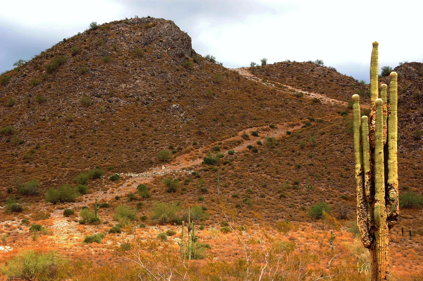
Six thousand feet in fourteen miles
The climb up the Rincon Mountains from the desert floor gains over 6,000 feet of elevation in just 14 miles. It is the single biggest sustained ascent of this stretch of the Arizona Trail — a desert-to-conifer transect that leaves the saguaros far below.
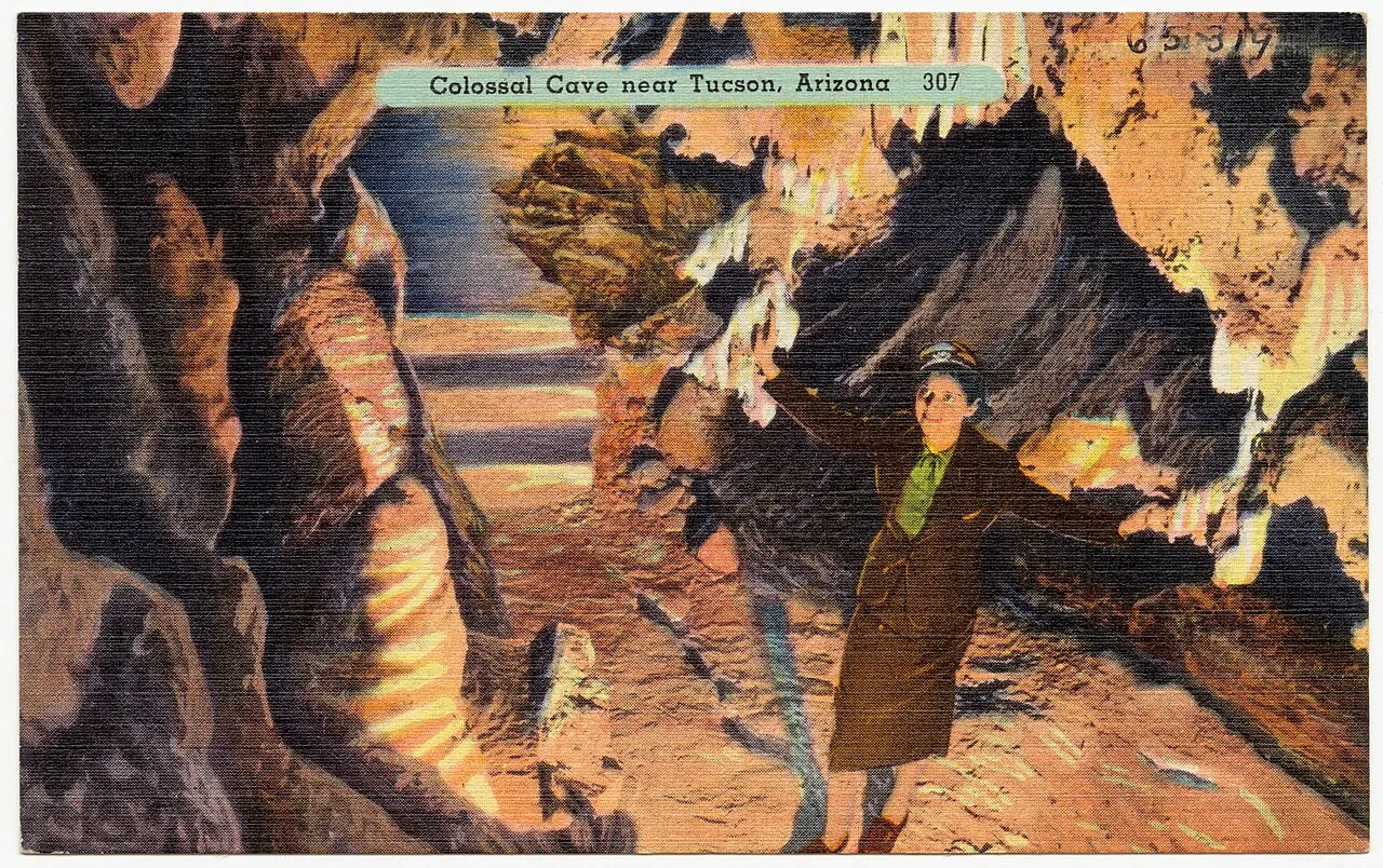
An old outlaw hideout
Colossal Cave, which Passage 8 passes, was reputedly used as a hideout by a gang that robbed a Southern Pacific passenger train — traditionally dated to 1887, though the exact year isn't confirmed. The cave's cool, branching passages made an ideal place to lie low — a slice of Wild West lore right on the trail. (Gang name varies by account.)
No dispersed camping in Saguaro NP
Dispersed backcountry camping is strictly prohibited inside Saguaro National Park. You must camp only at designated sites (Grass Shack, Manning Camp, and others) with a reserved permit — so plan your mileage to reach a legal site, since the long Rincon climb leaves few options in between.
Up the Manning Camp Trail
Inside Saguaro National Park, the AZT follows the Quilter Trail and then the Manning Camp Trail, which climbs past Grass Shack toward Manning Camp. The park designated the Manning Camp Trail part of the Arizona National Scenic Trail in 2012.
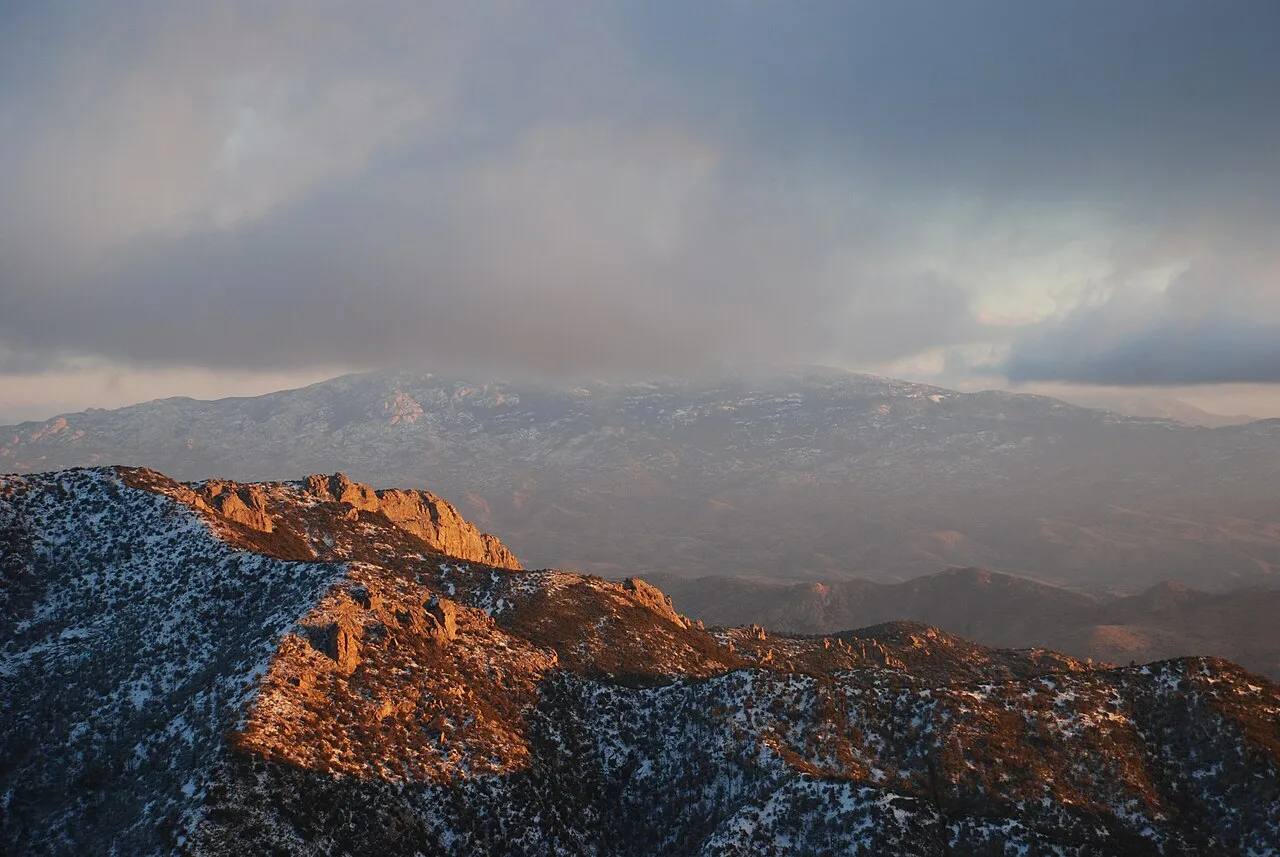
Bypassing Mica Mountain
At the Mica Mountain junction, the AZT leaves the summit trail and contours around to bypass the 8,666-foot peak. Bagging the actual high point is a short off-trail side trip — worth it for the forest and views, but not on the official route.
The high country's crown jewel
Manning Camp is a historic ranger camp in the high Rincons — the most coveted permitted campsite in the park's backcountry.
The most dependable water source
Manning Camp has a year-round spring and a waterfall, making it the single most dependable water source on this stretch of the Arizona Trail.
A Pleistocene relic
Mica Mountain, at about 8,666 feet, is the highest point in the Rincon Mountains — a Pleistocene-era relic standing far above the surrounding desert floor.
By the numbers
- Elevation of Mica Mountain, the Rincon high point (ft)
- 8666 ft
- Elevation of Manning Camp (ft)
- 7920 ft
Self-test
Answer each question from memory, then check your work against the answer key.
1. After the Quilter Trail, which park trail carries the AZT up the big Rincon climb past Grass Shack?
- AItalian Spring Trail
- BManning Camp Trail
- COracle Ridge Trail
- DTanque Verde Ridge Trail
2. How much elevation does the AZT's climb up the Rincon Mountains gain, and over what distance?
- AOver 6,000 feet in 14 miles
- BAbout 3,500 feet in 25 miles
- COver 9,500 feet in 20 miles
- DAbout 2,000 feet in 8 miles
3. In which district of Saguaro National Park does the AZT make its big Rincon climb out of the desert?
- AThe western, Tucson Mountain district
- BThe southern, Rincon Valley district
- CThe eastern, Rincon Mountain district
- DThe northern, Santa Catalina district
4. On its desert-grassland approach, Passage 8 traverses Colossal Cave Mountain Park and which natural preserve?
- ASan Pedro Riparian preserve
- BEmpire Ranch preserve
- CLas Cienegas grassland reserve
- DCienega Creek Natural Preserve
5. Before the big Rincon climb begins, how is the Passage 8 terrain best described?
- AOak and pine–oak woodland
- BDense riparian cottonwood gallery forest
- CDesert-grassland with golden grasses, mesquite, and saguaro
- DPine and mixed-conifer forest
6. According to Wild West lore, what was Colossal Cave reputedly used for?
- AA Hohokam grain store
- BA Civil War field hospital
- CA copper mining shaft
- DA hideout after a train robbery
7. The gang tied to Colossal Cave robbed a passenger train belonging to which railroad?
- ASouthern Pacific
- BUnion Pacific
- CDenver & Rio Grande
- DAtchison, Topeka & Santa Fe
8. What feature of Colossal Cave made it an ideal place for the gang to lie low?
- AA single narrow cliff-guarded entrance
- BIts cool, branching passages
- CAn underground river for escape
- DIts position on the Mexican border
9. On which passage of the Arizona Trail does the route pass Colossal Cave?
- APassage 11
- BPassage 7
- CPassage 8
- DPassage 9
10. The train-robbery legend tied to Colossal Cave is traditionally dated to which year?
- A1851
- B1934
- C1912
- D1887
11. What is the approximate elevation of Mica Mountain, the high point of the Rincons?
- AAbout 6,000 feet
- BAbout 8,666 feet
- CAbout 7,920 feet
- DAbout 9,150 feet
12. What does the AZT do at the Mica Mountain junction?
- ABypasses the summit, contouring around the peak
- BForks off the main trail toward Rincon Peak instead
- CEnds at the Mica Mountain summit
- DCrosses directly over the summit
13. Mica Mountain is the highest point in which mountain range?
- AThe Rincon Mountains
- BThe Santa Rita Mountains
- CThe Huachuca Mountains
- DThe Santa Catalina Mountains
14. What kind of forest tops out on Mica Mountain?
- ARiparian cottonwood forest
- BCool mixed-conifer forest
- CSaguaro cactus desert
- DOak-juniper woodland
15. How can an AZT hiker reach the true summit of Mica Mountain?
- ABy a permitted technical rock climb
- BBy detouring down to Manning Camp first
- CBy taking a short off-trail side trip from the AZT
- DBy staying on the AZT, which crosses the summit
16. At roughly what elevation sits Manning Camp in the high Rincons?
- AAbout 8,482 feet
- BAbout 6,500 feet
- CAbout 8,666 feet
- DAbout 7,920 feet
17. What is Manning Camp?
- AA fire lookout tower
- BA historic ranger camp
- CA former mining town
- DA trailhead parking lot
18. What water features make Manning Camp so valuable to hikers?
- AA rainwater cistern that empties by midsummer
- BA piped campground spigot shut off each summer
- CA reliable year-round spring and a waterfall
- DA seasonal creek that can run dry
19. Beyond its water, what makes Manning Camp the prize at the top of the Rincon climb?
- AIt's the most coveted designated campsite in the park's backcountry
- BIt hands out free walk-up permits each morning
- CIt sits right on the summit of Mica Mountain, the Rincon high point
- DIt's the one site where dispersed camping is allowed
20. To stay overnight at Manning Camp, what must a hiker do?
- ACamp first-come, first-served
- BPay a cash fee at the park gate
- CGet a ranger's verbal okay on arrival
- DReserve a permit through recreation.gov
21. What is Grass Shack along the AZT in the Rincons?
- AA natural rock shelter
- BA designated backcountry campground
- CA historic homestead ruin
- DA desert spring box
22. Where does Grass Shack sit relative to Manning Camp on the Rincon climb?
- ALower on the climb than Manning Camp
- BOn the opposite side of the range
- CAt the same elevation as Manning Camp
- DHigher, near the summit above Manning Camp
23. What kind of water source does Grass Shack offer?
- ANo water source at all
- BA reliable year-round spring
- CA piped municipal supply
- DA seasonal water source
24. Why is Grass Shack useful to hikers on the Rincon ascent?
- AIt permits dispersed camping anywhere nearby
- BIt is the only water source in the whole park
- CIt lets you break the big climb partway up
- DIt marks the official summit of the range
25. How does a hiker secure a spot at Grass Shack?
- ARegister at a summit ranger station
- BReserve it through recreation.gov
- CArrive first-come with no permit needed
- DSet up anywhere, since dispersed camping is allowed
Go deeper
Answer key
- 1. B Manning Camp TrailAfter the Quilter Trail, the AZT follows the Manning Camp Trail past Grass Shack toward Manning Camp. The Tanque Verde Ridge Trail is a separate park route up to Cow Head Saddle that the AZT does not use.
- 2. A Over 6,000 feet in 14 milesThe Rincon climb gains over 6,000 feet in just 14 miles — the single biggest sustained ascent of this stretch, a desert-to-conifer transect that leaves the saguaros far below.
- 3. C The eastern, Rincon Mountain districtPassage 8 heads for Saguaro National Park's eastern (Rincon Mountain) district, where the big climb begins. The Tucson Mountain district lies west of the city; the other two are not park districts.
- 4. D Cienega Creek Natural PreservePassage 8 traverses the Cienega Creek Natural Preserve and Colossal Cave Mountain Park on its way to Saguaro NP's eastern district before the real climbing begins.
- 5. C Desert-grassland with golden grasses, mesquite, and saguaroPassage 8 is classic desert-grassland walking — golden grasses, mesquite, and saguaro — before the trail climbs the Quilter and Manning Camp Trails into higher zones.
- 6. D A hideout after a train robberyColossal Cave was reputedly used as a hideout by a gang that robbed a Southern Pacific passenger train — traditionally dated to 1887, though the exact year is unconfirmed — its branching passages made an ideal place to lie low.
- 7. A Southern PacificThe lore holds that the gang robbed a Southern Pacific passenger train, then hid out in Colossal Cave. The other railroads did not figure in this story.
- 8. B Its cool, branching passagesThe cave's cool, branching passages made it an ideal hideout — a maze to disappear into. The other features are not part of the account.
- 9. C Passage 8Colossal Cave is on Passage 8, the desert-grassland approach that also traverses Cienega Creek Natural Preserve; Passage 9 continues the climb into the high Rincons.
- 10. D 1887Tradition dates the Southern Pacific train robbery behind the Colossal Cave hideout legend to 1887, though the exact year is not confirmed.
- 11. B About 8,666 feetMica Mountain tops out at roughly 8,666 ft in cool mixed-conifer forest. 7,920 ft is Manning Camp, not the summit.
- 12. A Bypasses the summit, contouring around the peakTrue to form, the AZT leaves the summit trail at the junction and contours around Mica Mountain, so bagging the high point is a short off-trail side trip.
- 13. A The Rincon MountainsMica Mountain (~8,666 ft) is the high point of the Rincon Mountains, a Pleistocene relic stranded far above the desert.
- 14. B Cool mixed-conifer forestMica Mountain tops out in cool mixed-conifer forest — a Pleistocene relic high above the desert floor. Cactus and lower woodlands sit far below it on the climb.
- 15. C By taking a short off-trail side trip from the AZTAt the Mica Mountain junction the AZT leaves the summit trail, so bagging the ~8,666-ft high point is a short off-trail side trip. The official route never crosses the summit.
- 16. D About 7,920 feetManning Camp sits at about 7,920 ft. 8,666 ft is Mica Mountain and 8,482 ft is Rincon Peak — both summits, not the camp.
- 17. B A historic ranger campManning Camp is a historic ranger camp in the high Rincons, the crown jewel of the high country and the most coveted permitted campsite in the park's backcountry.
- 18. C A reliable year-round spring and a waterfallManning Camp has a reliable year-round spring and a waterfall, making it the single most dependable water source on this stretch of trail.
- 19. A It's the most coveted designated campsite in the park's backcountryManning Camp is the most coveted designated, permit-required campsite in Saguaro NP's backcountry. Dispersed camping is banned parkwide, and permits must be reserved in advance, not walked up.
- 20. D Reserve a permit through recreation.govManning Camp is a designated, permit-required campsite. Book it through recreation.gov before your hike — there's no legal fallback to dispersed camping in Saguaro NP.
- 21. B A designated backcountry campgroundGrass Shack is a designated backcountry campground in Saguaro National Park, a permitted place to break the big Rincon ascent.
- 22. A Lower on the climb than Manning CampGrass Shack sits lower on the Rincon climb than Manning Camp, letting hikers break the big ascent partway up.
- 23. D A seasonal water sourceGrass Shack offers a seasonal water source — unlike Manning Camp's reliable year-round spring, it cannot always be counted on.
- 24. C It lets you break the big climb partway upPositioned partway up the climb, Grass Shack gives a legal, permitted place to split the 6,000-foot ascent into more manageable days.
- 25. B Reserve it through recreation.govGrass Shack requires a recreation.gov reservation, booked before the hike. Dispersed camping is strictly prohibited in Saguaro NP, so there's no legal fallback.
Sources
- Wikipedia — Rincon Peak — en.wikipedia.org/wiki/Rincon_Peak
- Arizona Trail Association — Passage 9: Rincon Mountains — aztrail.org/explore/passages/passage-9-rincon-mountains/
- National Park Service — Saguaro National Park: Nature & Science — www.nps.gov/sagu/learn/nature/index.htm
- Wikipedia — Mica Mountain — en.wikipedia.org/wiki/Mica_Mountain
- Wikipedia — Rincon Mountains — en.wikipedia.org/wiki/Rincon_Mountains
- National Park Service — Manning Camp Trail restoration (Manning Camp Trail designated part of the AZT, 2012) — www.nps.gov/sagu/learn/news/gaoa-funds-trail-restoration.htm
- National Park Service — Tanque Verde Ridge Trail — www.nps.gov/places/tanque-verde-ridge-trail.htm
- National Park Service — Saguaro National Park: Rincon Valley Area (Hope Camp Trail) — www.nps.gov/sagu/planyourvisit/rincon-valley-area.htm
Image credits
- Six thousand feet in fourteen miles: Wikimedia Commons · Midnight Believer · CC BY-SA 2.0 — commons.wikimedia.org/wiki/File:Silly_mountain_arizona.jpg
- An old outlaw hideout: Tichnor Brothers, Publisher · Public domain — commons.wikimedia.org/wiki/File:Colossal_cave_near_Tucson,_Arizona_(65319).jpg
- Bypassing Mica Mountain: All Fronts Quiet · CC BY-SA 3.0 — commons.wikimedia.org/wiki/File:Mica_Mountain_obscured_by_winter_clouds_-_panoramio.jpg


