
U.S. National Parks study guide · Lesson 3 of 27
Lesson 3: How the Landscapes Formed
The Forces That Shape the Land · Reading the Rock
This is the lesson's study guide from the FlashFeed app, plus its key facts and a self-test.
What you'll be able to do
- Match the tectonic and erosional forces to the parks they built.
- Define shield volcanoes and geothermal features.
- Explain how calderas and canyons form.
- Define the vocabulary of sculpted rock and uplifted mountains (hoodoo, arch, fault-block, batholith, natural bridge).
- Recognize iconic formations and cave records on sight.
The Forces That Shape the Land
Nearly every wonder in the national parks is the slow handwriting of a few patient forces: heat rising from the deep earth, plates grinding against one another, ice and water carving stone away, and wind piling it back up. Learn these six processes and the parks stop being a list of pretty places and become a single, legible story.
The Yellowstone Hotspot
A hotspot is a plume of hot mantle rock that stays fixed in place while the tectonic plate above it drifts. As North America slides southwest, the plume burns a "track" of progressively older volcanic centers across the continent. Beneath Yellowstone, that plume has driven three cataclysmic caldera eruptions — 2.1 million, 1.3 million, and 640,000 years ago. The youngest left the Yellowstone Caldera, a depression roughly 30 by 45 miles across. The same shallow heat still powers the park's geothermal show today.
How a Caldera Is Born
A caldera is not a crater blasted outward; it is the opposite — a collapse inward. When a magma chamber empties in a massive eruption, the ground above loses its support and caves into the void. Crater Lake fills exactly such a basin, formed when Mount Mazama collapsed about 7,700 years ago. Rain and snowmelt slowly filled the bowl to a depth of 1,943 feet, making it the deepest lake in the United States and famous for its almost unreal blue.
Rivers of Ice
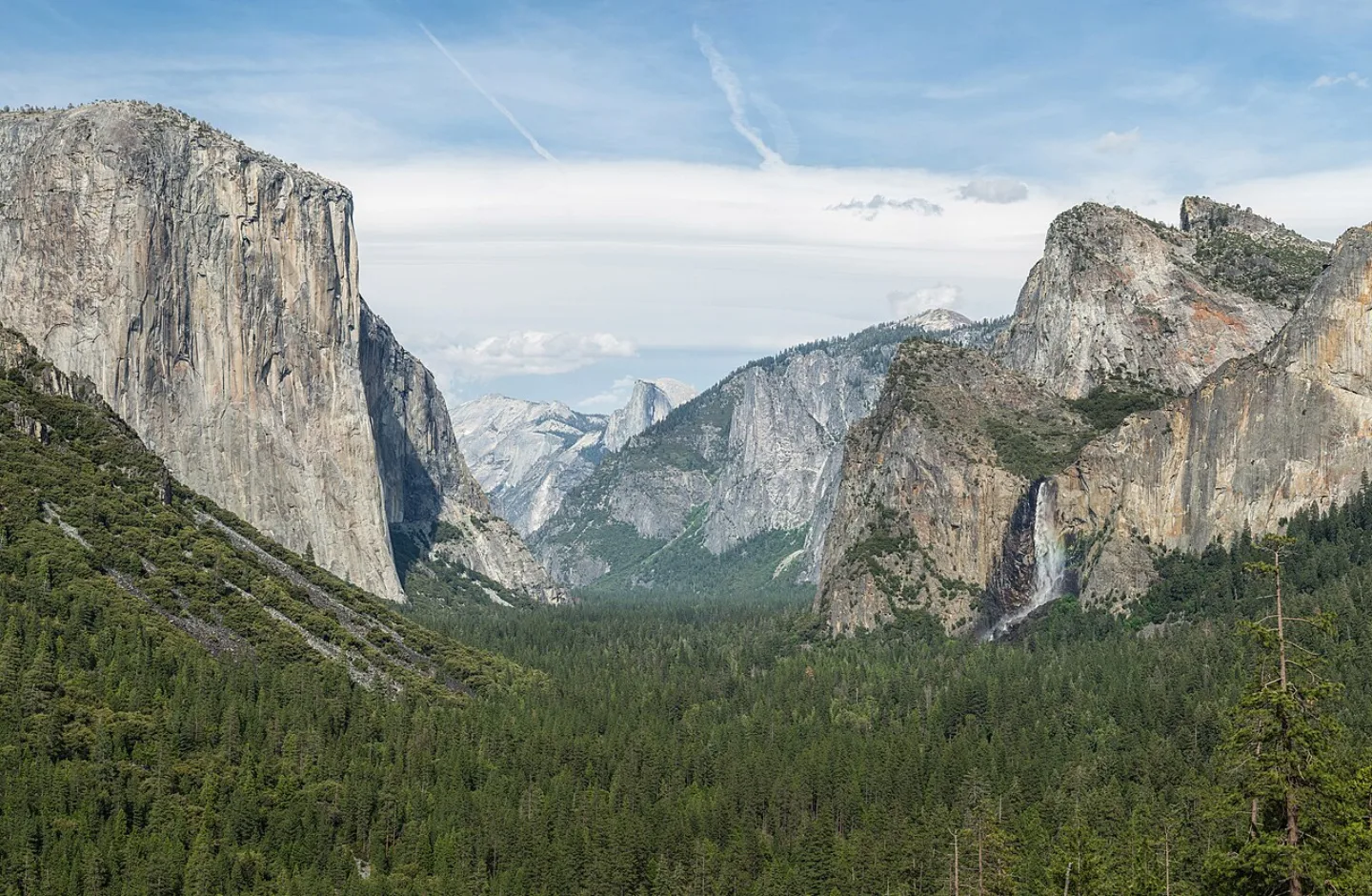
Glaciers move like rivers in slow motion, and they reshape mountains as they go. They grind valleys from a sharp V into a broad U, scoop out bowl-shaped cirques, and whittle ridges into knife-edged arêtes and pointed horns; the rubble they shove ahead piles into moraines. Yosemite Valley is the textbook U-shaped trough, with Half Dome and El Capitan standing as granite that ice scoured and polished. Glacier National Park's horns and hanging valleys were carved the same way — though it has lost most of its ice. Of an estimated 150 glaciers in 1850, only about 25 named glaciers remain, each shrinking as the climate warms.
The River That Cut Through Time
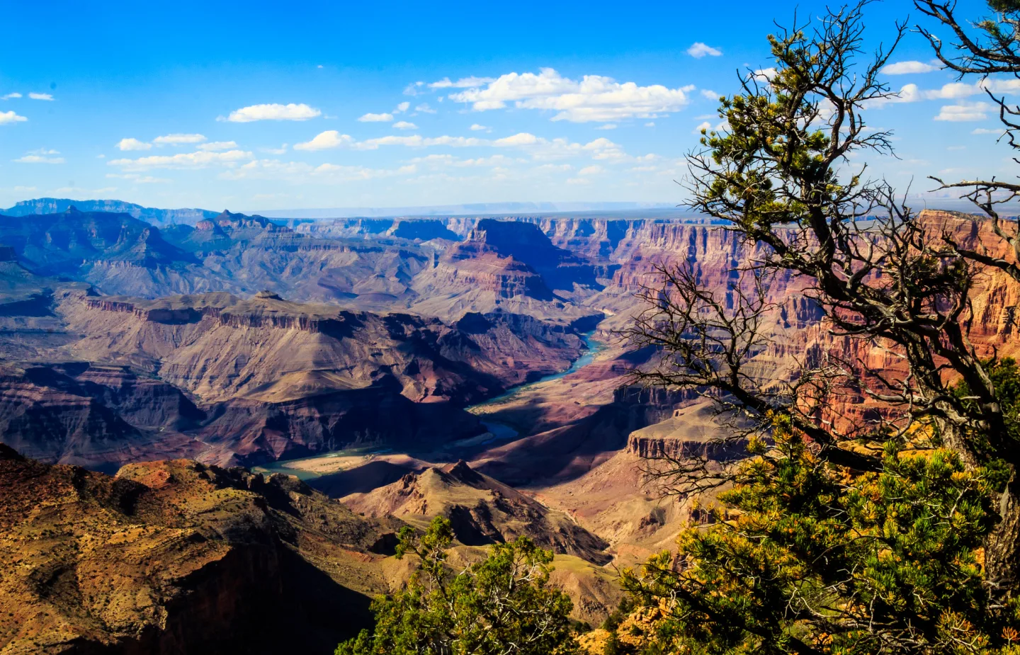
A canyon forms when a river cuts downward faster than its walls erode back — a process most dramatic where rock has been uplifted in a dry climate. The Colorado River has carved the Grand Canyon over the past 5–6 million years, exposing rock layers that span nearly 2 billion years of Earth history, down to the 1.8-billion-year-old Vishnu Schist at the bottom.
Two more forces round out the toolkit. Subduction — one plate diving beneath another — builds volcanic arcs like the Cascade Range (Rainier, Lassen, North Cascades). Fault-block uplift, where stretching crust breaks and tilts upward, raised the foothill-less Teton Range. Karst, the slow dissolving of limestone by acidic water, hollowed out Mammoth Cave, the longest on Earth. And wind, trapping sand against a barrier, built the Great Sand Dunes, the tallest in North America. Shaping these landscapes also leaves features like shield volcanoes — broad domes of fluid basaltic lava, such as Mauna Loa — and geothermal features, where shallow magma heats groundwater into the roughly 500 geysers that give Yellowstone about half of Earth's total. Even the ancient, eroded Appalachians, once Himalayan in scale, are part of the same long story of building up and wearing down.
Reading the Rock
Once you know the forces, you can read the result. Every park has its own vocabulary of stone — words that tell you exactly how a feature was made and what made it. Master a handful of these terms and a canyon rim becomes a sentence you can parse on sight.
A caldera is a basin that forms when a magma chamber empties in a huge eruption and the overlying ground collapses into the void — the inward cousin of a crater. Crater Lake fills one left by Mount Mazama. A hoodoo is a tall, thin spire left standing as frost-wedging and rain dissolve the softer rock around it; Bryce Canyon has the densest concentration of them on Earth. An arch opens where water and ice widen cracks in a sandstone fin until a hole breaks clean through — Arches NP catalogs more than 2,000, including the slender 290-foot Landscape span.
The mountains have their own terms. A fault-block mountain is a range lifted when stretching crust breaks and tilts upward along a fracture; the Tetons rose this way over 10 million years, leaping 7,000 feet from the valley floor with no foothills to ease the climb. A batholith is a vast mass of granite that cooled slowly deep underground before being uplifted and exposed — the tilted Sierra Nevada is one, carrying Yosemite and Sequoia on its back. And the difference between a natural bridge and an arch comes down to the sculptor: a natural bridge is cut by a flowing stream gnawing through the base of a fin (Rainbow Bridge), while an arch is shaped by seepage and frost.
Petrified Dunes of Zion
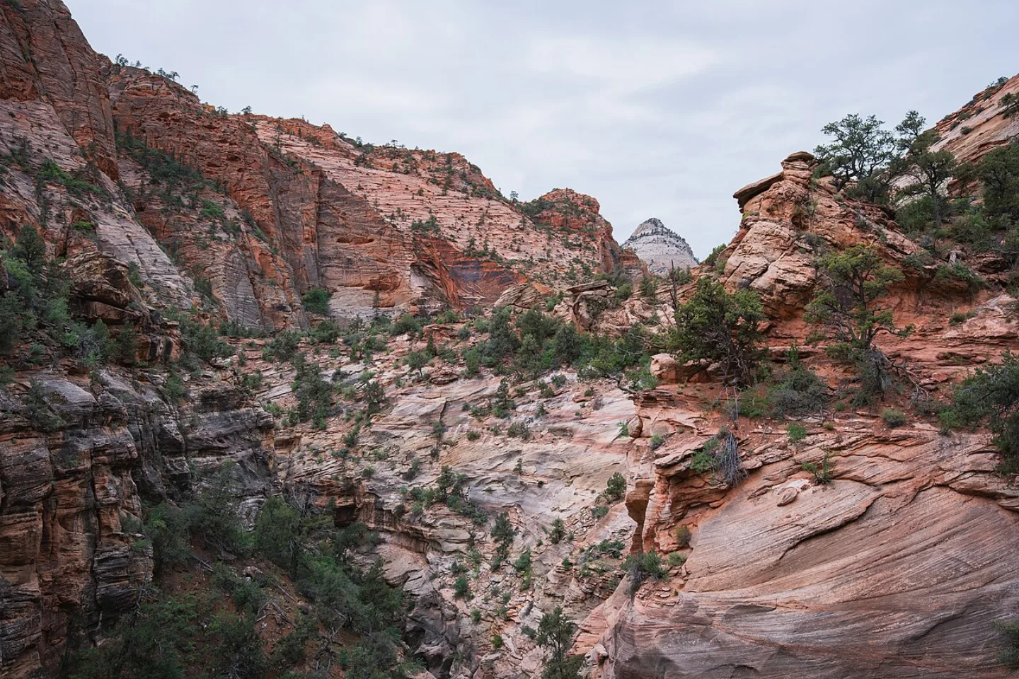
Zion's soaring walls were once a desert. The Navajo Sandstone is a layer of ancient sand dunes turned to stone, and it forms sheer cliffs that rise as much as 2,000 feet. The hardening of that long-buried dune field gave Zion its smooth, towering faces. The Virgin River is still carving — deepening Zion Canyon and squeezing through the slot-canyon corridor called The Narrows, where the walls close in within arm's reach.
The Honeycomb of Wind Cave
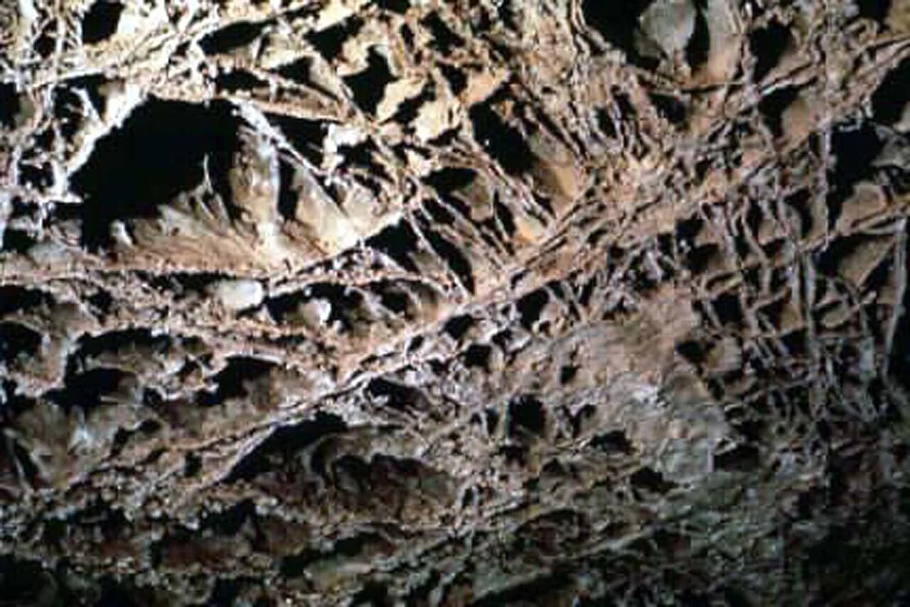
Some of the rarest cave decoration on Earth hangs from the ceilings of Wind Cave in South Dakota. Boxwork is a delicate honeycomb of thin calcite fins, left jutting out after the softer rock around them dissolved away. It is so unusual that Wind Cave is thought to contain about 95% of all the boxwork known in the world — a single cave holding nearly the planet's entire supply of a geological oddity.
These terms come alive in famous formations worth recognizing on sight. Delicate Arch is the freestanding span on Utah's license plate, carved by frost and seepage. Half Dome is the glacially sliced granite landmark over Yosemite Valley. Old Faithful is the clockwork geyser of Yellowstone, driven by magma-heated groundwater. Mammoth Cave is the karst labyrinth of Kentucky, longest on Earth with over 426 miles mapped. And Petrified Forest preserves logs turned to silica stone some 225 million years ago — proof that even wood, given time and the right chemistry, becomes rock to be read.
Key terms
- Shield volcano
- A broad, gently sloping dome built from fluid basaltic lava that spreads far before cooling; Mauna Loa, the world's largest active example by volume, rises in Hawaii Volcanoes NP.
- Geothermal feature
- A geyser, hot spring, mudpot, or fumarole produced where groundwater is heated by shallow magma; Yellowstone holds about half of Earth's active geysers, roughly 500 of them.
- Caldera
- A large basin-shaped depression that forms when a magma chamber empties in a huge eruption and the overlying ground collapses into the void; Crater Lake fills one left by Mount Mazama.
- Hoodoo
- A tall, thin spire of rock left standing as frost-wedging and rain dissolve softer limestone around it; Bryce Canyon has the densest concentration of them on Earth.
- Arch
- An opening formed where water and ice widen cracks in a sandstone fin until a hole breaks clean through; over 2,000 dot a single Utah park, including the 290-foot Landscape span.
- Fault-block mountain
- A range raised when stretching crust breaks and tilts upward along a fracture; the Tetons rose this way over 10 million years, leaping 7,000 feet from the valley with no foothills.
- Batholith
- A vast mass of granite that cooled slowly deep underground before being uplifted and exposed; the tilted Sierra Nevada is one, carrying Yosemite and Sequoia on its back.
- Natural bridge
- A rock span carved by a flowing stream that cuts through the base of a fin — the key difference from a seepage-and-frost arch; Rainbow Bridge was sculpted this way by running water.
Key concepts
Delicate Arch
- It is a freestanding sandstone formation in a Utah park that catalogs more than 2,000 such openings.
- Frost and seepage widened cracks in a sandstone fin until this graceful, leg-like span was left standing alone.
- It is the most photographed feature in its park and appears on Utah's license plate.
Half Dome
- It is a granite landmark rising above a glacially carved U-shaped valley in California's Sierra Nevada.
- Ice Age glaciers scoured and steepened its rounded back, while its sheer face drops nearly vertically.
- Its distinctive sliced-off profile towers over Yosemite Valley and draws cable-route hikers to its summit.
Old Faithful
- It is a geothermal feature in the world's first national park, which holds about half of Earth's active geysers.
- Groundwater heated by shallow magma drives it to erupt on a famously regular schedule, roughly every 60 to 90 minutes.
- Crowds gather on a boardwalk to watch its predictable column of boiling water and steam burst skyward.
Mammoth Cave
- It is a karst landscape in Kentucky where slightly acidic water dissolved soluble limestone over eons.
- With over 426 miles mapped, it is the longest known cave system on Earth — more than twice any other.
- Its name reflects the sheer scale of its passages, not any connection to the Ice Age animal.
Petrified Forest
- It is an Arizona park preserving one of the world's largest concentrations of fossilized logs.
- Buried wood here had its organic matter replaced molecule-by-molecule with silica, turning trees to stone about 225 million years ago.
- Its rainbow-banded ancient logs lie scattered across the Late Triassic badlands of the Painted Desert.
El Capitan
- A sheer granite monolith guarding one side of Yosemite Valley, among the largest exposed granite faces on Earth
- It rises roughly 3,000 feet straight up from the valley floor
- Climbers regard its Dawn Wall and the Nose among the hardest big-wall free climbs in the world
Key facts
Rivers of Ice
Glaciers are rivers of ice that grind valleys from V-shaped to U-shaped, scoop bowl-like cirques from mountainsides, and sharpen ridges into knife-edged arêtes and horns. Yosemite Valley is the textbook example — Half Dome and El Capitan are granite scoured and polished by Ice Age ice. In Glacier National Park, those same forces carved horns and hanging valleys, though the ice that made them is now nearly gone.
The River That Cut Through Time
A canyon forms when a river slices downward faster than its walls can crumble back — a process that runs deepest through uplifted rock in dry country. The Colorado River has carved the Grand Canyon over the past 5–6 million years, peeling back layers that span nearly 2 billion years of Earth history, all the way down to the 1.8-billion-year-old Vishnu Schist at the bottom.
No Foothills
The Teton Range was thrust upward by fault-block uplift, where stretching crust breaks and tilts — a process abrupt enough that the mountains rise straight from the valley floor with no foothills.
Petrified Dunes of Zion
Zion's soaring walls are ancient sand dunes turned to stone. The Navajo Sandstone — hardened from a sea of prehistoric desert dunes — forms sheer cliffs up to about 2,000 feet tall. The Virgin River is still at work, slicing ever deeper into Zion Canyon and squeezing through the slot-canyon corridor known as The Narrows.
The Honeycomb of Wind Cave
Some of the rarest cave decoration on Earth hangs from the ceilings of Wind Cave in South Dakota. Boxwork — a delicate honeycomb of thin calcite fins left behind after the surrounding rock dissolved away — is so unusual that Wind Cave contains an estimated 95% of all the boxwork known in the world.
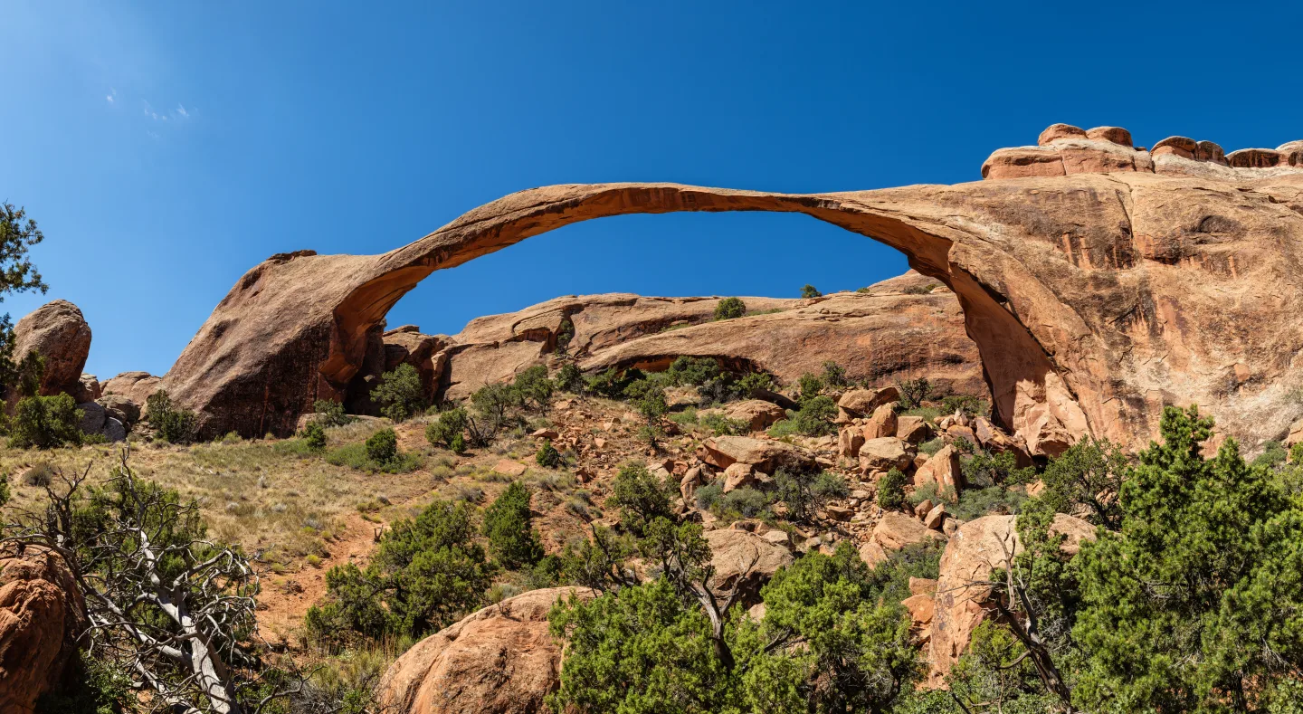
Landscape Arch's 290 Feet
Arches National Park in Utah has catalogued more than 2,000 natural stone arches, openings formed as water and ice widen cracks in a sandstone fin until a hole breaks clean through. Its slender Landscape Arch spans 290 feet.
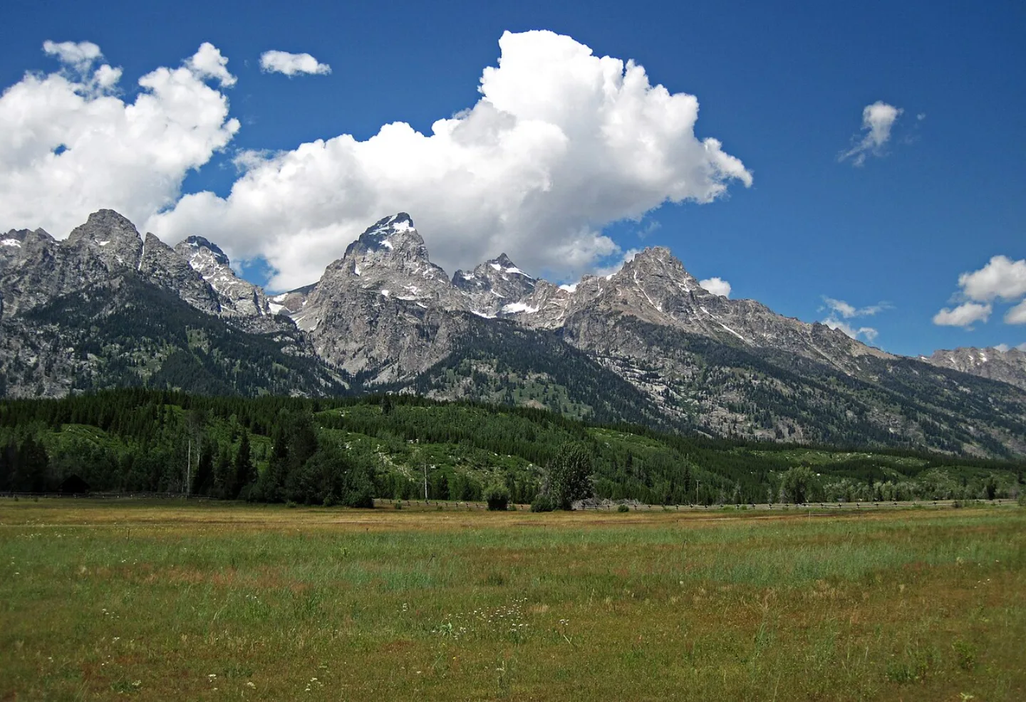
Ten Million Years of Uplift
The Tetons are a classic fault-block mountain range, raised where stretching crust broke and tilted upward over 10 million years. They leap 7,000 feet above the valley floor with no foothills in between.
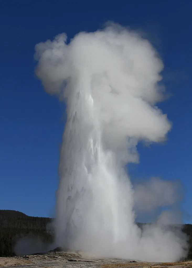
Heated From Below
Old Faithful, Yellowstone's clockwork landmark, is a geyser — a geothermal feature driven by groundwater heated by shallow magma, unlike erosional rock features such as arches and hoodoos.
By the numbers
- How deep is Crater Lake, the deepest lake in the United States?
- 1943 ft
- How many miles of passage have been mapped in Mammoth Cave, the world's longest cave system?
- 426 miles
Matched pairs
Each item on the left goes with the one on the right.
- Subduction (one plate diving under another)
- Cascade Range — Rainier, Lassen, North Cascades
- Fault-block uplift (crust breaks and tilts up)
- Teton Range — Grand Teton NP
- Karst (acidic water dissolving limestone)
- Mammoth Cave — longest cave on Earth
- Wind piling sand trapped by a barrier
- Great Sand Dunes — tallest dunes in North America
Self-test
Answer each question from memory, then check your work against the answer key.
1. Which force built the volcanic arc of the Cascade Range — Rainier, Lassen, and North Cascades?
- AWind deposition
- BFault-block uplift
- CKarst dissolution
- DSubduction, one plate diving beneath another
2. The foothill-less Teton Range was raised by which process?
- AKarst dissolution
- BSubduction
- CFault-block uplift
- DHotspot volcanism
3. Which park was hollowed out by karst — acidic water slowly dissolving limestone?
- AGrand Teton
- BMammoth Cave
- CGreat Sand Dunes
- DNorth Cascades
4. Great Sand Dunes, the tallest dunes in North America, were built by which force?
- AWind trapping sand against a barrier
- BKarst dissolution
- CGlacial deposition
- DSubduction
5. Which force-and-park pairing is INCORRECT?
- AWind — Great Sand Dunes
- BFault-block uplift — Teton Range
- CKarst — Mammoth Cave
- DSubduction — Great Sand Dunes
6. What best defines a shield volcano?
- AA steep cone built from explosive ash
- BA thin spire left standing by frost-wedging
- CA broad, gently sloping dome built from fluid basaltic lava
- DA basin left when a magma chamber empties and collapses
7. Which peak is the world's largest active shield volcano by volume?
- AMauna Loa
- BMount Mazama
- CMount Rainier
- DLassen Peak
8. A geyser, hot spring, mudpot, or fumarole is an example of what?
- AA caldera
- BA geothermal feature
- CA hoodoo
- DA shield volcano
9. Yellowstone holds about half of Earth's active geysers — roughly how many?
- AAbout 5,000
- BAbout 50
- CAbout 500
- DAbout 100
10. Geothermal features form where groundwater is heated by what?
- AGlacial ice
- BShallow magma
- CDissolving limestone
- DWind friction
11. How does a caldera form?
- AWind piles sand against a barrier
- BA river cuts downward through uplifted rock
- CIce grinds a V-shaped valley into a U
- DThe ground collapses into the void after a magma chamber empties
12. How deep is Crater Lake, the deepest lake in the United States?
- A1,943 feet
- B2,943 feet
- C1,493 feet
- D1,150 feet
13. How do glaciers reshape mountain valleys as they move?
- AThey collapse the ground into a basin
- BThey dissolve limestone into a honeycomb
- CThey grind a sharp V-shaped valley into a broad U
- DThey pile sand into towering dunes
14. The Grand Canyon exists because the Colorado River did what?
- ADissolved limestone with acidic water
- BDeposited sand against a barrier
- CCollapsed after a magma chamber emptied
- DCut downward faster than its walls could erode back
15. Of an estimated 150 glaciers in Glacier National Park in 1850, roughly how many named glaciers remain today?
- AAbout 50
- BAbout 25
- CAbout 75
- DAbout 100
16. What is a hoodoo?
- AA tall, thin spire left standing as softer rock dissolves around it
- BA granite mass cooled deep underground
- CAn opening broken clean through a sandstone fin
- DA range tilted upward along a fault
17. What distinguishes a natural bridge from an arch?
- AA natural bridge forms underground; an arch above ground
- BA natural bridge is cut by a flowing stream; an arch by seepage and frost
- CA natural bridge is granite; an arch is limestone
- DA natural bridge is always larger than any arch
18. What is a batholith?
- AA range lifted and tilted along a fracture
- BA basin left by a collapsed magma chamber
- CA honeycomb of thin calcite fins
- DA vast granite mass that cooled slowly deep underground before being uplifted
19. The Tetons, which rose 7,000 feet with no foothills, are a classic example of which landform?
- AFault-block mountain
- BHoodoo field
- CBatholith
- DShield volcano
20. Which of these terms is defined INCORRECTLY?
- AFault-block mountain — a range broken and tilted upward along a fracture
- BArch — an opening where water and ice widen cracks in a sandstone fin
- CHoodoo — a rock span cut by a flowing stream through a fin
- DBatholith — a vast granite mass cooled deep underground then uplifted
21. Which formation is the glacially sliced granite landmark rising over Yosemite Valley?
- ADelicate Arch
- BLandscape Arch
- CHalf Dome
- DOld Faithful
22. Old Faithful, Yellowstone's clockwork landmark, is what kind of feature?
- AA glacial horn
- BA geyser driven by magma-heated groundwater
- CA freestanding sandstone arch
- DA limestone hoodoo
23. Mammoth Cave in Kentucky holds which record?
- ALongest known passage network on Earth
- BDensest hoodoos on Earth
- CDeepest lake in the United States
- DTallest dunes in North America
24. Wind Cave in South Dakota holds an estimated 95% of the world's supply of which rare cave decoration?
- AStalactites
- BPetrified logs
- CHoodoos
- DBoxwork
25. Roughly how many natural stone arches has Arches National Park in Utah catalogued?
- AAround 50
- BMore than 2,000
- CRoughly 200
- DClose to 20,000
Go deeper
- WatchTwo Billion Years in One Canyon Read the Grand Canyon from rim to river, and you read time.
- WatchThe Cave With the World's Boxwork Every park has its own vocabulary of stone. One of the rarest words is boxwork.
- StudyU.S. National Parks in the FlashFeed app
Answer key
- 1. D Subduction, one plate diving beneath anotherSubduction, where one plate dives beneath another, builds volcanic arcs like the Cascades. Fault-block uplift raised the Tetons, and karst and wind shaped caves and dunes, not volcanoes.
- 2. C Fault-block upliftFault-block uplift, where stretching crust breaks and tilts upward, raised the Tetons with no foothills. Subduction builds the Cascades; karst hollows caves; a hotspot drives Yellowstone.
- 3. B Mammoth CaveKarst dissolved limestone to hollow out Mammoth Cave, the longest cave system on Earth. Great Sand Dunes formed from wind-blown sand, North Cascades from glacial carving of uplifted terrain, and Grand Teton from fault-block uplift — different processes, different parks.
- 4. A Wind trapping sand against a barrierWind trapping sand against a barrier built the Great Sand Dunes, the tallest in North America. Glaciers, subduction, and karst shaped valleys, volcanoes, and caves instead.
- 5. D Subduction — Great Sand DunesGreat Sand Dunes were built by wind, not subduction — subduction built the Cascade Range. The other three pairings are correct.
- 6. C A broad, gently sloping dome built from fluid basaltic lavaA shield volcano is a broad, gently sloping dome of fluid basaltic lava that spreads far before cooling. A collapse basin is a caldera; a frost-wedged spire is a hoodoo.
- 7. A Mauna LoaMauna Loa, in Hawaii Volcanoes NP, is the world's largest active shield volcano by volume. Rainier and Lassen are Cascade arc volcanoes, and Mazama collapsed to form Crater Lake.
- 8. B A geothermal featureGeysers, hot springs, mudpots, and fumaroles are all geothermal features, produced where groundwater is heated by shallow magma. A caldera is a collapse basin; a hoodoo is an eroded spire.
- 9. C About 500Yellowstone holds roughly 500 geysers, about half of Earth's total, all driven by groundwater heated by the shallow hotspot magma.
- 10. B Shallow magmaGeothermal features arise where shallow magma heats groundwater into geysers, hot springs, and fumaroles. Ice, wind, and limestone drive glaciation, dunes, and karst instead.
- 11. D The ground collapses into the void after a magma chamber emptiesA caldera is a collapse inward: when a magma chamber empties in a huge eruption, the ground above caves into the void — the opposite of an outward-blasted crater. Crater Lake fills one.
- 12. A 1,943 feetCrater Lake reaches 1,943 feet deep, making it the deepest lake in the United States, after rain and snowmelt filled the caldera left by Mount Mazama.
- 13. C They grind a sharp V-shaped valley into a broad UGlaciers grind V-shaped valleys into broad U shapes, as at Yosemite, while scooping cirques and sharpening horns. Collapse basins, honeycomb, and dunes come from other forces.
- 14. D Cut downward faster than its walls could erode backA canyon forms when a river cuts downward faster than its walls erode back — most dramatic in uplifted rock in a dry climate. The Colorado did this over 5–6 million years.
- 15. B About 25Only about 25 named glaciers survive of the roughly 150 present in 1850, each shrinking as the climate warms, even though it was that same glacial carving that shaped the park's horns and hanging valleys.
- 16. A A tall, thin spire left standing as softer rock dissolves around itA hoodoo is a tall, thin spire left as frost-wedging and rain dissolve the softer rock around it; Bryce Canyon has the densest concentration. The other choices define a fault-block, batholith, and arch.
- 17. B A natural bridge is cut by a flowing stream; an arch by seepage and frostThe difference is the sculptor: a natural bridge is cut by a flowing stream gnawing through a fin's base (Rainbow Bridge), while an arch is shaped by seepage and frost.
- 18. D A vast granite mass that cooled slowly deep underground before being upliftedA batholith is a vast mass of granite that cooled slowly deep underground before uplift and exposure — the Sierra Nevada is one. A collapse basin is a caldera; a tilted range is a fault-block.
- 19. A Fault-block mountainThe Tetons are a fault-block mountain, raised where stretching crust broke and tilted upward over 10 million years, leaping 7,000 feet from the valley with no foothills.
- 20. C Hoodoo — a rock span cut by a flowing stream through a finThat definition describes a natural bridge, not a hoodoo. A hoodoo is a thin spire left as softer rock erodes away. The other three definitions are correct.
- 21. C Half DomeHalf Dome is the glacially sliced granite landmark over Yosemite Valley. Delicate Arch and Landscape Arch are in Utah, and Old Faithful is Yellowstone's geyser.
- 22. B A geyser driven by magma-heated groundwaterOld Faithful is a geyser, a geothermal feature driven by groundwater heated by shallow magma. Arches, horns, and hoodoos are erosional rock features, not geothermal.
- 23. A Longest known passage network on EarthMammoth Cave, a karst labyrinth, is the longest cave on Earth with over 426 miles mapped. The other records belong to Crater Lake, Great Sand Dunes, and Bryce Canyon.
- 24. D BoxworkWind Cave holds about 95% of all known boxwork — a delicate honeycomb of calcite fins left jutting out after softer rock dissolved. Hoodoos, stalactites, and petrified logs form elsewhere.
- 25. B More than 2,000Arches NP catalogs more than 2,000 arches, openings formed as water and ice widen cracks in a sandstone fin until a hole breaks clean through, including the slender 290-foot Landscape Arch.
Sources
- U.S. National Parks — Geology
Image credits
- Rivers of Ice: Diliff · CC BY-SA 3.0 — commons.wikimedia.org/wiki/File:Tunnel_View,_Yosemite_Valley,_Yosemite_NP_-_Diliff.jpg
- The River That Cut Through Time: Wikimedia Commons · Lennart Sikkema · CC BY 3.0 — commons.wikimedia.org/wiki/File:Canyon_River_Tree_(165872763).jpeg
- Petrified Dunes of Zion: Christian David · CC BY-SA 4.0 — commons.wikimedia.org/wiki/File:Cross-bedded_Navajo_Sandstone,_Canyon_Overlook_Trail,_Zion_National_Park,_Utah.jpg
- The Honeycomb of Wind Cave: Wikimedia Commons · USGS/USGov · Public domain — commons.wikimedia.org/wiki/File:Boxwork_in_Elks_Room_Sf34.jpg
- Landscape Arch's 290 Feet: Wikimedia Commons · Thomas Wolf, www.foto-tw.de · CC BY-SA 3.0 — commons.wikimedia.org/wiki/File:Landscape_Arch_Utah.jpg
- Ten Million Years of Uplift: James St. John · CC BY 2.0 — commons.wikimedia.org/wiki/File:Teton_Range_%26_Jackson_Hole_Valley_(Grand_Teton_National_Park,_Wyoming,_USA)_6_(19933289906).jpg
- Heated From Below: YellowstoneNPS (Openverse) · pdm 1.0 — www.flickr.com/photos/80223459@N05/11226616993


