
U.S. National Parks study guide · Lesson 18 of 27
Spotlight: Glacier
Crown of the Continent · Vanishing Ice and Wild Life · Visiting Glacier
This is the lesson's study guide from the FlashFeed app, plus its key facts and a self-test.
What you'll be able to do
- Explain Glacier's glacial landforms and its Going-to-the-Sun Road.
- Identify Glacier's Triple Divide Peak, Garden Wall arete, and famous glacier and island landmarks.
- Explain Glacier's shrinking ice, wildlife, and Indigenous peoples.
- Plan a Glacier visit around its lakes, trails, and vehicle reservations.
Crown of the Continent
Straddling the spine of the northern Rockies in Montana, Glacier National Park earned a regal nickname long before most Americans ever saw it. Established in 1910, its roughly 1.01 million acres are a museum of what moving ice can do to stone — and a place where the very water that falls from the sky is sorted toward three different oceans.
Glacier National Park
The conservationist George Bird Grinnell lobbied hard for this park and gave it the name that endures: the "Crown of the Continent." It is an apt crown. Ice Age glaciers ground the mountains into textbook shapes — pyramid-like horns, knife-edge arêtes, and broad U-shaped valleys — and left behind roughly 700 lakes, many of them the unreal turquoise of glacial flour suspended in meltwater. The park rises from about 3,150 ft to 10,466 ft at Mount Cleveland, its highest peak. More than scenery, it is a working laboratory of geology, climate, and a nearly intact wild ecosystem.
Going to the Sun Road
No road in America delivers the high country quite like the Going-to-the-Sun Road. In 50 miles it crosses the entire park, topping the Continental Divide at Logan Pass, 6,646 ft. Built in the 1930s, it is an engineering legend — a narrow ribbon blasted into cliffs along the Garden Wall, with waterfalls spilling across the pavement and hairpin turns hung over thousand-foot drops. Snow rules it most of the year: plows chew through drifts up to 80 feet deep each spring, and the high stretch typically opens only from late June to mid-October. Driving it is the single most popular thing to do in the park.
Belt Supergroup and Stromatolites
Look closely at Glacier's cliffs and you are reading a billion years of time. The peaks are built from the Belt Supergroup, sedimentary rock laid down in shallow seas over a billion years ago, then shoved skyward along the Lewis Overthrust — older rock literally pushed up on top of younger rock. Pressed into those layers are stromatolites, cabbage-shaped mounds built by mats of microbes in the Proterozoic, long before complex life. They are among the best-preserved ancient fossils on Earth, and the reddish and greenish bands in the rock are simply iron that did or didn't see ancient air.
Triple Divide Peak
The park holds one of the most remarkable hydrological points on the planet: Triple Divide Peak. A snowflake landing on its slopes can end up in three different oceans. Water shed here may flow west to the Pacific, north to Hudson Bay and the Arctic, or down the Missouri–Mississippi to the Gulf of Mexico. The knife-edged ridges that do this sorting — the arêtes, including the famous Garden Wall traced by the Highline Trail — are themselves the work of glaciers gnawing a mountain from opposite sides until only a blade of rock remains.
Vanishing Ice and Wild Life
The park is named for ice — and that ice is leaving. Glacier is at once a place of staggering wildness, with one of the most complete predator-prey communities in the lower 48, and a front-row seat to climate change you can measure on a hiking trail. The people who have known these mountains longest call them sacred.
The Vanishing Glaciers
Around 1850, at the close of the Little Ice Age, roughly 150 glaciers gripped these peaks. Today, by USGS counts, only about 25 named glaciers larger than 25 acres remain, and they continue to shrink — scientists project they will largely disappear in coming decades. The loss is not abstract here: paired photographs from the same overlooks, taken decades apart, show ice pulling visibly back up the mountainsides. Glacier has become a living classroom where the consequences of a warming climate are written directly onto the landscape.
Grinnell Glacier
The park's most-visited ice is Grinnell Glacier, high in the Many Glacier valley and named, like the park's nickname, for George Bird Grinnell. At its foot sits a turquoise meltwater lake studded with small icebergs — a postcard of beauty and of loss at once, since the lake itself is water that used to be ice. Reaching it is a reward earned: the strenuous round-trip hike runs about 10.6 miles and climbs roughly 1,600 ft, ending at the very edge of the retreating glacier.
Mountain Goat the Park Symbol
Glacier's official emblem is the mountain goat, a shaggy white climber utterly at home on cliffs that would stop almost anything else. Its secret is its feet: soft, two-toed hooves with rubbery pads that grip near-vertical rock as the goats lick mineral salts from exposed faces. Sharing the heights are curl-horned bighorn sheep. Below, in forest and meadow, roam grizzly and black bears, moose, wolverines, and lynx — a roster that makes Glacier one of the most intact wild ecosystems remaining in the contiguous United States. The highest peak the goats look down from is Mount Cleveland, 10,466 ft.
The first peoples
Long before any road or lodge, these mountains belonged to Indigenous nations who hold them sacred still. To the east are the Blackfeet (Niitsitapi), for whom the high peaks are the "Backbone of the World." To the west are the Salish, Pend d'Oreille, and Kootenai (Kalispel), with deep ties to the park's western valleys. Their presence is not a chapter of the past but a living relationship with a landscape they have stewarded for millennia.
Visiting Glacier
Glacier rewards planning. Its season is short, its most famous corridors now need timed reservations, and its best places are spread across two very different sides of the Continental Divide — the wet, forested west and the dramatic, peak-walled east. Here is how to meet the park at its best.
Many Glacier
If the park has a heart, it is Many Glacier, on the east side. Ringed by towering peaks and fed by glacier-blue lakes, it is the launch point for the Grinnell Glacier and Iceberg Lake hikes and one of the most reliable places in the park to see grizzlies and moose. The historic Many Glacier Hotel, a Swiss-chalet lodge on Swiftcurrent Lake, anchors a valley many rangers quietly rank as the most beautiful of all.
Lake McDonald
On the wetter, forested west side lies Lake McDonald, the park's largest lake — about 10 miles long and 472 ft deep. Its surprise is underfoot: a shoreline of smooth, colorful pebbles in reds and greens, tinted by iron in the ancient Belt rock. The reds formed where the iron baked in ancient air; the greens stayed submerged. It is a billion-year-old geology lesson you can hold in your palm, with the historic Lake McDonald Lodge nearby.
St Mary Lake and Wild Goose Island
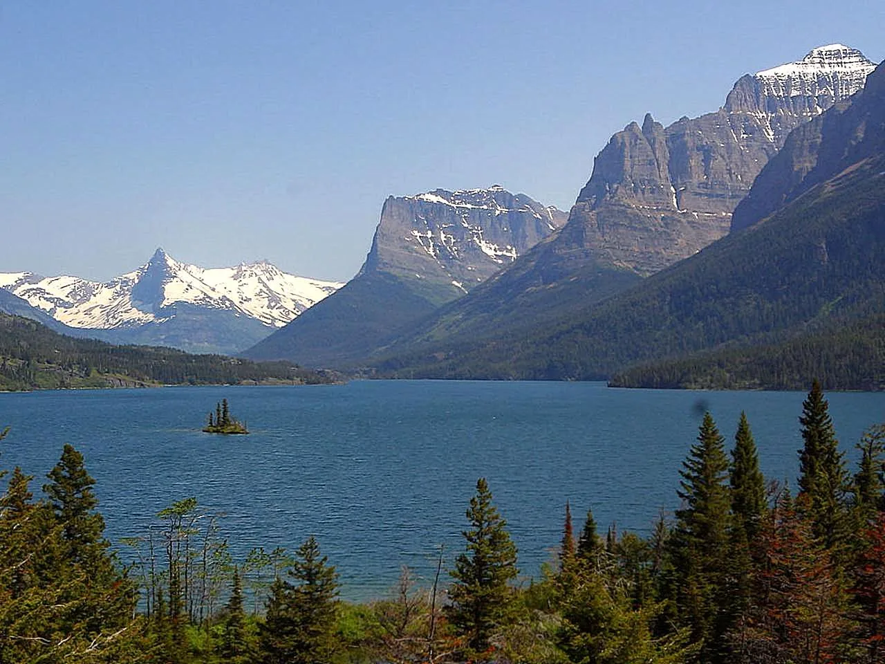
Back on the east side, St. Mary Lake stretches deep blue between steep walls of rock, and from a roadside overlook a tiny, tree-tufted speck floats in it: Wild Goose Island. Barely an acre, it may be the single most-photographed scene in the park — peaks mirrored in still dawn water, the lonely little island as the focal point. The pullout is right on the Going-to-the-Sun Road, making it an easy stop.
The big hikes
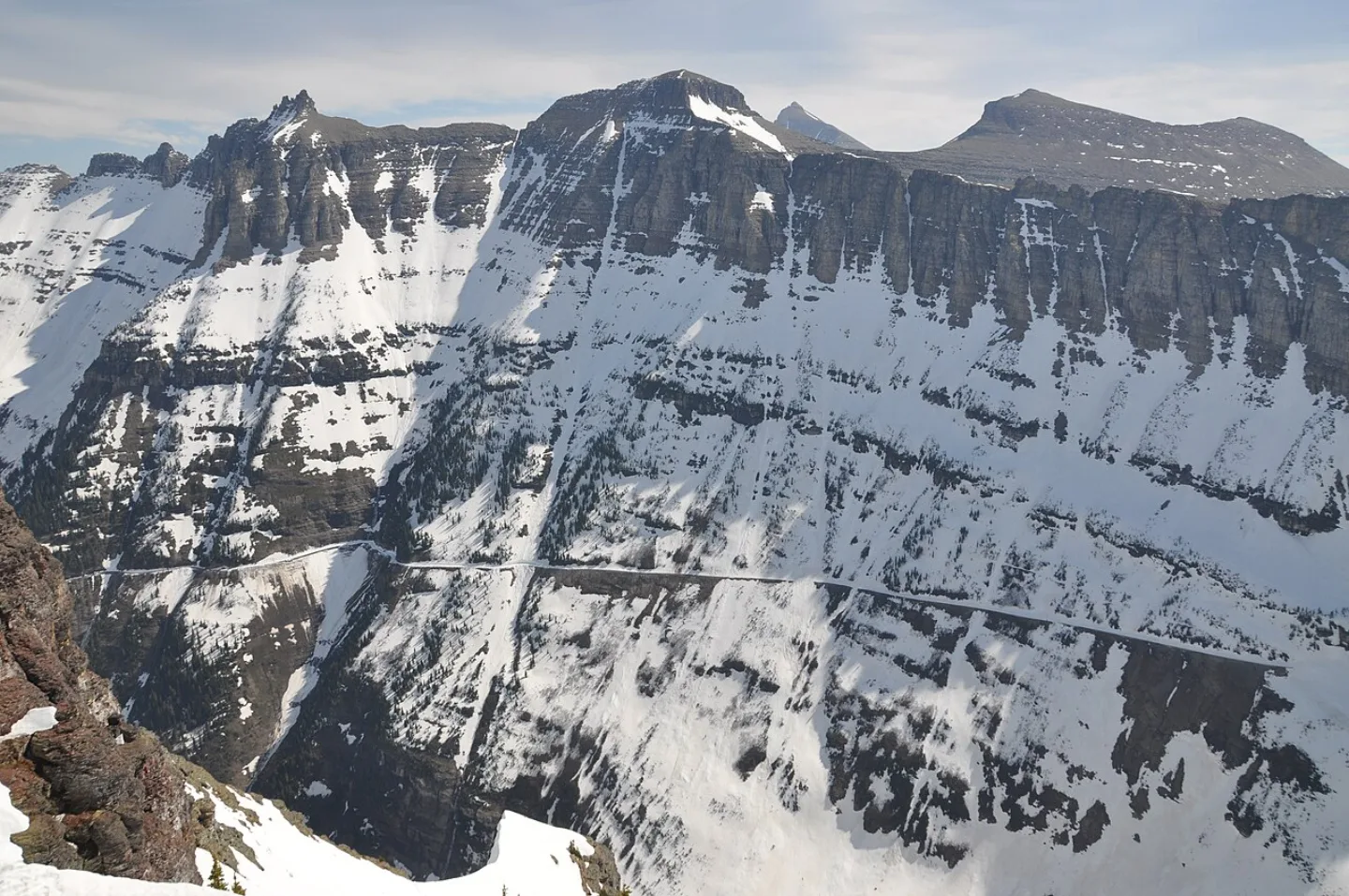
Two trails define Glacier's high country. The Highline Trail runs about 11.8 miles from Logan Pass along the Garden Wall — moderate in grade but thrillingly exposed, with a famous cable-assisted ledge near the start. The Grinnell Glacier hike (~10.6 miles round trip, ~1,600 ft gain) is strenuous but ends at the park's namesake ice. Plan around the calendar: the high road opens only late June to mid-October, with full road and trail access best from mid-July to mid-September, and vehicle reservations are required for the Going-to-the-Sun and North Fork corridors in peak season — check NPS each year.
Worlds First International Peace Park
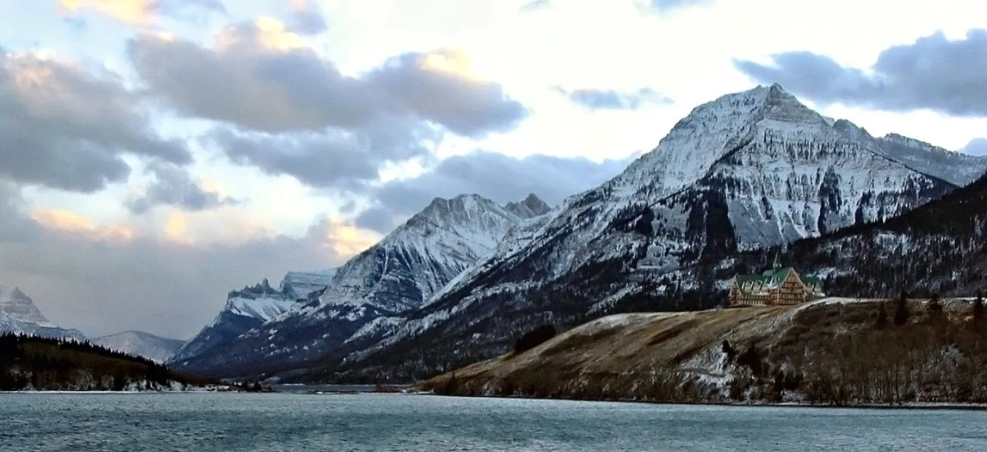
Glacier does not stop at the Canadian line — the mountains continue into Alberta's Waterton Lakes National Park. In 1932, the two nations joined them as the world's first International Peace Park, a symbol of friendship across an unfortified border. Together they are now a shared UNESCO World Heritage Site, managed cooperatively as one wild ecosystem split only by a line on a map.
Key concepts
Triple Divide Peak
- One of the most remarkable hydrological points on the planet, high in Glacier National Park.
- A snowflake landing on its slopes can end up in any of three different oceans.
- Water shed here may flow to the Pacific, to Hudson Bay and the Arctic, or down the Missouri-Mississippi to the Gulf of Mexico.
Grinnell Glacier
- The park's most-visited ice, tucked high in the Many Glacier valley.
- Named, like the park's 'Crown of the Continent' nickname, for a famous conservationist.
- A strenuous 10.6-mile round-trip hike ends at its turquoise meltwater lake, dotted with small icebergs.
Lake McDonald
- The largest lake in Glacier National Park, on its wetter, forested west side.
- About 10 miles long and 472 feet deep, with a historic lodge on its shore.
- Its shoreline is a bed of smooth red and green pebbles, colored by iron in billion-year-old Belt rock.
Wild Goose Island
- Perhaps the single most-photographed scene in the whole park.
- From a roadside overlook on the Going-to-the-Sun Road, a tiny tree-tufted speck floats in St. Mary Lake.
- Barely an acre across, this lonely little dot of rock and trees anchors a view of peaks mirrored in still dawn water.
Key facts
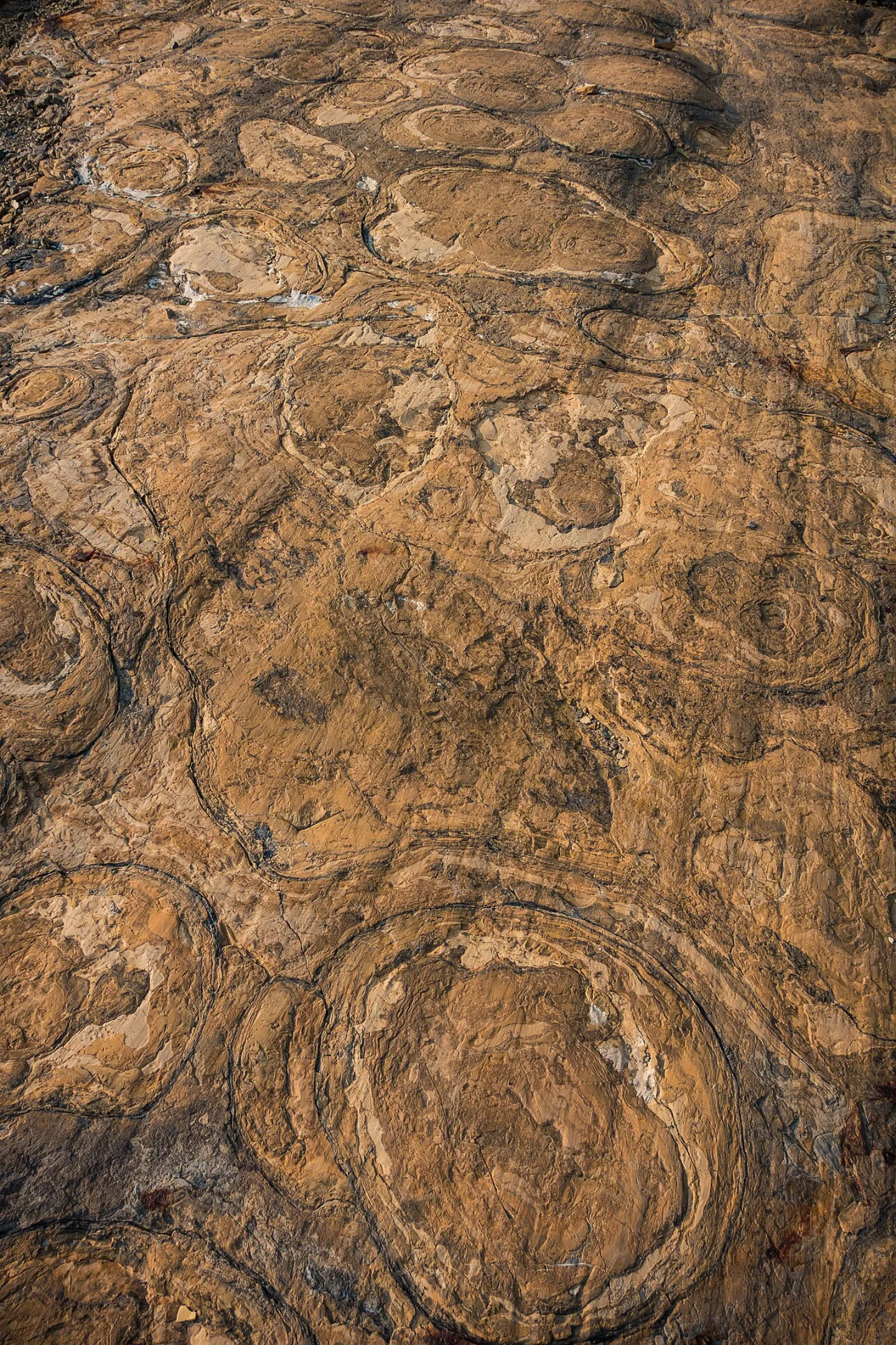
Belt Supergroup and Stromatolites
Glacier's peaks are built from the Belt Supergroup — sedimentary rock laid down in shallow seas over a billion years ago, then thrust upward along the Lewis Overthrust. Pressed into those ancient layers are some of Earth's best-preserved Proterozoic fossils: stromatolites, the cabbage-shaped mounds built by mats of microbes long before complex life. You can read a billion years of seabed in the cliff faces.
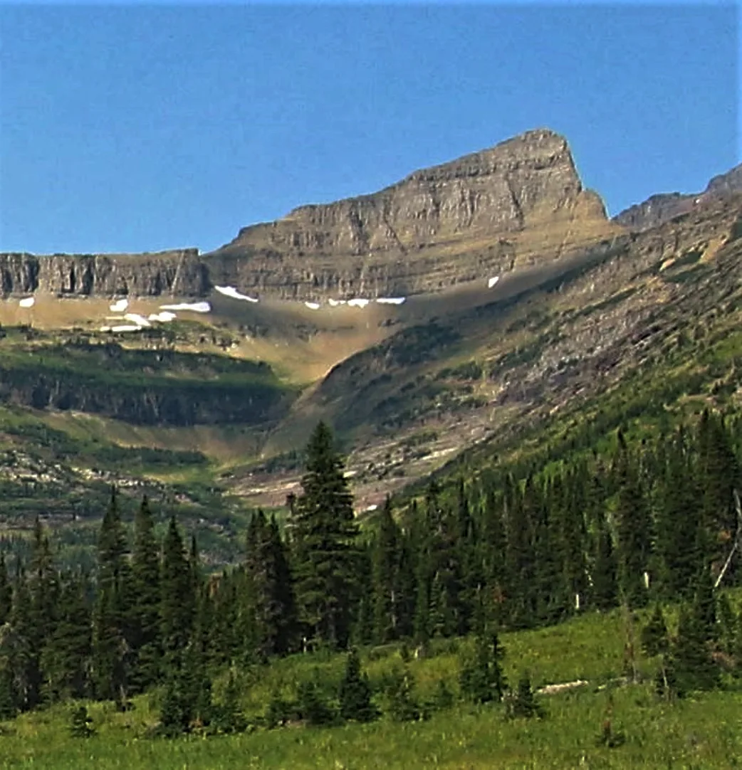
Triple Divide Peak
From Triple Divide Peak, a single snowflake's fate splits three ways. This is the hydrological apex of the continent: water shed here can flow to the Pacific Ocean, to Hudson Bay and the Arctic, or down the Missouri–Mississippi to the Gulf of Mexico. Few points on Earth feed three distinct ocean watersheds — the Garden Wall and surrounding arêtes are the knife edges that sort the drops.
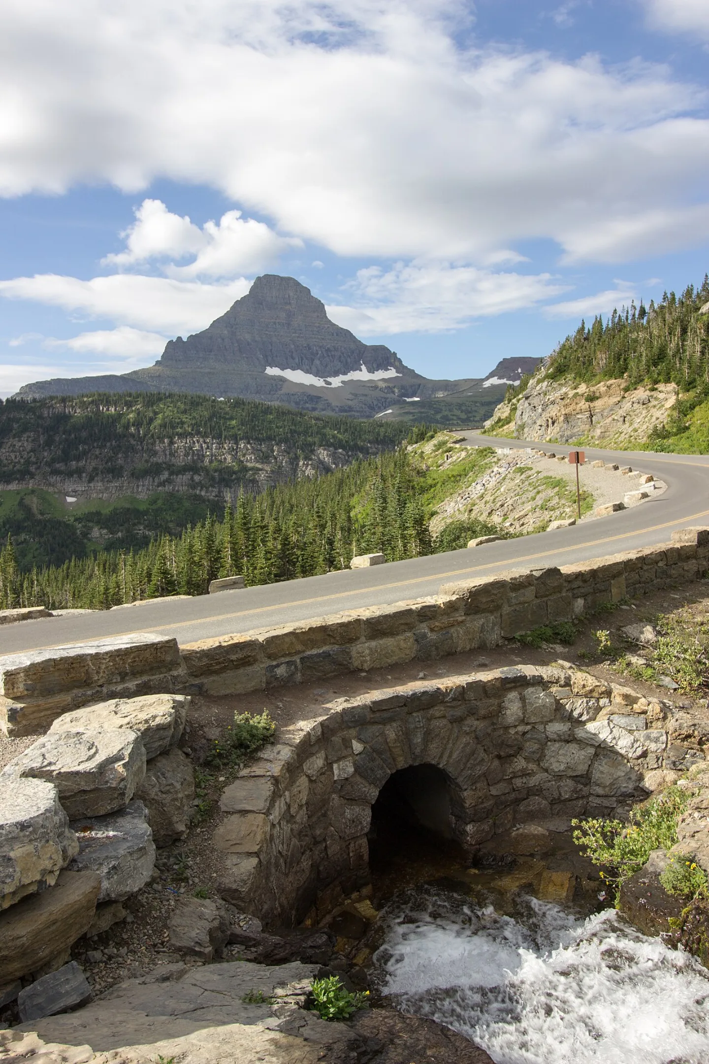
80-Foot Snowdrifts
Every spring, plow crews dig through snowdrifts as deep as 80 feet to reopen the Going-to-the-Sun Road, whose high stretch typically stays open only from late June to mid-October.
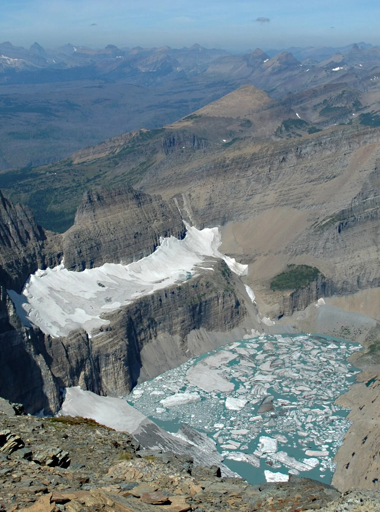
Grinnell Glacier
Named for the park's champion, Grinnell Glacier is the most-visited ice in the park — a turquoise meltwater lake fed by a retreating glacier high in the Many Glacier valley. Repeat photographs from the same overlook, decades apart, show the ice pulling steadily back up the mountain. The strenuous ~10.6-mile round-trip hike, climbing about 1,600 ft, ends at the edge of that shrinking ice.
Backbone of the World
On the park's east side, the Blackfeet (Niitsitapi) hold the high peaks sacred, calling them the 'Backbone of the World.'
Glacier's wild community
Beyond its famous mountain goats and bighorn sheep, Glacier is home to an intact wild community that includes grizzly and black bears, moose, wolverines, and lynx.
Wild Goose Island
On the park's east side, St. Mary Lake stretches deep blue between steep peaks, and from a roadside overlook a tiny, tree-tufted speck floats in it: Wild Goose Island. Barely an acre, it may be the most-photographed scene in the park — peaks mirrored in still dawn water with the lonely little island as its focal point. The overlook is right off the Going-to-the-Sun Road.
World's First International Peace Park
Glacier doesn't stop at the Canadian line — the mountains carry on into Alberta's Waterton Lakes National Park. In 1932, the two nations joined them as the world's first International Peace Park, a symbol of friendship across an unfortified border. Together they are now a joint UNESCO World Heritage Site, managed cooperatively as one wild ecosystem split only by a map line.
Above Sheer Drop-Offs
From Logan Pass, the Highline Trail traces the Garden Wall for about 11.8 miles — a moderate but thrillingly exposed route above sheer drop-offs.
By the numbers
- How high is Logan Pass, the high point of the Going-to-the-Sun Road?
- 6646 ft
- How many miles long is the Going-to-the-Sun Road across Glacier?
- 50 miles
- About how many lakes does Glacier National Park hold?
- 700 lakes
- About how many glaciers did the park's mountains hold around 1850?
- 150 glaciers
- About how many named glaciers larger than 25 acres remain today (USGS)?
- 25 glaciers
- How tall is Mount Cleveland, Glacier's highest peak?
- 10466 ft
- About how many miles long is Lake McDonald, the park's largest lake?
- 10 miles
- About how many miles long is the Highline Trail from Logan Pass along the Garden Wall?
- 11.8 miles
- About how many miles round trip is the strenuous Grinnell Glacier hike?
- 10.6 miles
- In what year did Glacier and Waterton Lakes become the world's first International Peace Park?
- 1932 year
Matched pairs
Each item on the left goes with the one on the right.
- Horn
- Pyramid-shaped peak carved when glaciers gnaw a mountain from several sides
- Arête
- Knife-edge ridge left between two glaciers — Glacier's Garden Wall is one
- Garden Wall
- Glacier's most famous arête, traced by the exposed Highline Trail
- Grizzly bear
- Large brown bear; Glacier is core habitat in the lower-48 Rockies
- Blackfeet (Niitsitapi)
- People of the park's east side; the sacred peaks are the Backbone of the World
- Salish, Pend d'Oreille & Kootenai
- Peoples of the park's west side, with deep ties to its valleys
- Highline Trail
- Exposed ~11.8-mi route from Logan Pass along the Garden Wall arête
- Vehicle reservation
- Timed entry needed for Going-to-the-Sun & North Fork in peak season
Self-test
Answer each question from memory, then check your work against the answer key.
1. Each spring, plow crews chew through snowdrifts up to how deep to reopen the Going-to-the-Sun Road?
- A45 feet
- B150 feet
- C20 feet
- D80 feet
2. The Going-to-the-Sun Road tops the Continental Divide at Logan Pass. What is Logan Pass's elevation?
- A6,646 ft
- B5,280 ft
- C10,466 ft
- D3,150 ft
3. About how many miles long is the Going-to-the-Sun Road that crosses the entire park?
- A25 miles
- B105 miles
- C50 miles
- D72 miles
4. Ice Age glaciers left Glacier National Park with roughly how many lakes?
- A250
- B700
- C70
- D150
5. What is the term for the knife-edge ridge left when two glaciers grind a mountain from opposite sides?
- ACirque
- BArête
- CMoraine
- DHorn
6. From which point in Glacier can a single snowflake's meltwater end up flowing to three different oceans?
- ATriple Divide Peak
- BGrinnell Point
- CLogan Pass
- DMount Cleveland
7. Water shed at Triple Divide Peak may reach the Pacific and the Gulf of Mexico. What is the third destination?
- AThe Caribbean Sea
- BThe Atlantic via the St. Lawrence
- CHudson Bay and the Arctic
- DThe Great Lakes
8. Glacier's most famous arête, a knife-edge ridge traced by the Highline Trail, is known as the what?
- ABelt Supergroup
- BContinental Divide
- CLewis Overthrust
- DGarden Wall
9. What is the name of the park's most-visited glacier, sitting above a turquoise meltwater lake in the Many Glacier valley?
- AGrinnell Glacier
- BJackson Glacier
- CSperry Glacier
- DBlackfoot Glacier
10. A tiny, tree-tufted, roughly one-acre island in St. Mary Lake, perhaps the park's most-photographed scene, is called what?
- AGoose Neck Rock
- BHeron Island
- CWild Goose Island
- DSwiftcurrent Isle
11. Which animal is the official symbol of Glacier National Park?
- AGrizzly bear
- BMoose
- CBighorn sheep
- DMountain goat
12. Around 1850, at the close of the Little Ice Age, about how many glaciers gripped Glacier's mountains?
- A25
- B150
- C50
- D700
13. By USGS counts, about how many named glaciers larger than 25 acres remain in the park today?
- A25
- B60
- C5
- D150
14. Which people, on the park's east side, call the high peaks the 'Backbone of the World'?
- APend d'Oreille
- BSalish
- CKootenai (Kalispel)
- DBlackfeet (Niitsitapi)
15. Which animal is NOT part of Glacier's intact wild community?
- ALynx
- BBison
- CMoose
- DWolverine
16. What gives Lake McDonald's shoreline pebbles their famous red and green colors?
- AAsh from ancient volcanic eruptions
- BAlgae and lichen that stain the wet stones
- CIron in the billion-year-old Belt rock — red where it met ancient air, green where it stayed submerged
- DCopper ore ground up and left by retreating glaciers
17. Lake McDonald, the park's largest lake on the forested west side, is about how many miles long?
- A10 miles
- B4 miles
- C50 miles
- D25 miles
18. The Highline Trail runs about how many miles from Logan Pass along the Garden Wall?
- A10.6 miles
- B11.8 miles
- C50 miles
- D6.6 miles
19. In what year did Glacier and Alberta's Waterton Lakes become the world's first International Peace Park?
- A1972
- B1895
- C1932
- D1910
20. To drive the Going-to-the-Sun and North Fork corridors in peak season, what do visitors now need?
- AA backcountry camping permit
- BNothing — entry is first-come
- CA state fishing license
- DA timed vehicle reservation
Go deeper
- WatchThree Oceans A snowflake in Glacier National Park can end up in 3 different oceans.
- WatchThe Ice Is Leaving Glacier National Park is named for ice. And that ice is leaving.
- WatchRed and Green Pebbles Why are the rocks at Lake McDonald so colorful? The shore is covered in smooth pebbles, in reds and greens.
- StudyU.S. National Parks in the FlashFeed app
Answer key
- 1. D 80 feetSpring plows clear drifts up to 80 feet deep to reopen the road, whose high stretch typically opens only from late June to mid-October.
- 2. A 6,646 ftLogan Pass sits at 6,646 ft, the road's high point on the Continental Divide. 10,466 ft is Mount Cleveland, the park's highest peak; 3,150 ft is roughly the park's low point.
- 3. C 50 milesThe Going-to-the-Sun Road runs 50 miles clean across Glacier, crossing the Divide at Logan Pass. It is the single most popular thing to do in the park.
- 4. B 700About 700 lakes dot the park, many an unreal turquoise from glacial flour in the meltwater. 150 is the count of glaciers around 1850, not lakes.
- 5. B ArêteAn arête is the knife-edge ridge between two glaciers — Glacier's Garden Wall is one. A horn is instead a pyramid-shaped peak carved from several sides.
- 6. A Triple Divide PeakTriple Divide Peak is the continent's hydrological apex, sending water toward the Pacific, Hudson Bay/Arctic, and the Gulf of Mexico. Mount Cleveland is merely the tallest peak.
- 7. C Hudson Bay and the ArcticThe third watershed drains north to Hudson Bay and the Arctic. The other two paths are west to the Pacific and down the Missouri–Mississippi to the Gulf of Mexico.
- 8. D Garden WallThe Garden Wall is the park's celebrated arête, followed by the exposed Highline Trail. The Lewis Overthrust is the fault that thrust older rock atop younger; the Belt Supergroup is the rock itself.
- 9. A Grinnell GlacierGrinnell Glacier — named, like the park's nickname, for George Bird Grinnell — is the most-visited ice, reached by a strenuous ~10.6-mile round-trip hike.
- 10. C Wild Goose IslandWild Goose Island is the barely-an-acre speck in St. Mary Lake, framed by peaks mirrored in still dawn water — likely the single most-photographed view in Glacier.
- 11. D Mountain goatThe shaggy white mountain goat is the park's emblem, perfectly adapted to its sheer cliffs.
- 12. B 150Roughly 150 glaciers existed around 1850. Only about 25 named glaciers larger than 25 acres remain today, and they keep shrinking.
- 13. A 25Only about 25 named glaciers larger than 25 acres remain, down from roughly 150 around 1850 — and scientists project they will largely vanish in coming decades.
- 14. D Blackfeet (Niitsitapi)The Blackfeet (Niitsitapi), to the east, hold the peaks sacred as the 'Backbone of the World.' The Salish, Pend d'Oreille, and Kootenai are tied to the western valleys.
- 15. B BisonGlacier's intact wild community includes grizzly and black bears, moose, wolverines, and lynx — plus mountain goats and bighorn sheep. Bison, iconic to Yellowstone, is not among them.
- 16. C Iron in the billion-year-old Belt rock — red where it met ancient air, green where it stayed submergedThe pebbles are ancient Belt Supergroup rock tinted by iron: reds formed where the iron was exposed to oxygen in ancient air, greens where it stayed submerged — a billion-year geology lesson you can hold.
- 17. A 10 milesLake McDonald is about 10 miles long and 472 ft deep, the park's largest lake, famous for its red and green iron-tinted shoreline pebbles.
- 18. B 11.8 milesThe Highline Trail is about 11.8 miles, moderate but thrillingly exposed. The ~10.6-mile figure is the strenuous Grinnell Glacier round trip.
- 19. C 1932The two nations joined the parks in 1932 as the world's first International Peace Park. 1910 is when Glacier itself was established.
- 20. D A timed vehicle reservationPeak-season access to those corridors requires a timed vehicle reservation (check NPS yearly). A backcountry permit is for overnight camping, not driving the road.
Sources
- U.S. National Parks — Glacier
Image credits
- Belt Supergroup and Stromatolites: GlacierNPS · Public domain — commons.wikimedia.org/wiki/File:Stromatolite_Fossils_near_Grinnell_Glacier_(41130800560).jpg
- Triple Divide Peak: Wikimedia Commons · Eggbones · CC BY-SA 4.0 — commons.wikimedia.org/wiki/File:Triple_Divide_Peak.jpg
- 80-Foot Snowdrifts: Wikimedia Commons · Joeyp3413 · CC BY-SA 3.0 — commons.wikimedia.org/wiki/File:Going_To_The_Sun_Road_Bridge.jpg
- Grinnell Glacier: Lindsey Bengtson, USGS · Public domain — commons.wikimedia.org/wiki/File:Grinnell_Glacier_2009.jpg
- Wild Goose Island: Jon Sullivan · Public domain — commons.wikimedia.org/wiki/File:Wild_goose_island_on_St_Mary_lake_in_glacier_national_park.jpg
- World's First International Peace Park: Gorgo · Public domain — en.wikipedia.org/wiki/Waterton_Lakes_National_Park
- Above Sheer Drop-Offs: GlacierNPS · Public domain — commons.wikimedia.org/wiki/File:Highline_Trail_along_Garden_Wall.jpg


