
U.S. National Parks study guide · Lesson 15 of 27
Spotlight: Grand Canyon
A Mile Deep and Billions of Years Old · Rims, River & People · Visiting the Grand Canyon
This is the lesson's study guide from the FlashFeed app, plus its key facts and a self-test.
What you'll be able to do
- Recall the Grand Canyon's scale and the deep-time record in its walls.
- Explain the canyon's stacked life zones and the peoples who call it home.
- Plan a Grand Canyon visit around its overlooks, trails, and seasons.
- Identify the Grand Canyon's landmarks on sight.
A Mile Deep and Billions of Years Old
Stand at the edge of the Grand Canyon and the numbers stop feeling like numbers. Below you is a chasm so vast that the far wall fades into haze and the river that carved it shrinks to a green thread. This part is about that scale — and about the deep time written into every band of rock.
The Grand Canyon
The Grand Canyon stretches about 277 river miles along the Colorado River in northern Arizona, opens to as much as 18 miles from rim to rim, and drops over a mile — roughly 6,000 feet — to the water. Those walls expose nearly 2 billion years of Earth's history, one of the most complete rock records anywhere on the planet. Theodore Roosevelt, who called it a place "every American should see," protected it as a national monument in 1908; Congress made it a national park in 1919. At about 1.2 million acres, it is the country's 11th-largest national park.
How the River Carved It
The canyon is a paradox: ancient rock, young canyon. Over roughly the past 5 to 6 million years, the Colorado Plateau bulged slowly upward, and the Colorado River sawed straight down through the rising rock, carrying the debris toward the sea. The result is a staircase of exposed layers, each older than the one above it. At the very bottom, in the dark, twisted inner gorge, lies the Vishnu Schist — about 1.8 billion years old, the basement of the canyon. The deeper you descend, the further back in time you travel.
Two terms unlock the canyon's geology. The Vishnu Schist is that ancient bottom rock, formed deep in the Earth's crust and later lifted into view. The Great Unconformity is a stranger thing: a place in the walls where layers that should hold roughly a billion years of history are simply gone — eroded away long ago, leaving young rock resting directly on very old rock with the in-between missing.
The canyon has two faces. The South Rim, at about 7,000 feet, is lower, drier, and open all year — where about nine in ten visitors go. The North Rim is higher, cooler, forested, and open only in the warm months. They sit just 10 miles apart as the condor flies, yet driving between them takes over four hours.
One myth is worth retiring. Awesome as it is, the Grand Canyon is not the deepest canyon in the United States — Hells Canyon on the Idaho-Oregon border, among others, cuts deeper. What sets the Grand Canyon apart is not raw depth but its sheer breadth and the staggering sweep of time laid bare in its walls.
Rims, River & People
The Grand Canyon is not just rock. It is a stack of living worlds, a homeland for many peoples, and a stage for one of conservation's great comebacks. This part follows life and people from the cool forested rim down to the desert river.
From Mexico to Canada in One Canyon
Hike from rim to river and you cross a continent's worth of ecosystems in a single afternoon. Biologists describe the descent as covering the same span of life zones you would meet traveling from Mexico to Canada. The North Rim, above 8,000 feet, holds a cool spruce-fir forest. The South Rim, near 7,000 feet, wears ponderosa pine and pinyon-juniper. Down at the river it becomes Sonoran desert scrub — cactus, lizards, and searing heat. That vertical climate ladder is why the canyon shelters such astonishing variety of life.
That same heat is a serious hazard. The inner canyon routinely climbs to 100–115°F in summer, often around 110°F, even when the rim feels pleasant. The temperature gap between rim and river is one of the canyon's most dangerous surprises.
Return of the Condor
The California condor is North America's largest land bird, with a wingspan of nearly 9.5 feet. In the 1980s it nearly disappeared — the entire species fell to just 22 birds, every one taken into captivity in a last-ditch rescue. Through captive breeding and reintroduction, condors now soar again on the thermals rising out of the Grand Canyon. Each wild bird wears a numbered wing tag, and spotting one wheeling above the rim is among the park's greatest wildlife thrills.
The canyon's wildlife holds a quieter rarity too. The Kaibab squirrel, a handsome tassel-eared squirrel, lives only on the North Rim — isolated there for so long that it evolved into its own distinct form, found nowhere else on Earth.
The Grand Canyon is also a homeland. Eleven tribes are traditionally associated with the canyon, including the Hualapai, Navajo (Diné), Hopi, Zuni, Southern Paiute, and the Havasupai — "people of the blue-green water." The Havasupai are unique among them: they still live inside the canyon, in the village of Supai, reachable only by foot, mule, or helicopter. Their turquoise waterfalls draw pilgrims from around the world, and their presence is a reminder that the Grand Canyon has been home to people for many centuries, not just a destination to visit.
Visiting the Grand Canyon
Few places reward a visit like the Grand Canyon — and few punish a careless one so quickly. This part covers where to stand, where to walk, the canyon's hard safety rule, and when to come.
One of America's Most Visited Parks
Nearly 4.9 million people visited the Grand Canyon in 2024, making it the country's third-most-visited national park. About 90 percent of them head for the South Rim, where the lodges, the visitor center, the shuttle buses, and the paved Rim Trail are concentrated. The quieter, higher North Rim takes the rest — and is open only from roughly mid-May to mid-October, closing under deep snow the rest of the year. Two South Rim overlooks anchor most first visits: Mather Point, the classic first look beside the main visitor center, and the historic Desert View Watchtower designed by architect Mary Colter.
Never Rim to River and Back in a Day
The park's single firmest warning deserves its own card: never hike from the rim to the Colorado River and back in one day. Going down feels deceptively easy — you descend roughly a vertical mile — but the return is a brutal, heat-soaked climb, and every year it sends hikers into rescue or worse. The way down is optional; the way up is not.
Two corridor trails carry most hikers. The Bright Angel Trail is the signature route, with shade and seasonal water stops down to Havasupai Gardens (about 9 miles round trip) and on toward the river. The South Kaibab Trail trades water for views, riding an open ridgeline to Ooh Aah Point (~1.8 miles) and Skeleton Point (~6 miles round trip) — spectacular, but carry every drop you need. Deep at the bottom sits Phantom Ranch, a rustic lodge reachable only on foot, by mule, or by raft, where overnight beds are awarded by lottery months ahead.
The Famous Mules
For more than a century, sure-footed mules have carried riders and supplies down the canyon's steep trails to Phantom Ranch on the canyon floor. The mule trains are a Grand Canyon institution — slow, patient, and utterly unbothered by the dizzying drop-offs that make first-time riders grip the saddle horn a little tighter. They remain one of the classic ways to reach the river without walking out under your own power.
As for timing: aim for spring or fall. Summer rims are pleasant enough, but the inner canyon turns dangerously hot, often 100–115°F; winter ices the rim trails. The shoulder seasons give you moderate temperatures, thinner crowds, and the canyon close to its best.
Key terms
- Supai
- The remote tribal village deep within the canyon, reachable only by foot, mule, or helicopter — the only such community inside a U.S. national park
Key concepts
Bright Angel Trail
- A South Rim corridor route most hikers use to descend toward the Colorado River.
- It is the signature way down, prized for its shade and seasonal water stops.
- It passes Havasupai Gardens, about 9 miles round trip, on the way toward the river.
South Kaibab Trail
- One of the two corridor trails carrying hikers down toward the Colorado River.
- It trades water for views, riding an open ridgeline with no shade, so carry every drop you need.
- Its overlooks include Ooh Aah Point and Skeleton Point.
Phantom Ranch
- A rustic lodge deep at the very bottom of the canyon, beside the river.
- It can be reached only on foot, by mule, or by raft.
- Its overnight beds are awarded by a lottery months ahead.
Desert View Watchtower
- A historic South Rim landmark that anchors many first visits, alongside Mather Point.
- It was designed by the architect Mary Colter.
Mather Point
- The classic first look at the canyon for most arriving South Rim visitors.
- It sits right beside the park's main visitor center and shuttle hub.
- One of two anchor overlooks — this is the busy one by the visitor center, not the historic stone lookout to the east.
Key facts
Over a Mile Down
From its rim down to the Colorado River, the Grand Canyon plunges about 6,000 feet, over a mile of vertical drop. That depth, combined with the canyon's breadth, is central to its scale.
A Billion Missing Years
In the canyon's walls, the Great Unconformity marks a gap where roughly a billion years of rock record are simply missing, eroded away so that young rock rests directly on much older rock.
Not the Deepest
Despite its fame, the Grand Canyon is not the deepest canyon in the United States — Hells Canyon cuts deeper. What sets it apart is its breadth and the vast sweep of geologic time exposed in its walls, not raw depth.
Eleven Tribes
Eleven tribes are traditionally associated with the Grand Canyon, including the Hualapai, Navajo, Hopi, Zuni, Southern Paiute, and Havasupai.
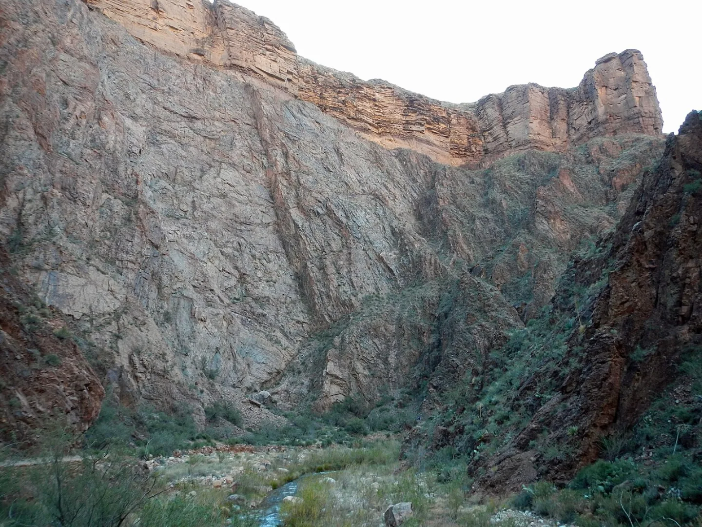
Found Nowhere Else
The tassel-eared Kaibab squirrel exists naturally in only one place on Earth: the cool, forested North Rim of the Grand Canyon, where it evolved in isolation into its own distinct form.
People of Blue-Green Water
The Havasupai, whose name means 'people of the blue-green water,' still live inside the Grand Canyon in the village of Supai, reachable only by foot, mule, or helicopter.
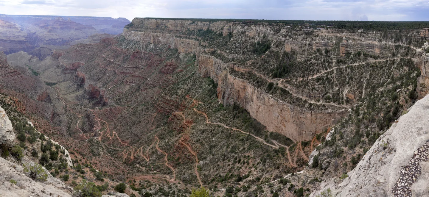
Down Is Optional, Up Isn't
The park's single firmest warning: do not try to hike from the rim down to the Colorado River and back in one day. What feels easy going down — you descend roughly a vertical mile — becomes a brutal, heat-soaked climb back out, and every year it sends hikers to rescue. The way down is optional; the way up is not.
The Famous Mules
For over a century, sure-footed mules have carried riders and supplies down the canyon's steep trails to Phantom Ranch on the canyon floor. The mule trains are a Grand Canyon institution — slow, patient, and unfazed by the dizzying drop-offs that make first-time riders grip the saddle horn a little tighter.
100 to 115 Degrees
Spring and fall bring the mildest temperatures for hiking below the Grand Canyon's rim. Summer can turn the inner canyon dangerously hot, often 100 to 115°F, while winter ices over the rim trails.
The First View
Mather Point, on the South Rim beside the main visitor center, is the classic first overlook where most visitors get their first view of the canyon.
By the numbers
- Roughly how deep is the Grand Canyon, from rim to river?
- 6000 ft
- How long is the Grand Canyon, measured along the Colorado River?
- 277 river miles
- At its widest, how far is it across the Grand Canyon from rim to rim?
- 18 miles
- About how old is the Vishnu Schist, the oldest rock at the canyon's bottom?
- 1.8 billion years
- How many tribes are traditionally associated with the Grand Canyon?
- 11 tribes
- About how wide is the wingspan of an adult California condor?
- 9.5 ft
- On a summer day, the inner canyon can reach roughly what temperature?
- 110 °F
- About how many people visited Grand Canyon National Park in 2024?
- 4900000 visitors
- About what percentage of Grand Canyon visitors go to the South Rim?
- 90 percent
Matched pairs
Each item on the left goes with the one on the right.
- Vishnu Schist
- The dark, ~1.8-billion-year-old rock at the very bottom of the canyon
- Great Unconformity
- A gap in the walls where ~1 billion years of rock record is simply missing
- South Rim vs. North Rim
- South is lower (~7,000 ft) and open year-round; North is higher, cooler, and seasonal
- Havasupai
- "People of the blue-green water," who still live in the canyon at Supai
- Kaibab squirrel
- A tassel-eared squirrel found only on the canyon's North Rim
- Mather Point
- The South Rim's classic first-look overlook, near the main visitor center
- Bright Angel Trail
- The South Rim's signature corridor trail, with water stops down to Havasupai Gardens
- South Kaibab Trail
- A ridgeline trail with sweeping views to Ooh Aah Point and Skeleton Point — but no water
- Phantom Ranch
- The rustic lodge at the canyon bottom, reached only on foot, by mule, or by raft
Self-test
Answer each question from memory, then check your work against the answer key.
1. The Grand Canyon is often described as a paradox of 'ancient rock, young canyon.' How did the canyon itself form?
- AA glacier gouged it out during the last ice age
- BThe Colorado Plateau rose while the Colorado River cut straight down through the rising rock
- CWind slowly scoured it over nearly 2 billion years
- DA massive fault split the plateau apart
2. How far does the Grand Canyon drop from its rim down to the Colorado River?
- AAbout 3,000 feet
- BAbout 10,000 feet — nearly two miles
- CAbout 6,000 feet — over a mile
- DAbout 1,000 feet
3. About how old is the Vishnu Schist, the dark rock at the very bottom of the inner gorge?
- AAbout 2 million years
- BAbout 500 million years
- CAbout 5 to 6 million years
- DAbout 1.8 billion years
4. In the canyon's geology, what does the Great Unconformity refer to?
- AA gap where roughly a billion years of rock record is simply missing
- BThe boundary line dividing the South Rim from the North Rim
- CThe single oldest, darkest rock layer at the canyon floor
- DThe point where the Colorado River changes direction
5. Which statement about the Grand Canyon's scale is FALSE?
- AIt runs about 277 river miles along the Colorado River
- BIts walls expose nearly 2 billion years of Earth's history
- CIt drops over a mile from rim to river
- DIt is the deepest canyon in the United States
6. Hiking from the Grand Canyon's rim down to the river crosses the same span of life zones as traveling between which two places?
- AMexico and Canada
- BTexas and Montana
- CFlorida and Maine
- DCalifornia and Alaska
7. How many tribes are traditionally associated with the Grand Canyon?
- AFive
- BEleven
- CEight
- DTwenty-two
8. About how wide is the wingspan of the California condor, North America's largest land bird?
- AClose to 4 feet
- BAround 12 feet
- CNearly 9.5 feet
- DRoughly 6 feet
9. The tassel-eared Kaibab squirrel lives naturally in only one place on Earth. Where?
- AOn both rims in equal numbers
- BOnly the Grand Canyon's North Rim
- COnly the Grand Canyon's South Rim
- DAlong the Colorado River at the canyon bottom
10. Which Grand Canyon tribe is known as the 'people of the blue-green water' and still lives inside the canyon?
- AHualapai
- BNavajo (Diné)
- CHavasupai
- DHopi
11. When is the best time to hike below the Grand Canyon's rim?
- ASpring or fall
- BLate August
- CMidwinter
- DMidsummer
12. About how many people visited Grand Canyon National Park in 2024?
- AAround 277,000
- BClose to 1.2 million
- CRoughly 10 million
- DNearly 4.9 million
13. About what share of Grand Canyon visitors head for the South Rim rather than the North Rim?
- AAbout 50 percent
- BAbout 10 percent
- CAbout 90 percent
- DAbout 75 percent
14. What is the park's single firmest safety warning for hikers?
- ANever hike without a wilderness permit
- BNever ride the mule trains alone
- CNever hike the North Rim in winter
- DNever hike from the rim to the river and back in one day
15. Which South Rim corridor trail rides an open ridgeline with sweeping views but has no water along the way?
- ARim Trail
- BSouth Kaibab Trail
- CBright Angel Trail
- DDesert View Trail
16. Which South Rim overlook is the classic first look at the canyon, sitting beside the main visitor center?
- AMather Point
- BSkeleton Point
- COoh Aah Point
- DDesert View Watchtower
17. The historic Desert View Watchtower on the South Rim was designed by which architect?
- AStephen Mather
- BMary Colter
- CFrank Lloyd Wright
- DTheodore Roosevelt
18. Which landmark is the rustic lodge at the canyon bottom, reachable only on foot, by mule, or by raft?
- AHavasupai Gardens
- BSkeleton Point
- CSupai
- DPhantom Ranch
19. Which signature corridor trail offers shade and seasonal water stops down to Havasupai Gardens?
- ARim Trail
- BDesert View Trail
- CBright Angel Trail
- DSouth Kaibab Trail
20. Ooh Aah Point and Skeleton Point are viewpoints along which Grand Canyon trail?
- ASouth Kaibab Trail
- BPhantom Ranch Trail
- CRim Trail
- DBright Angel Trail
Go deeper
- WatchNot the Deepest The Grand Canyon is not the deepest canyon in the United States. Hells Canyon cuts deeper, among others. It's on the Idaho-Oregon border.
- WatchSupai One village sits inside the Grand Canyon: Supai. It's reachable only by foot, by mule or by helicopter.
- WatchThe Way Up Never hike from the rim to the Colorado River and back in one day. It's the park's firmest warning.
- StudyU.S. National Parks in the FlashFeed app
Answer key
- 1. B The Colorado Plateau rose while the Colorado River cut straight down through the rising rockOver the past ~5–6 million years the Colorado Plateau bulged upward while the Colorado River sawed straight down through the rising rock — young carving through very old stone. The rock at the bottom, the Vishnu Schist, is ~1.8 billion years old.
- 2. C About 6,000 feet — over a mileThe canyon plunges over a mile — roughly 6,000 feet — from rim to river. That depth, combined with its breadth, is part of its scale.
- 3. D About 1.8 billion yearsThe Vishnu Schist is roughly 1.8 billion years old — the basement of the canyon. The 5–6 million year figure is how long the river has been carving, not the rock's age.
- 4. A A gap where roughly a billion years of rock record is simply missingThe Great Unconformity is a place in the walls where about a billion years of history are gone — eroded away — leaving young rock resting directly on very old rock.
- 5. D It is the deepest canyon in the United StatesThe Grand Canyon is NOT the deepest U.S. canyon — Hells Canyon cuts deeper. What sets it apart is its breadth and the sweep of time in its walls, not raw depth.
- 6. A Mexico and CanadaBiologists say descending from the cool spruce-fir North Rim to Sonoran desert scrub at the river covers the same range of life zones as a trip from Mexico to Canada — the vertical climate ladder that makes the canyon so biodiverse.
- 7. B ElevenEleven tribes are traditionally tied to the canyon, including the Hualapai, Navajo, Hopi, Zuni, Southern Paiute, and Havasupai. (Twenty-two was the condor's low point, not tribes.)
- 8. C Nearly 9.5 feetThe California condor's wingspan reaches nearly 9.5 feet, making it North America's largest land bird — a giant now soaring again on the canyon's thermals.
- 9. B Only the Grand Canyon's North RimThe Kaibab squirrel is found only on the cool, forested North Rim, isolated there so long it evolved into its own distinct form found nowhere else.
- 10. C HavasupaiThe Havasupai, 'people of the blue-green water,' still live inside the canyon in the village of Supai, reachable only by foot, mule, or helicopter.
- 11. A Spring or fallSpring and fall offer moderate temperatures. In summer the inner canyon turns dangerously hot, often 100–115°F, while winter brings ice to the rim trails.
- 12. D Nearly 4.9 millionNearly 4.9 million people visited in 2024, making the Grand Canyon the country's third-most-visited national park. (1.2 million is roughly its acreage, not visitors.)
- 13. C About 90 percentRoughly 90 percent of visitors go to the lower, year-round South Rim, where the lodges, visitor center, and Rim Trail are concentrated. The North Rim draws the rest.
- 14. D Never hike from the rim to the river and back in one dayThe way down is optional; the way up is not. The descent feels easy, but the heat-soaked climb back out sends hikers into rescue every year — so never do rim-to-river-and-back in a day.
- 15. B South Kaibab TrailThe South Kaibab Trail trades water for views along an open ridgeline to Ooh Aah and Skeleton Points. The Bright Angel Trail, by contrast, has shade and seasonal water stops.
- 16. A Mather PointMather Point is the classic first-look overlook next to the main visitor center. Ooh Aah and Skeleton Points are viewpoints down the South Kaibab Trail, not rim overlooks.
- 17. B Mary ColterArchitect Mary Colter designed the Desert View Watchtower. Stephen Mather led the early Park Service (Mather Point's namesake), and Roosevelt protected the canyon — neither designed it.
- 18. D Phantom RanchPhantom Ranch sits deep at the canyon floor, its beds awarded by lottery months ahead. Supai is the Havasupai village; Havasupai Gardens is a water stop on the Bright Angel Trail.
- 19. C Bright Angel TrailThe Bright Angel Trail is the signature route, with shade and seasonal water down to Havasupai Gardens. The South Kaibab Trail, by contrast, has views but no water.
- 20. A South Kaibab TrailThe South Kaibab Trail rides an open ridgeline past Ooh Aah Point (~1.8 mi) and Skeleton Point (~6 mi round trip). Bright Angel leads instead to Havasupai Gardens.
Sources
- U.S. National Parks — Grand Canyon
Image credits
- Found Nowhere Else: Wikimedia Commons · Fredlyfish4 · CC BY-SA 3.0 — commons.wikimedia.org/wiki/File:Cliffs_along_N_Kaibab_Trail.JPG
- Down Is Optional, Up Isn't: Wikimedia Commons · Jarek Tuszyński · CC BY-SA 4.0 — commons.wikimedia.org/wiki/File:Grand_Canyon_National_Park_-_South_-_03.jpg

