
U.S. National Parks study guide · Lesson 23 of 27
Spotlight: Olympic
Three Parks in One · Rainforest and Rugged Coast · Visiting Olympic
This is the lesson's study guide from the FlashFeed app, plus its key facts and a self-test.
What you'll be able to do
- Explain how Olympic packs glaciers, rainforest, and coast into one park.
- Trace Olympic's protection, its glaciated high point, and its landmark ridge and beach.
- Describe the Hoh rainforest and Olympic's wild coast, and define a nurse log.
- Plan an Olympic visit around Hurricane Ridge, Lake Crescent, and season.
Three Parks in One
Few national parks pack so many worlds into one boundary as Olympic. On the Olympic Peninsula in the far northwest corner of Washington, glaciers, rainforest, and a wild ocean coast crowd together — and a traveler with stamina can touch all three in a single day.
Olympic National Park
Olympic protects roughly 922,650 acres of the Olympic Peninsula, making it the 13th-largest national park in the United States. Its story of protection came in two stages: President Theodore Roosevelt declared Mount Olympus National Monument in 1909, and Congress redesignated the area a national park in 1938, a campaign championed by President Franklin Roosevelt. What sets Olympic apart is not size but variety — three distinct ecosystems stacked from sea level to summit. Glaciated mountains rise at the center, drenched temperate rainforest fills the western valleys, and about 73 miles of undeveloped Pacific coastline run along the edge. Some 3.7 million people visited in 2024, most circling the park on the highway that loops the peninsula, since no road crosses the wild interior.
Mount Olympus
The park's high point, Mount Olympus, reaches 7,980 feet. By the standards of nearby Mount Rainier that is modest, but Olympus sits squarely in the path of moisture-laden Pacific storms, so it is buried in snow and ice. More than 60 glaciers cling to the Olympic Mountains, fed by that relentless precipitation. The range itself is geologically young and strange: its marine sedimentary rock was scraped off the ocean floor and crumpled upward by subduction, the slow diving of one tectonic plate beneath another. Reaching the summit's Blue Glacier is a long backcountry expedition along the Hoh River Trail, not a day's outing — Olympus rewards only the committed.
Three Parks in One
Olympic's signature claim is almost a riddle: in one park you can stand on a glacier, walk through a rainforest, and reach a wild ocean beach, sometimes within the same day. Each realm keeps its own weather, plants, and animals — alpine ice up high, dripping moss-hung forest in the western valleys, and surf-pounded sea stacks along the coast. That breadth earned Olympic two international honors: it is recognized as a UNESCO Biosphere Reserve (1976) and a World Heritage Site (1981), prized as much for its intact wildness as for its beauty.
The numbers anchor the story. The park became a national park in 1938; its high point, Mount Olympus, stands at 7,980 feet; it spans about 922,650 acres with roughly 73 miles of coast and more than 60 glaciers. Two tectonic ideas tie the geology together — subduction built the mountains from old seafloor, and the same storm-fed heights now hold the ice. Together they explain how one corner of Washington became three parks in one.
Rainforest and Rugged Coast
Drop down from Olympic's icy peaks and the world turns green, then turns to surf. The park's western valleys hold one of the rainiest forests in the country, and beyond them lies a coast as wild as any in the Lower 48.
The Hoh Rain Forest
The Hoh Rain Forest, in a western valley fed by Pacific storms, is one of the wettest places in the contiguous United States, soaking up roughly 12 to 14 feet of rain a year. All that water builds a cathedral of green. Sitka spruce and western hemlock soar past 200 feet, and nearly every trunk, limb, and fallen log is sheathed in club moss, ferns, and lichen. Fallen "nurse logs" sprout rows of new trees along their length. The easy Hall of Mosses loop, about 0.8 miles, threads through the heart of it, the canopy so dense the light arrives soft and green. The Hoh is the most famous of these forests, but it is not the only one — the Quinault and Queets valleys nearby shelter their own moss-draped rainforest, each carved by its own river.
The Wild Coast
Olympic's coastal strip is one of the longest stretches of wilderness shoreline left in the Lower 48 — fog, driftwood, and sea stacks rising offshore like the ruined towers of a drowned coast. Rialto Beach and Ruby Beach are the celebrated frames. At low tide their pools brim with sea stars, anemones, urchins, and chitons, a hands-and-knees world of color. Unlike the high country, the coast is open year-round, though a visit almost always means rain gear: this is a shore best met wet, with the surf loud and the air full of salt and mist.
Roosevelt Elk
The largest of North America's elk, the Roosevelt elk graze the Hoh and Quinault valleys in herds, and their browsing keeps the rainforest understory open and oddly park-like. Protecting them was a driving reason the park exists; the herds were so central to the cause that Olympic was nearly named for the elk rather than the mountains. They share these forests with black bears and bald eagles, while the tide pools below hold a different cast of life entirely — one park, many animals, each tuned to its own elevation and weather.
A few facts pin the part together. The Hoh drinks about 12 feet of rain at the low end of its range; the Hall of Mosses loop runs roughly 0.8 miles; Ruby Beach is the postcard of sea stacks and tide pools; and the Roosevelt elk, the continent's largest, gave the park much of its reason to exist.
Visiting Olympic
No road crosses Olympic's wild heart, so seeing the park means choosing your spokes off the loop highway — a mountain overlook here, a clear lake there, a waterfall, a beach. Each entrance opens onto a different one of the park's three worlds.
Hurricane Ridge
The easiest way to stand among the high country is Hurricane Ridge, reached by a paved road that climbs from the town of Port Angeles to nearly a mile above the sea. From its subalpine meadows you look across a sea of glaciated peaks toward Mount Olympus, with wildflowers blooming in summer and deep snow piling in winter. The Hurricane Hill trail, about 3.2 miles round trip, climbs to even wider views — on a clear day, north across the Strait of Juan de Fuca toward Canada. It is the park's grandest scenery for the least effort.
Lake Crescent and Sol Duc Falls
On the park's north side, Lake Crescent is a deep, glacier-carved lake so clear that its water glows turquoise in sunlight, ringed by forested ridges and a historic lodge. A short drive away, the Sol Duc valley leads to Sol Duc Falls, where the river splits into ribbons as it drops into a mossy gorge. It is one of the most photographed waterfalls in the park, and an easy walk from the road through old-growth forest — a gentle counterpoint to the alpine heights of Hurricane Ridge.
The Peninsula's First Peoples
Eight tribes hold deep ties to the Olympic Peninsula, among them the Quinault, Hoh, Quileute, Makah, Klallam, and Skokomish — Coast Salish and neighboring peoples who fished its rivers and coast for thousands of years before any park existed. The Quileute, at La Push near the mouth of the Quillayute River, became known worldwide as a setting in the Twilight novels, though their living culture runs far deeper than any story. These nations remain woven through the region today, their lands and waters bordering the park on every side.
When to come matters. July through September is the dependable dry window for the high country, while the coast and rainforest stay open year-round, but wet. The figures to carry: about 3.7 million visitors in 2024, the Hurricane Hill trail at roughly 3.2 miles round trip, and the eight tribes of the peninsula whose history predates the park by millennia. Pair the names with the places — Hurricane Ridge for the peaks, Lake Crescent for the water, the Quileute for the coast — and Olympic comes into focus.
Key concepts
Mount Olympus
- The park's high point, buried in snow and ice despite standing under 8,000 feet.
- At 7,980 feet it sits squarely in the path of Pacific storms, feeding more than 60 glaciers.
- Reaching its Blue Glacier is a long backcountry trek up the Hoh River Trail.
Hoh Rain Forest
- A drenched western valley, one of the wettest places in the contiguous United States.
- Soaking up 12 to 14 feet of rain a year, it grows moss-draped Sitka spruce and hemlock past 200 feet.
- Its easy Hall of Mosses loop, about 0.8 miles, threads through soft green light.
Ruby Beach
- A wild stretch of Olympic's coastal strip, framed by fog and driftwood.
- Sea stacks rise offshore like the ruined towers of a drowned coast.
- At low tide its pools brim with sea stars, anemones, and urchins — the park's postcard shore.
Hurricane Ridge
- The easiest way to stand among Olympic's high country, reached by a paved road from Port Angeles.
- Its subalpine meadows climb nearly a mile above the sea, with summer wildflowers and deep winter snow.
- A short trail from the meadows opens wider views north across the Strait of Juan de Fuca toward Canada.
Lake Crescent
- A large body of water on the park's north side, ringed by forested ridges and a historic lodge.
- Carved deep by glaciers, it is famous for exceptional clarity.
- In sunlight its pure water glows a striking turquoise.
Key facts
Three Parks in One
Olympic's fame rests on a single, almost improbable claim: in one park you can touch a glacier, walk through a rainforest, and stand on a wild ocean beach — often on the same day. Glaciated peaks, temperate rainforest, and ~73 miles of undeveloped Pacific coast each form a distinct realm with its own weather, plants, and wildlife. That sweep of ecosystems is why Olympic carries two UNESCO honors: it is both a Biosphere Reserve and a World Heritage Site.
922,650 Acres
Olympic National Park covers roughly 922,650 acres, making it the 13th-largest national park in the United States.
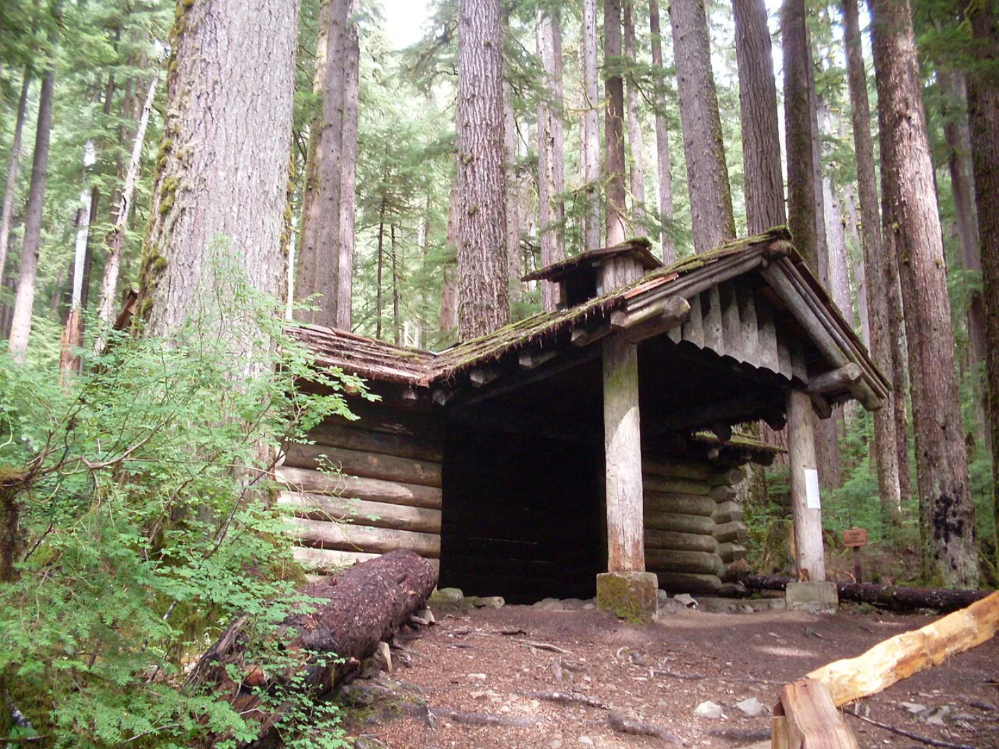
Two International Honors
Olympic National Park is recognized as both a UNESCO Biosphere Reserve and a World Heritage Site, prized for its intact wildness.
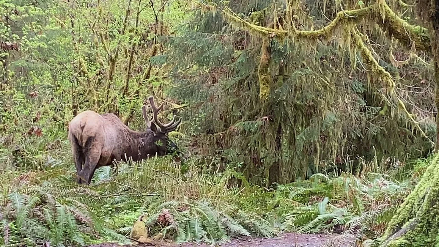
Roosevelt Elk
The largest of North America's elk, Roosevelt elk graze the Hoh and Quinault valleys in herds, and their grazing helps keep the rainforest understory open and park-like. Protecting them was a driving reason the park exists — the herds were so central to the cause that the park was nearly named for the elk rather than the mountains. They share these forests with black bears, bald eagles, and the tide-pool life of the coast.
The Postcard Shot
Ruby Beach is celebrated as Olympic National Park's postcard image of offshore sea stacks and tide pools, distinct from the mountain overlook at Hurricane Ridge or the waterfall at Sol Duc Falls.
The Hall of Mosses
The Hall of Mosses is an easy, roughly 0.8-mile loop trail through the heart of the Hoh Rain Forest, one of the park's most popular short walks.
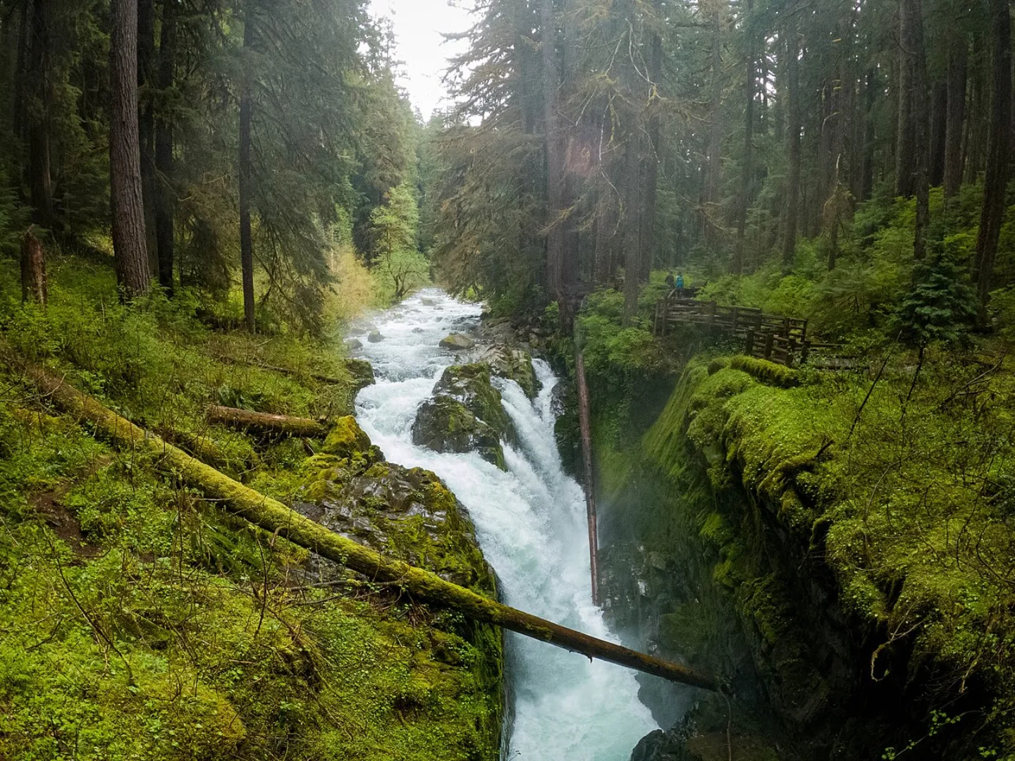
Lake Crescent and Sol Duc Falls
On the park's north side, Lake Crescent is a deep, glacier-carved lake so clear its water glows turquoise on a sunny day, ringed by forested ridges and a historic lodge. Nearby, the Sol Duc valley leads to Sol Duc Falls, where the river splits into ribbons over a mossy gorge — one of the most photographed waterfalls in the park, and an easy walk from the road through old-growth forest.
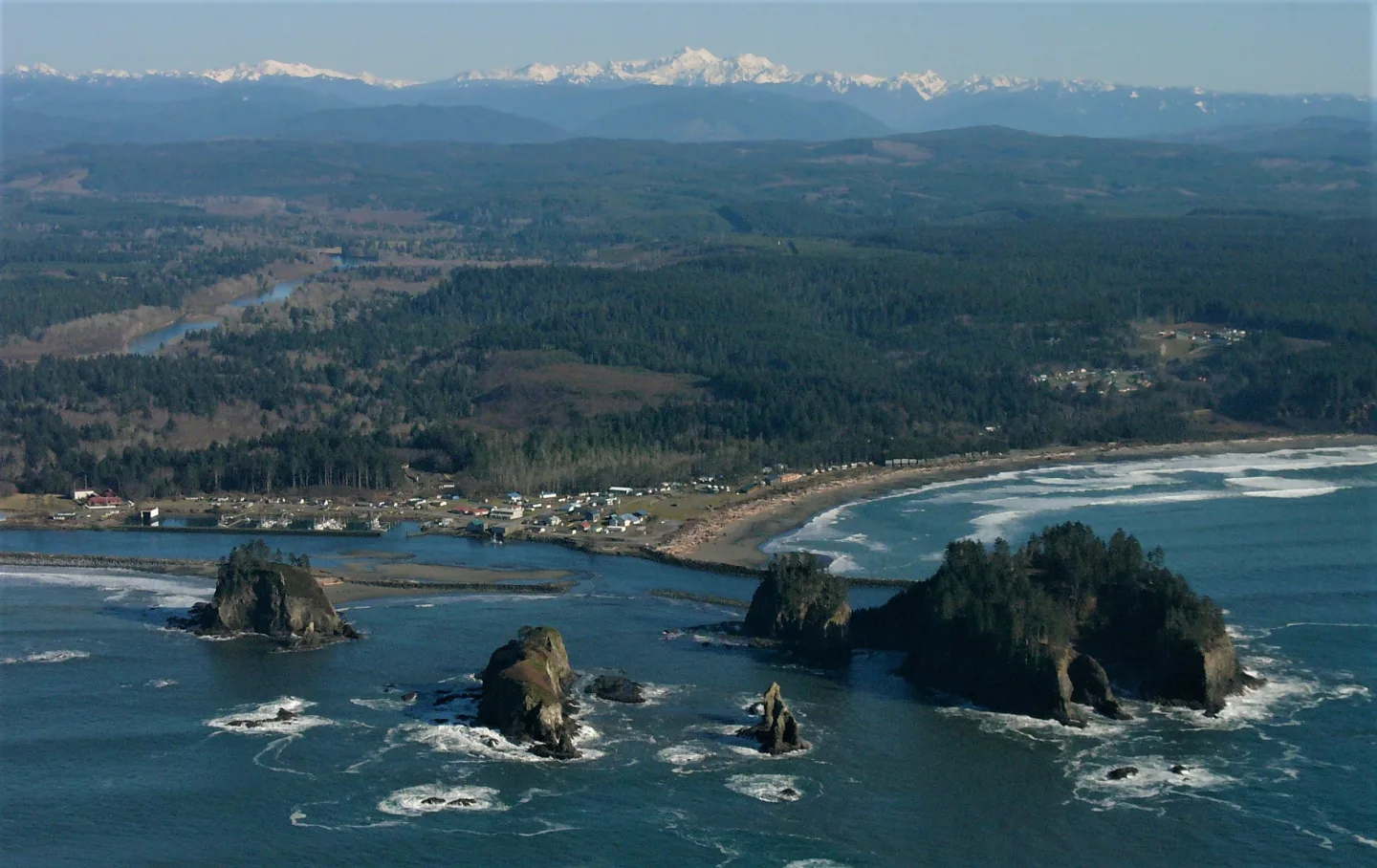
The Peninsula's First Peoples
Eight tribes hold deep ties to the Olympic Peninsula, among them the Quinault, Hoh, Quileute, Makah, Klallam, and Skokomish — Coast Salish and neighboring peoples who fished its rivers and coast for thousands of years. The Quileute of La Push, at the mouth of the Quillayute River, became known worldwide as a setting in the Twilight novels. Their living cultures remain woven through the region today.
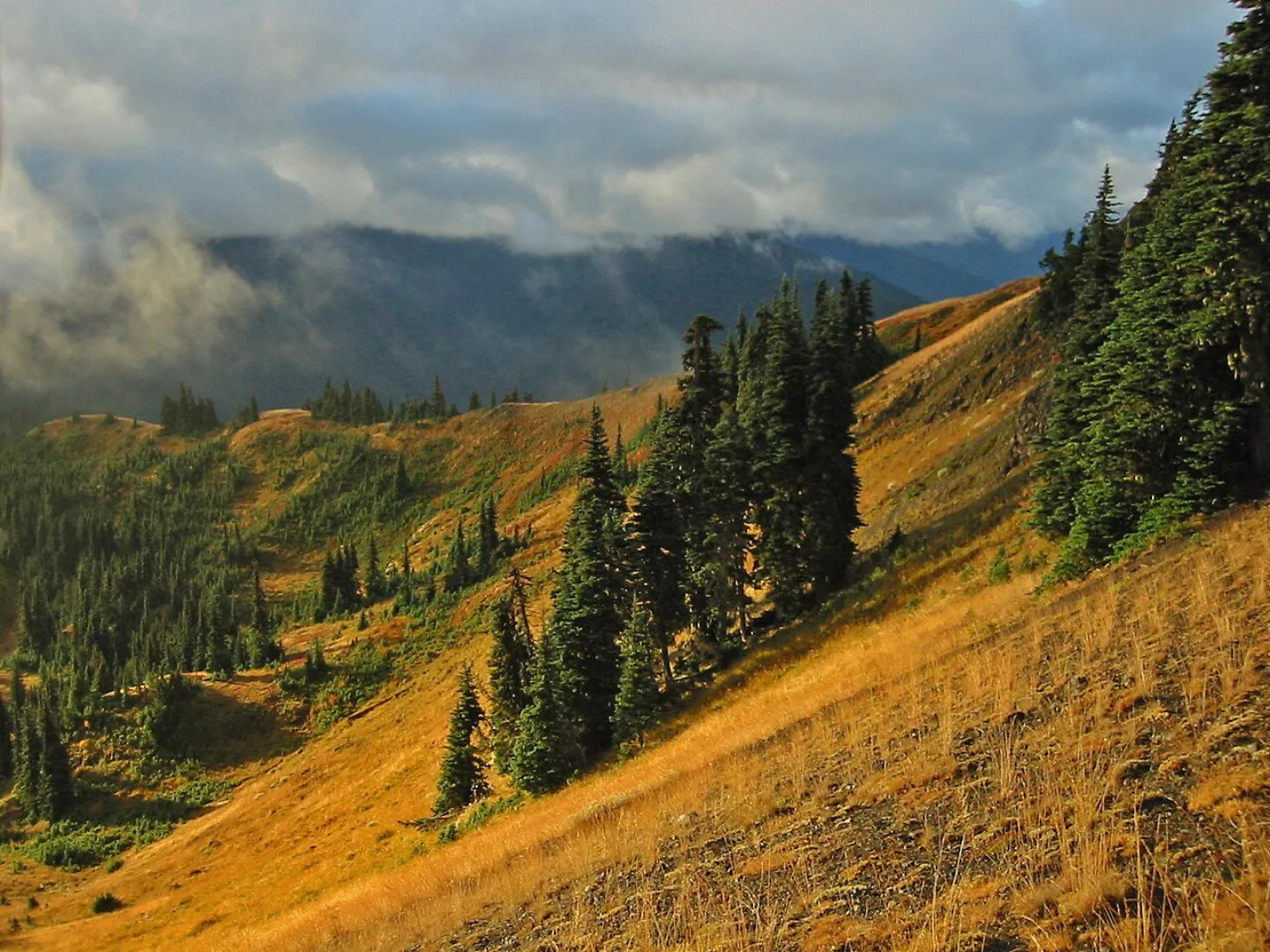
The Dry Window
July through September offers Olympic National Park's most dependable dry weather for high-country trips. The coast and rainforest stay visitable year-round, though wet.
Beyond Hurricane Ridge
Climbing from Hurricane Ridge to wider views north across the Strait of Juan de Fuca, the Hurricane Hill trail covers roughly 3.2 miles round trip.
By the numbers
- In what year was Olympic established as a national park?
- 1938 year
- How tall is Mount Olympus, the park's high point?
- 7980 ft
- Roughly how many acres does Olympic National Park cover?
- 922650 acres
- About how many miles of wild Pacific coastline does Olympic protect?
- 73 miles
- Roughly how many glaciers cling to the Olympic Mountains?
- 60 glaciers
- Roughly how many feet of rain does the Hoh Rain Forest receive each year (lower end of the range)?
- 12 feet
- About how long is the Hall of Mosses loop trail in the Hoh?
- 0.8 miles
- About how many people visited Olympic National Park in 2024?
- 3700000 visitors
- About how long is the Hurricane Hill trail (round trip)?
- 3.2 miles
- How many tribes hold ties to the Olympic Peninsula?
- 8 tribes
Matched pairs
Each item on the left goes with the one on the right.
- Mount Olympus
- The park's highest peak, at 7,980 ft, cloaked in glaciers
- 1938
- Year Olympic became a national park, championed by Franklin Roosevelt
- Subduction
- Plate-diving that scraped up seafloor rock to build the Olympic Mountains
- Hoh Rain Forest
- One of the wettest spots in the Lower 48, with ~12–14 ft of rain a year
- Ruby Beach
- Coastal beach famed for sea stacks and tide pools
- Roosevelt elk
- North America's largest elk; the park was nearly named for them
- Hurricane Ridge
- Paved-road viewpoint into the high country above Port Angeles
- Lake Crescent
- Deep, clear, glacier-carved lake on the park's north side
- Quileute
- La Push tribe made famous as a setting in the Twilight novels
Self-test
Answer each question from memory, then check your work against the answer key.
1. Olympic's fame rests on three stacked ecosystems within one boundary. Which trio are they?
- ADesert, prairie, and alpine tundra
- BVolcanoes, geysers, and hot springs
- CGlaciers, temperate rainforest, and Pacific coast
- DSwamp, mangrove, and coral reef
2. About how many miles of undeveloped Pacific coastline does Olympic protect?
- AAbout 73 miles
- BAbout 450 miles
- CAbout 12 miles
- DAbout 200 miles
3. Roughly how much land does Olympic National Park cover, making it the 13th-largest U.S. national park?
- AAbout 73,000 acres
- BAbout 922,650 acres
- CAbout 7,980 acres
- DAbout 3.7 million acres
4. How many glaciers cling to the Olympic Mountains, fed by relentless Pacific storms?
- AMore than 600
- BAround 8
- CRoughly 12
- DMore than 60
5. Olympic's intact wildness earned it rare international recognition. Which two honors does it hold?
- ADark Sky Park and UNESCO Geopark
- BNational Historic Landmark and Ramsar Wetland
- CUNESCO Biosphere Reserve and World Heritage Site
- DState Natural Area and Marine Sanctuary
6. Olympic was first designated in 1909 as what kind of federal land?
- AA state park
- BA national forest
- CA wildlife refuge
- DA national monument
7. In what year did Congress redesignate the area a national park, a campaign championed by Franklin Roosevelt?
- A1890
- B1938
- C1972
- D1909
8. How tall is Mount Olympus, the park's glaciated high point?
- A7,980 feet
- B12,340 feet
- C5,280 feet
- D14,411 feet
9. Which Olympic landmark is a paved-road viewpoint into the high country above Port Angeles?
- ALake Crescent
- BHoh Rain Forest
- CRuby Beach
- DHurricane Ridge
10. Which Olympic landmark is the postcard of offshore sea stacks and tide pools?
- ASol Duc Falls
- BHurricane Ridge
- CRuby Beach
- DMount Olympus
11. In the Hoh Rain Forest, what is a "nurse log"?
- AA fallen log along which rows of new trees sprout and take root
- BA ring of saplings encircling a single living parent tree
- CA standing dead tree hollowed out for nesting birds
- DA moss-covered boulder that stores rainwater for seedlings
12. Roughly how much rain does the Hoh Rain Forest soak up each year, making it one of the wettest spots in the contiguous U.S.?
- A12 to 14 inches
- B12 to 14 feet
- C3 to 4 feet
- D40 to 50 feet
13. About how long is the easy Hall of Mosses loop through the heart of the Hoh?
- AAbout 5 miles
- BAbout 12 miles
- CAbout 0.8 miles
- DAbout 3.2 miles
14. What distinction do the Roosevelt elk that graze the Hoh and Quinault valleys hold?
- AElk introduced from Yellowstone in the 1960s
- BThe smallest deer species in North America
- CAn endangered species found only on the coast
- DNorth America's largest elk; the park was nearly named for them
15. Which of these is NOT a feature of Olympic's wild coast?
- AA turquoise glacier-carved lake
- BDriftwood and fog
- COffshore sea stacks
- DTide pools with sea stars and anemones
16. Which window offers Olympic's most reliable dry weather for high-country trips?
- AOctober–November
- BJuly–September
- CApril–May
- DJanuary–March
17. The paved road up to Hurricane Ridge's high-country meadows climbs from which peninsula town?
- APort Angeles
- BPort Townsend
- CLa Push
- DForks
18. What best describes Lake Crescent, a highlight on Olympic's north side?
- AA fog-wrapped beach of sea stacks and tide pools
- BA deep, glacier-carved lake glowing turquoise
- CA subalpine meadow of summer wildflowers
- DA moss-draped rainforest valley of giant spruce
19. For a trip into Olympic's high country, which months are the dependable dry window?
- AApril through May
- BOctober through November
- CJanuary through March
- DJuly through September
20. About how long is the Hurricane Hill trail, which climbs to wider views above Hurricane Ridge?
- AAbout 5.4 miles round trip
- BAbout 0.8 miles round trip
- CAbout 3.2 miles round trip
- DAbout 1.6 miles round trip
Go deeper
Answer key
- 1. C Glaciers, temperate rainforest, and Pacific coastOlympic stacks glaciated peaks, drenched temperate rainforest, and wild Pacific coast into one park — a traveler can touch all three in a day.
- 2. A About 73 milesRoughly 73 miles of wild coast run along the park's edge, one of the longest wilderness shorelines left in the Lower 48.
- 3. B About 922,650 acresOlympic spans about 922,650 acres. 3.7 million is the 2024 visitor count and 7,980 is Mount Olympus's height in feet — not the park's acreage.
- 4. D More than 60More than 60 glaciers cling to the range. Storm-fed snow buries Mount Olympus despite its modest 7,980-foot height.
- 5. C UNESCO Biosphere Reserve and World Heritage SiteOlympic is recognized as both a UNESCO Biosphere Reserve and a World Heritage Site, prized for its intact wildness.
- 6. D A national monumentPresident Theodore Roosevelt declared Mount Olympus National Monument in 1909; it was redesignated a national park in 1938.
- 7. B 1938Olympic became a national park in 1938. 1909 was when Theodore Roosevelt declared the earlier Mount Olympus National Monument.
- 8. A 7,980 feetMount Olympus reaches 7,980 feet — modest next to Mount Rainier, yet buried in ice thanks to storm-fed snow.
- 9. D Hurricane RidgeHurricane Ridge is reached by a paved road climbing from Port Angeles to nearly a mile high, with views toward Mount Olympus.
- 10. C Ruby BeachRuby Beach is celebrated for sea stacks and tide pools. Hurricane Ridge is a mountain overlook and Sol Duc Falls is a waterfall.
- 11. A A fallen log along which rows of new trees sprout and take rootIn the drenched Hoh, fallen "nurse logs" become seedbeds — new trees sprout in rows along the decaying trunk, drawing moisture and nutrients as it slowly rots into the forest floor.
- 12. B 12 to 14 feetThe Hoh receives about 12 to 14 feet of rain a year — feet, not inches — building its cathedral of moss and towering conifers.
- 13. C About 0.8 milesThe Hall of Mosses loop runs roughly 0.8 miles. 3.2 miles is the Hurricane Hill trail up at Hurricane Ridge.
- 14. D North America's largest elk; the park was nearly named for themRoosevelt elk are the continent's largest elk, and protecting them was so central that Olympic was nearly named for the elk.
- 15. A A turquoise glacier-carved lakeThe turquoise glacier-carved lake is Lake Crescent, inland on the north side. The coast is defined by sea stacks, tide pools, driftwood, and fog.
- 16. B July–SeptemberJuly through September is the dependable dry season; the coast and rainforest stay visitable year-round, but wet.
- 17. A Port AngelesHurricane Ridge is reached by a paved road that climbs from Port Angeles to nearly a mile above the sea.
- 18. B A deep, glacier-carved lake glowing turquoiseLake Crescent is a deep, glacier-carved lake so clear its water glows turquoise in sunlight, ringed by forested ridges and a historic lodge.
- 19. D July through SeptemberJuly through September is Olympic's reliable dry season for the high country; the coast and rainforest stay open year-round but wet.
- 20. C About 3.2 miles round tripThe Hurricane Hill trail runs about 3.2 miles round trip, climbing from Hurricane Ridge to wider views north across the Strait of Juan de Fuca.
Sources
- U.S. National Parks — Olympic
Image credits
- Two International Honors: Wikimedia Commons · Bigfathairymarmot at English Wikipedia · Public domain — commons.wikimedia.org/wiki/File:Canyon_Creek_Shelter_ONP1.jpg
- Roosevelt Elk: USFWS Pacific · Public domain — commons.wikimedia.org/wiki/File:Grazing_bull_elk,_Olympic_National_Park_(52094128946).jpg
- Lake Crescent and Sol Duc Falls: Sea Cow · CC BY-SA 4.0 — commons.wikimedia.org/wiki/File:Sol_Duc_Falls_2022.jpg
- The Peninsula's First Peoples: Wikimedia Commons · Sam Beebe · CC BY 2.0 — commons.wikimedia.org/wiki/File:La_Push_aerial.jpg
- The Dry Window: Wikimedia Commons · Wsiegmund · CC BY 2.5 — commons.wikimedia.org/wiki/File:HurricaneRidge_7392t.jpg


